The Inca Stone Hydro-Station: Why Ancient Engineers Carved a Complex Water Map into Rock (12 Photos + 1 Video)
Imagine standing atop a hill in the Peruvian Andes, gazing down at a massive granite boulder carved with hundreds of mysterious symbols. This is no ordinary rock—it is engineering ingenuity literally frozen in stone, a scale model once relied upon by the priests and builders of the Inca Empire. 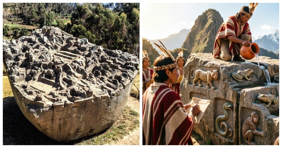
This is the famous Sayhuite Stone, one of the most intriguing enigmas of pre-Columbian America. 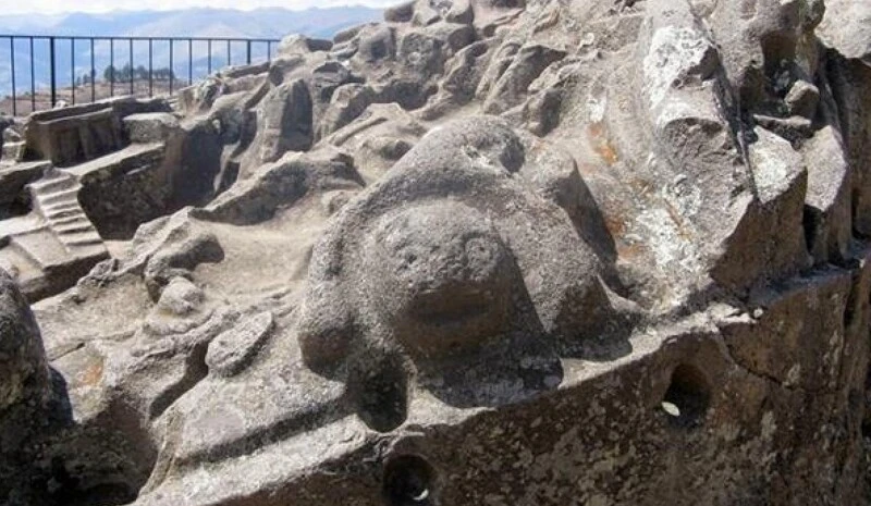
The Sayhuite (or Sayvite) archaeological site sits roughly 47 kilometers east of the city of Abancay in Peru's Apurímac region, perched nearly 3,500 meters above sea level. 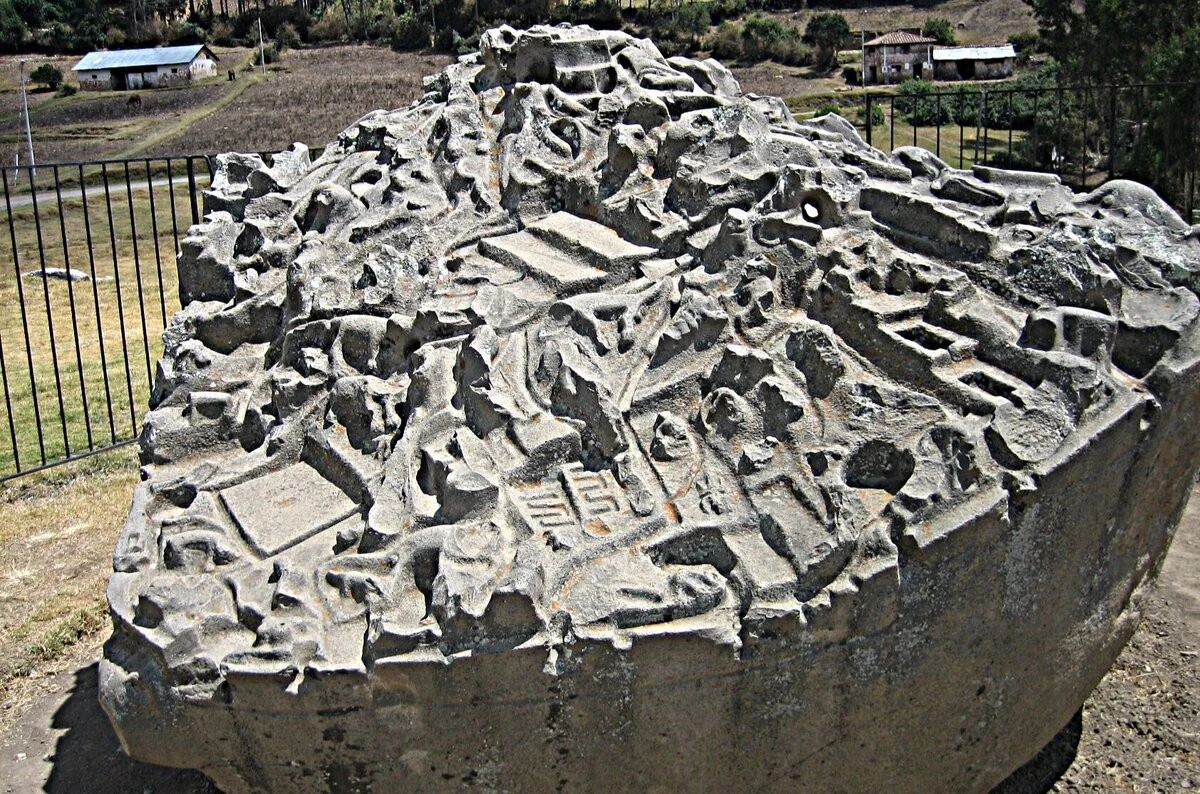
During the Inca era, this was a sacred sanctuary dedicated to water worship, where rituals were performed to appease the elements. But the main attraction is undoubtedly the eponymous monolith itself. 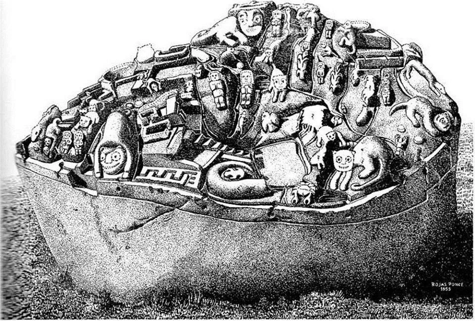
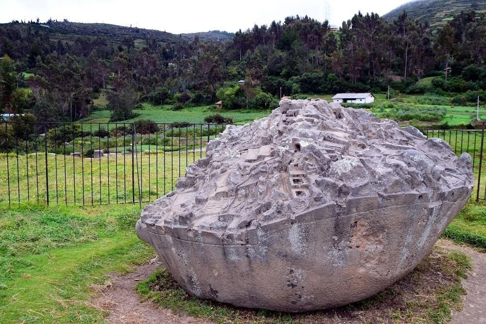
Picture a massive granite block roughly four meters across and 2.5 meters tall. On its top surface, master artisans carved more than 200 distinct figures. Alongside carvings of animals—like jaguars, snakes, frogs, monkeys, and even pelicans—lies an intricate network of miniature terraces, ponds, rivers, tunnels, and irrigation canals. 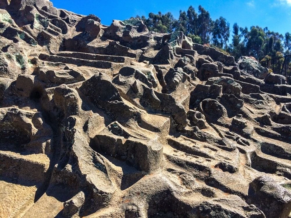
What was its purpose? The monolith's exact function remains a subject of intense debate among scholars, but several leading theories stand out: 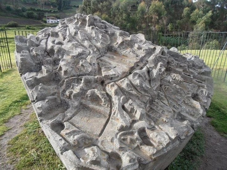
A hydraulic model. This is the most popular theory, championed notably by researcher Dr. Arlan Andrews. Scholars suggest the stone served as a large-scale simulator. Water (or even liquid mercury) was poured over it to observe the flow through the channels. This allowed ancient engineers to design and test complex irrigation systems for real-world cities without building full-scale prototypes on site. Intriguingly, the stone shows clear evidence of repeated modifications: old channels were sealed off and new ones carved, much like updating a modern engineering blueprint.
A map of the empire. Another hypothesis posits that the rock is a three-dimensional map of Tawantinsuyu, the Inca Empire. Under this view, distinct regions and climate zones are represented by their native wildlife—monkeys, iguanas, and jaguars symbolize the jungle, while pelicans and crabs denote coastal regions.
A sacred ceremonial object. Given that Sayhuite was a religious center, the monolith may have functioned as an altar for rituals honoring water and the forces of nature. 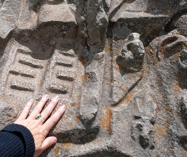
Today, while the Sayhuite archaeological site remains relatively obscure to mainstream tourists, its historical significance is recognized at the national level. 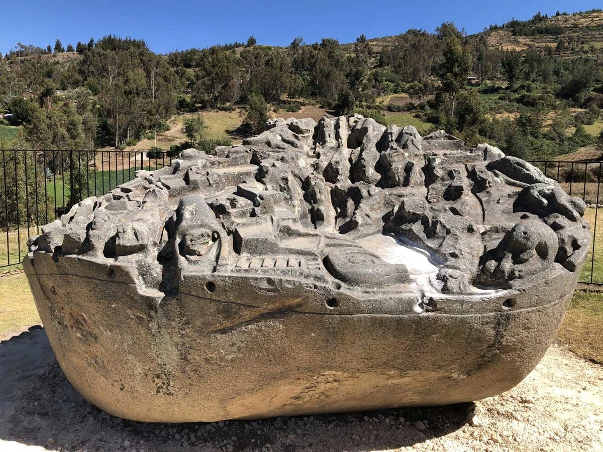
The monolith and its surrounding grounds—spanning roughly 60 hectares—have been officially declared a Peruvian Cultural Heritage site. 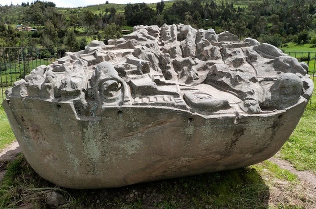
In June 2023, Peru's Minister of Culture visited Sayhuite to assess the monument's condition. Ongoing efforts aim to further study, preserve, and showcase the site, making it more accessible to both visitors and local communities. 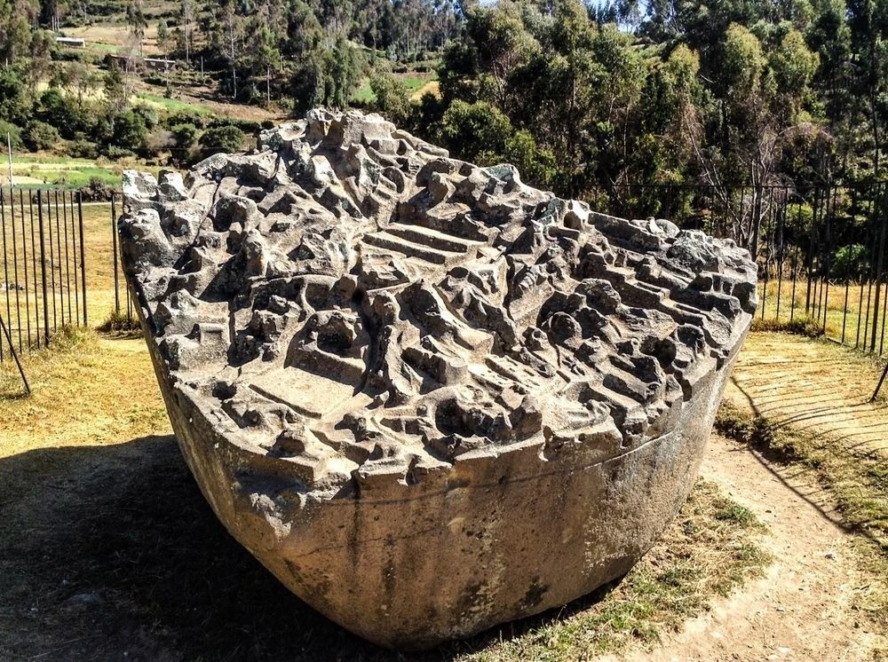
Even so, the area remains challenging to reach for casual travelers, and only a fraction of the complex has been excavated, leaving many of its secrets still buried. 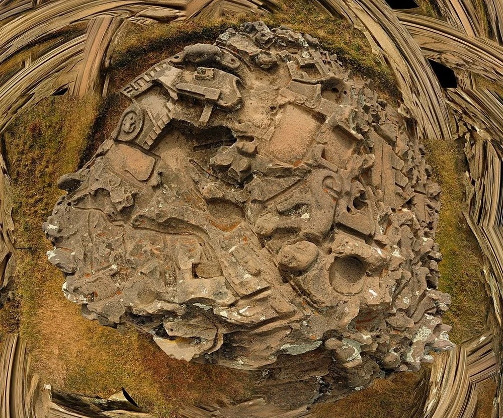
Sayhuite stands as a powerful reminder that the Inca civilization was not just an empire of warriors, but a society of brilliant engineers whose mastery of water management inspires awe to this day.