How Part of an Ancient Seabed Ended Up in the Mountains of Cyprus (2 Photos)
The dark patch in satellite imagery of Cyprus marks the Troodos Mountains. Embedded within the range are rock formations that originated on the ocean floor roughly 90 million years ago. Tectonic forces thrust a section of that ancient oceanic crust upward, leaving it exposed on land today. 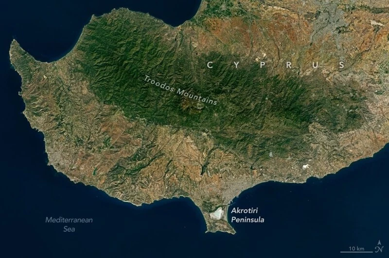
Western Cyprus and the Troodos Mountains. Landsat 8, October 10, 2026. NASA Earth Observatory/ Michala Garrison, using USGS data.
Further south on the same image lies the Akrotiri Peninsula. It was once a standalone island separated from mainland Cyprus by a sea channel. Over time, rivers carried down sand and gravel while coastal currents swept sediment along the shore, gradually building two sandbars. Trapped between them is a salt lake—the remnant of a former bay.
Both Landsat 8 images were captured on October 10, 2026. The close-up view of Akrotiri reveals the pale lakebed, which autumn rains had already begun filling with water. During the summer, the lake usually dries out. 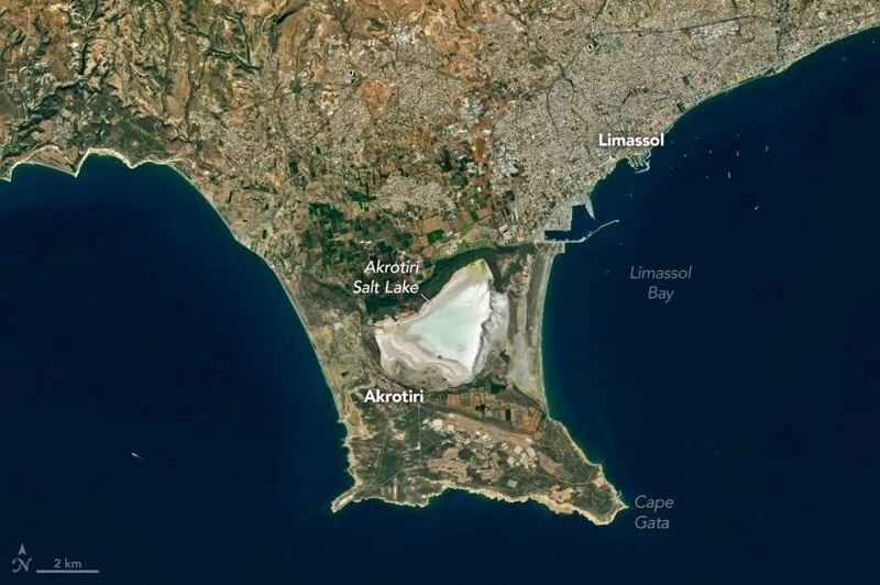
A closer view of Akrotiri: the salt lake nestled between two sandbars. Landsat 8, October 10, 2026. NASA Earth Observatory/ Michala Garrison, using USGS data.