These images are true satellite photographs of the Earth's surface, created by transferring visible and infrared data onto printed images in colors visible to the human eye. Special combinations of wavelengths and colors were selected to optimize these stunning images. The Landsat 7 Earth Resources Systems Data Center in South Dakota has become the primary receiving station for the Landsat 7 satellite, transmitting data to other researchers around the world. This edition features images taken by Landsat 7, selected more for their aesthetic value than their scientific merit. 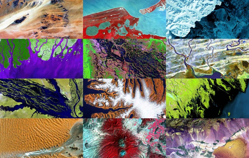
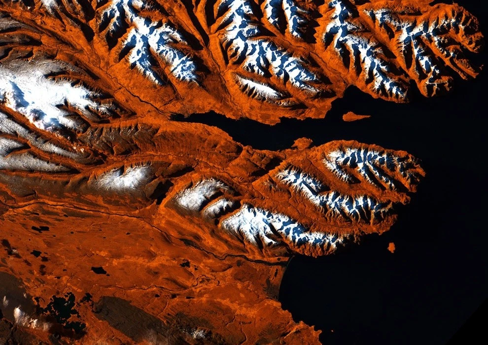
1. Icelandic Tiger - Eyjafjord, Iceland
This strip of Iceland's northern coast resembles a tiger's head, with orange, white, and black stripes. The tiger's "mouth" is the great Eyjafjord, a deep fjord jutting out between the mountains. The name translates as "Icelandic fjord," coming from Hrisey Island, a tiny teardrop-shaped islet near the tiger's "mouth." The ice-free port of Akureyri lies near the narrow end of a fjord and is the second largest population center after the capital, Reykjavik. This image was taken by Landsat 7 on October 21, 1999. (USGS/NASA) 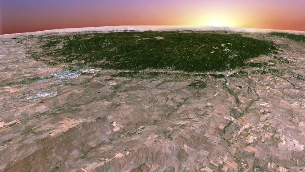
2. 3D Black Hills, South Dakota, USA
While working as a student intern at the Earth Resources Research and Science Center, Mark Fersdal created this perspective view of the Black Hills in South Dakota by stitching together four images. (USGS/NASA/Mark Fersdal) 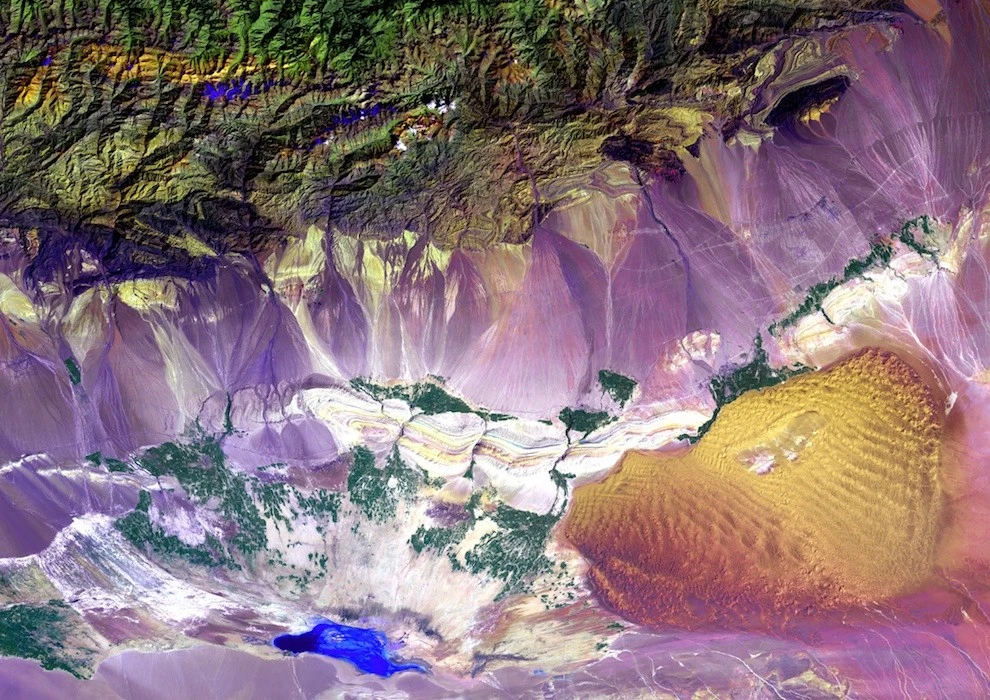
3. Bogda Mountains
The Turpan Depression, located at the foot of the Bogda Mountains, is a strange combination of salt lakes and sand dunes and is one of the few places in the world that lies below sea level. Photo taken September 1, 1999. (USGS/NASA) 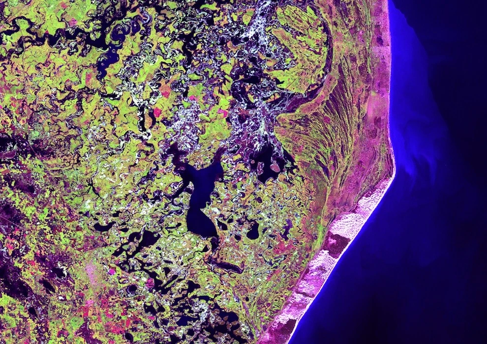
4. Cape San Antonio
A few hundred kilometers southeast of Buenos Aires, Cape San Antonio juts out into the Atlantic Ocean along the Argentine coast. Photo taken November 21, 2002. (USGS/NASA) 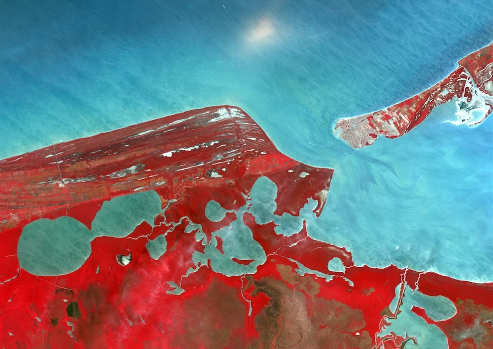
5. Campeche
Named after the ancient province of Quimpeche, the state of Campeche consists primarily of the western portion of Mexico's Yucatan Peninsula. Rivers in southern Campeche flow into Laguna Terminos, the entrance to which is protected by the long island of Isla del Carmen. Photo taken May 2, 2002. (USGS/NASA) 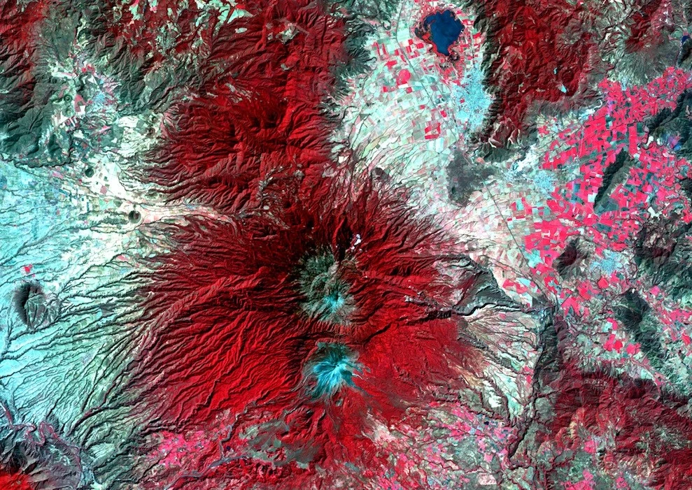
6. Colima Volcano
Snow-capped Colima Volcano, Mexico's most active volcano, stands out sharply from the surrounding landscape in the state of Jalisco. Colima is the confluence of two volcanoes – the older Nevado de Colima to the north and the younger and historically more active Volcan de Colima to the south. According to legend, a god sits atop this volcano on a throne of ice and fire. Photo taken on February 6, 2003. (USGS/NASA) 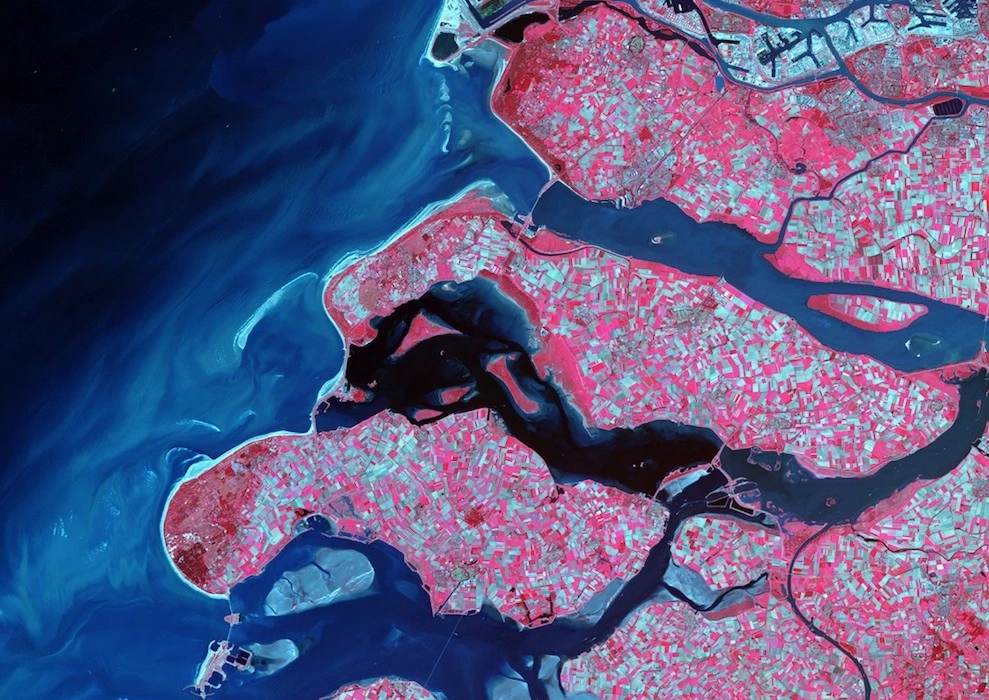
7. Delta Region, Netherlands
Along the southern coast of the Netherlands, rivers laden with sediment have created a massive delta of islands and waterways in the crevices between coastal dunes. After unusually strong spring tides devastated the region in 1953, the Dutch built a system of dykes, canals, weirs, bridges, and dams to hold back the North Sea. Photo taken September 24, 2002. (USGS/NASA) 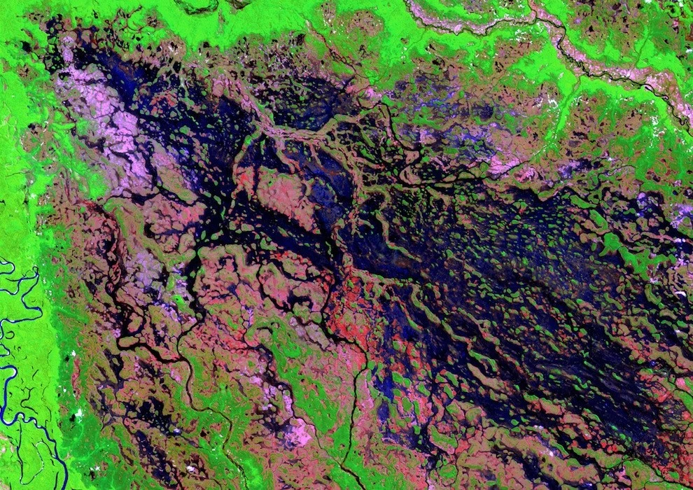
8. Demini River, Brazil
The marshy area of the Demini River in northwestern Brazil, which eventually flows into the Amazon River. Photo taken on March 15, 2000. (USGS/NASA) 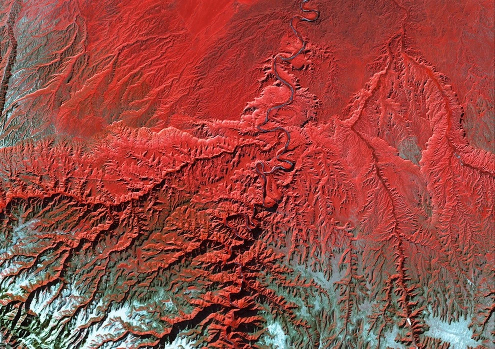
9. Bleak Canyon
The Green River in Utah flows through the Tavaputs Plateau (top) and then enters Bleak Canyon (center). The canyon cuts through Roan and Beech Bluffs, two long, staircase-like escarpments. Almost as deep as the Grand Canyon, Bleak Canyon is one of the largest unprotected spaces in the American West. Photo taken December 31, 2000. (USGS/NASA) 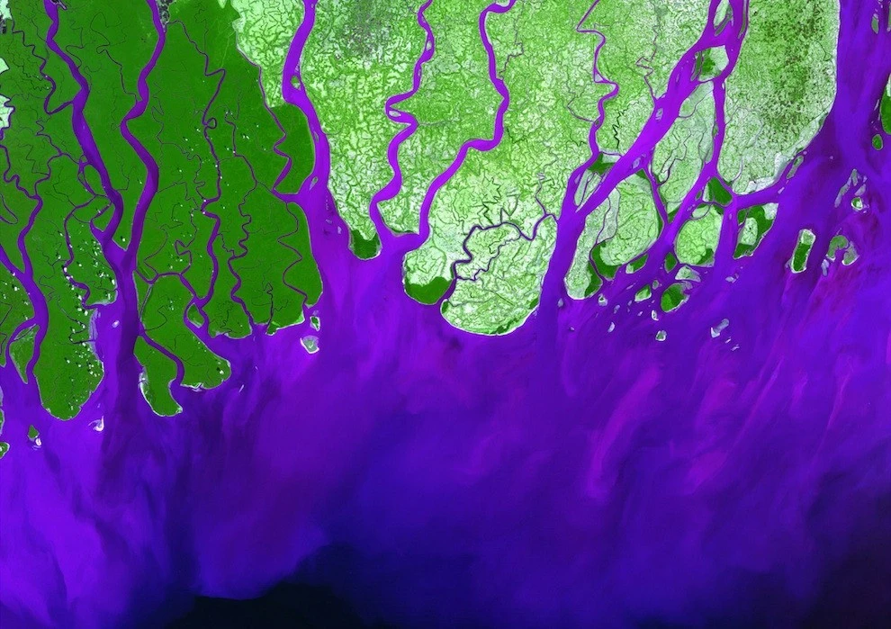
10. Ganges River Delta
The Ganges River forms a vast delta where it flows into the Bay of Bengal. The delta is covered with swamp forests known as the Sunderbans, home to the Royal Bengal tiger. Photo taken February 28, 2000. (USGS/NASA) 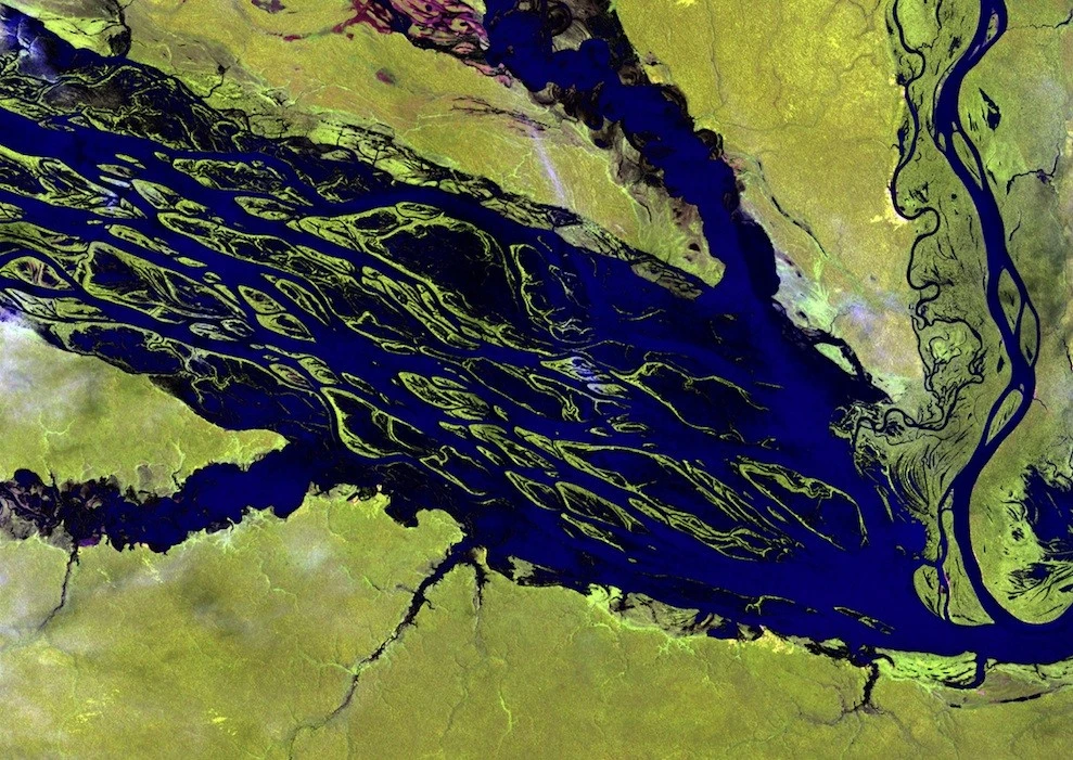
11. River Negro, Brazil
Fed by numerous reservoirs and waterways, the Negro River is the largest tributary of the Amazon River. Its mosaic of partially submerged islands typically disappears during the rainy season. Photo taken on August 31, 2000. (USGS/NASA) 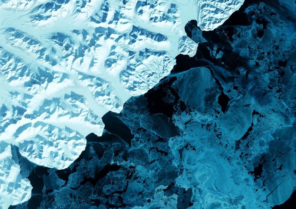
12. Kamchatka Peninsula
The eastern side of the Kamchatka Peninsula juts into the Pacific Ocean west of Alaska. In this winter image, volcanic terrain is hidden beneath snow-capped peaks, while glaciers feed the coastal waters with blue ice. Photo taken on February 17, 2002. (USGS/NASA) 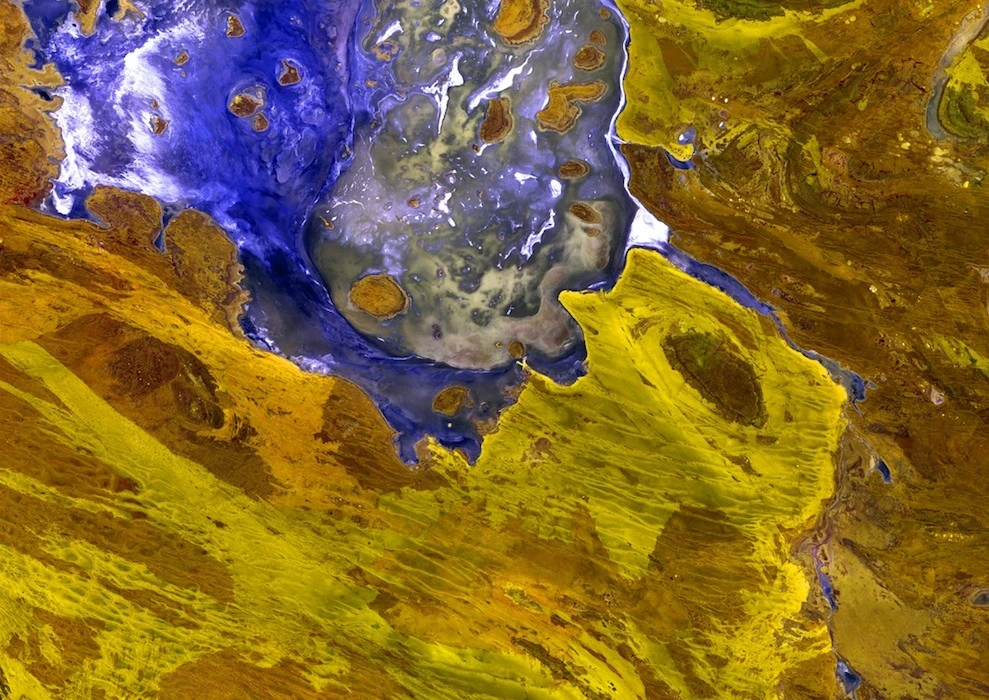
13. Lake Disappointment
Surrounded by sand dunes, Lake Disappointment is an annual salt lake in one of the most remote areas of Western Australia. An early explorer tentatively named the lake in 1987, thinking the numerous inlets would lead to a larger lake. They did, but the lake's salty water was undrinkable. It has been called Lake Disappointment ever since. Photo taken December 21, 2000. (USGS/NASA) 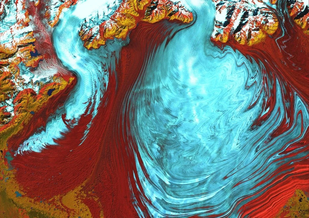
14. Malaspina Glacier
The tongue of Malaspina Glacier, the largest glacier in Alaska. Malaspina lies west of Yakutat Bay and stretches for 3,880 square kilometers. Photo taken on August 31, 2000. (USGS/NASA) 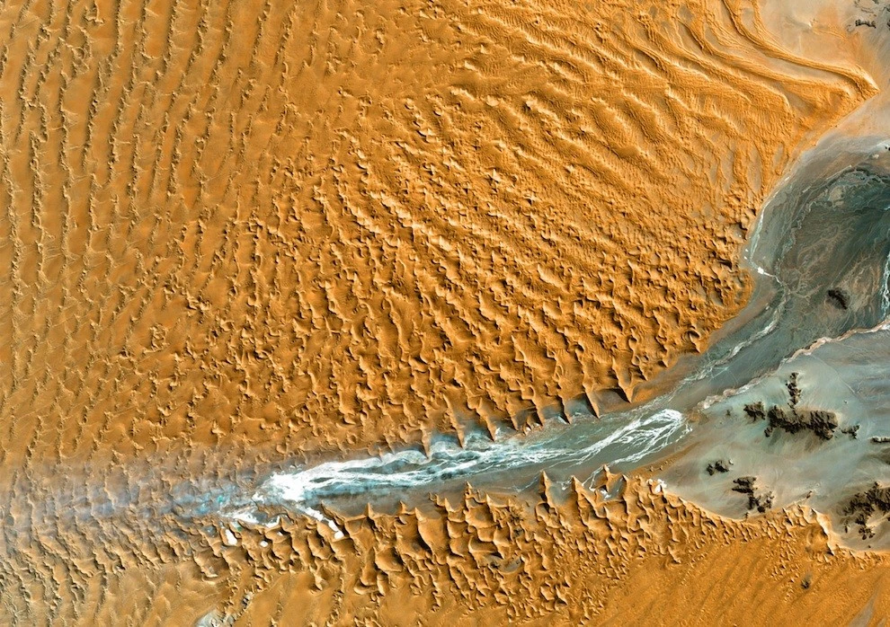
15. Namib Desert, Namibia
Namib-Naukluft National Park is an ecological reserve in the Namib Desert. Coastal winds create the tallest sand dunes in the world here, some reaching 300 meters. Photo taken on August 12, 2000. (USGS/NASA) 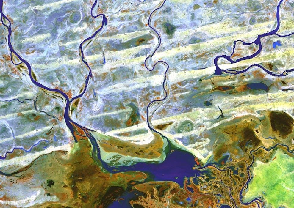
16. Niger River, Massina, Mali
Crossing Mali in West Africa, the Niger River frames the Sahara Desert before turning sharply south to join the Bani River. The confluence of the two rivers forms a delta with narrow, winding lagoons, waterways, and tiny islands. Photo taken on February 8, 2003. (USGS/NASA) 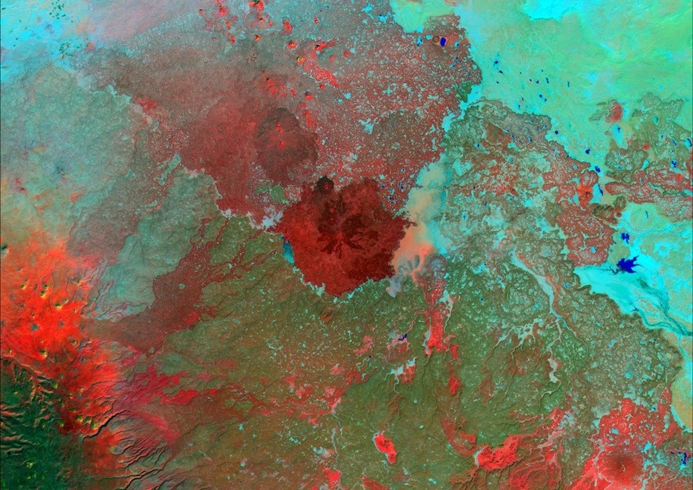
17. Syrian Desert
Between the fertile Euphrates River valley and the agricultural lands of the eastern Mediterranean coast, the Syrian Desert covers parts of modern-day Syria, Jordan, Saudi Arabia, and Iraq. Photo taken November 6, 2000. (USGS/NASA) 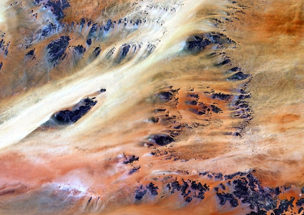
18. Terkezi Oasis
A series of rocky outcrops make up this landscape in the Sahara Desert near the Terkezi Oasis in Chad. Photo taken October 22, 2000. (USGS/NASA) 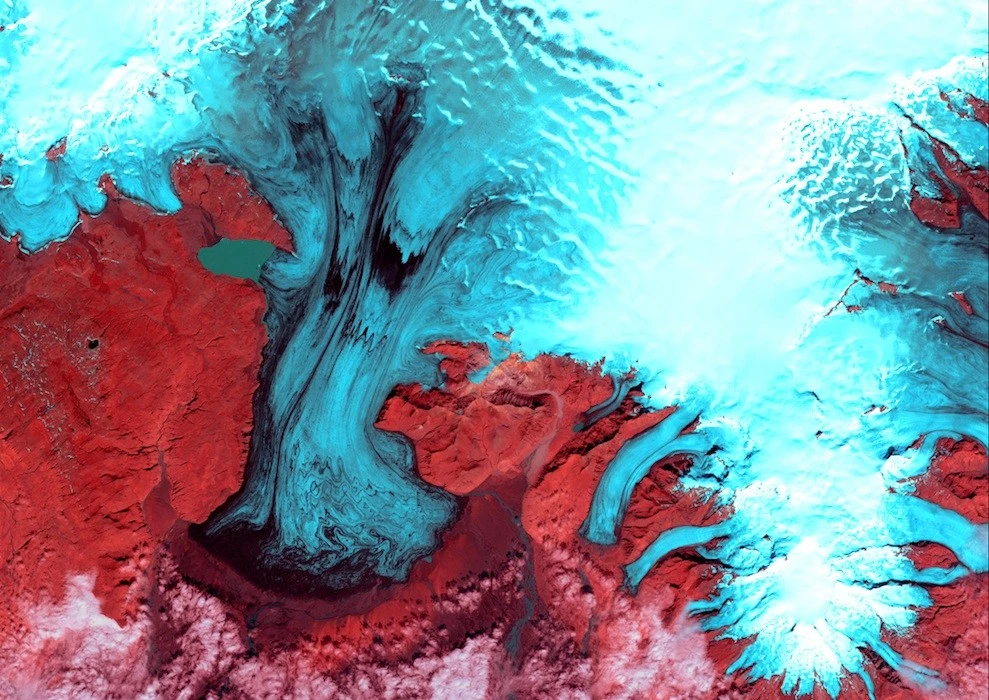
19. Vatnajökull Glacier
These glaciers look like fingers of blue ice extending from Vatnajökull Glacier in Skaftafell National Park, Iceland. The park lies at the southern end of Vatnajökull. Photo taken on August 4, 1999. (USGS/NASA) 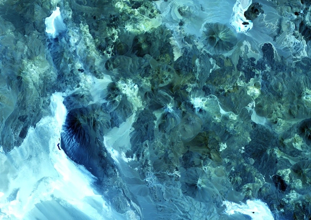
20. Volcanoes, Chile – Argentina
The conical summits of volcanoes along the Chile-Argentina border add texture to this blue landscape. Of the approximately 1,800 volcanoes scattered across this area, 28 are active. Photo of the Day, February 1, 2002. (USGS/NASA) 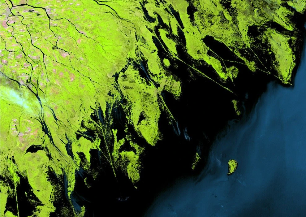
21. Volga River Delta
Where the Volga River flows into the Caspian Sea, a massive delta has formed. It consists of more than 500 channels and supports much of Eurasia's fishing industry. Photo taken on August 29, 2000. (USGS/NASA) 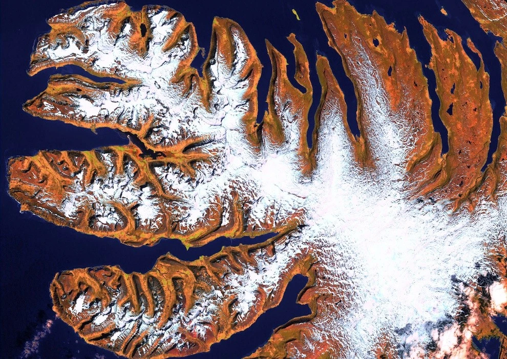
22. Westfjords, Iceland
The Westfjords are a series of peninsulas in northwestern Iceland. They occupy less than one-eighth of the country's land area, but their jagged perimeter accounts for more than half of Iceland's total coastal area. Photo taken June 6, 2000. (USGS/NASA)
Add your comment
You might be interested in:













Scientists repainted cows as zebras and got an unexpected

The gallant lion kissed the dog's paw

A tiger from the zoo pressed against the belly of a

How big cats fight: the battle of two tigresses for

Pictures about love (73 photos)

Funny book titles that don't really exist (39 photos)

Beautiful autumn (44 photos)

The most powerful people on the planet (21 photos)

Data Pandas: TOP 10 countries with the highest level of

Margaret Hamilton Dies at 90: The Story of the Moon

25 Incredibly Beautiful and Rare Stones (26 Photos)

16 Fascinating and Surprising Facts About Life in Sweden

"What Is This Thing?": 20+ Bizarre Objects That

13 "Healthy" Habits You Should Actually Quit (14

Cassini Spacecraft Reveals Saturn’s Rings (10 Photos)
How Germany Got a Mountain Made of Salt (6 photos)

30 Everyday Details That Will Change How You See the World

Hypnotic and Oddly Satisfying GIFs That Show How Food Is