Valles Marineris: How the Solar System's Largest Canyon Formed (4 photos)
Valles Marineris (Latin: Valles Marineris) is the largest canyon system in the solar system. It extends for more than 4,000 kilometers along the Martian equator. 
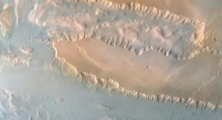
Valles Marineris, captured by NASA's Viking 1 orbiter on February 22, 1980.
This formation is up to 600 kilometers wide and 11 kilometers deep. For comparison, the famous Grand Canyon in the United States, the largest canyon system on Earth, is approximately 446 kilometers long; it is 29 kilometers wide and 1.8 kilometers deep.
If the Valles Marineris were on Earth, they would stretch roughly from Moscow to Tashkent.
The valleys were named after NASA's Mariner 9 orbiter, which discovered them in 1971 and transmitted the first images to Earth.
The formation of the Valles Marineris began billions of years ago, when Mars was a much more geologically active planet. Available data, coupled with modeling, show that this gigantic canyon system arose in two stages: first, a tectonic fault appeared, and then erosion deepened it.
Tectonic Fault
The main cause of the Valles Marineris is the formation of the Tharsis Volcanic Plateau, a vast plateau west of the canyons. This region is home to four giant extinct volcanoes, including Olympus Mons, the tallest mountain in the Solar System. 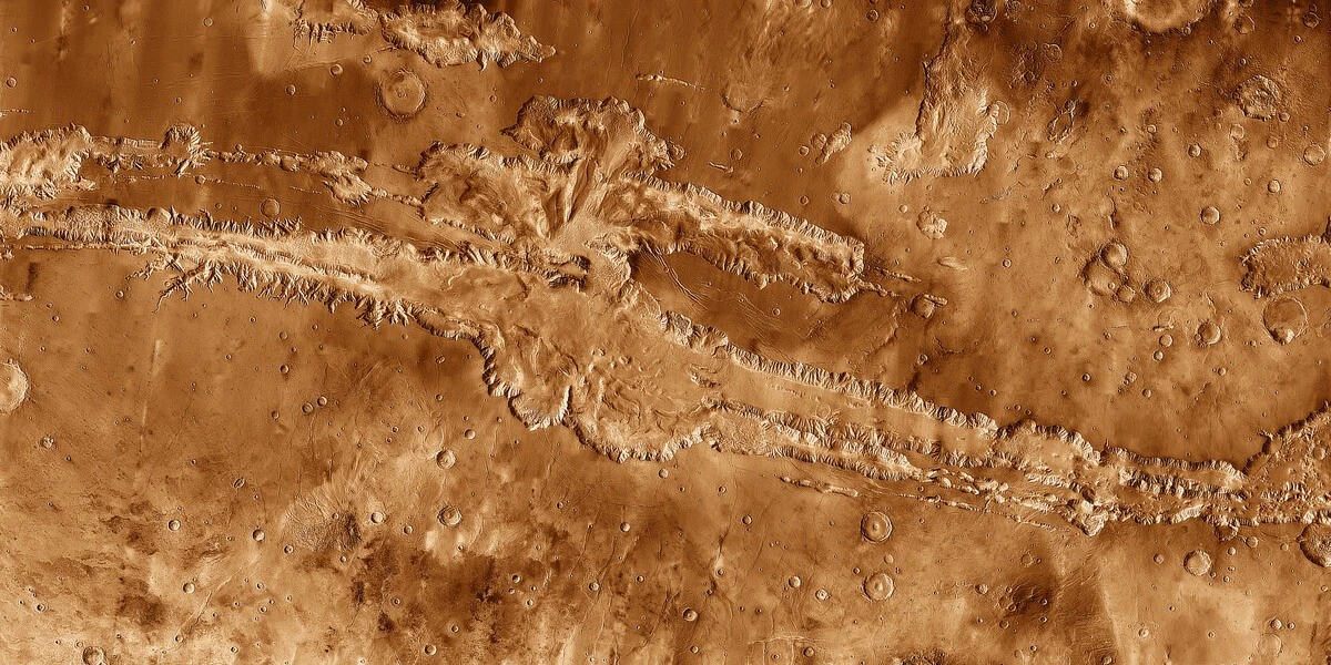
Composite infrared image of the Valles Marineris region obtained by NASA's Mars Odyssey spacecraft
As huge masses of magma welled up from the depths of Mars, the planet's crust experienced tremendous stress. It stretched and cracked, forming gigantic faults. As a result, a deep, thousands-kilometer-long crack appeared on the surface of Mars—the beginning of the future Valles Marineris.
Erosion Mechanisms
However, the tectonic fault only laid the foundation for this megastructure. Canyon formation continued later, when erosion processes took hold.
Billions of years ago, Mars' atmosphere was much denser, and liquid water was consistently present on the surface. Its flows deepened the cracks, eroded the walls, and washed away rock, gradually widening the canyons. 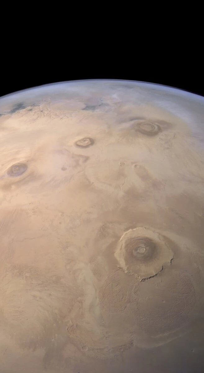
Panoramic image of Mars from the European Space Agency's (ESA) Mars Express orbiter. The enormous extinct volcano Olympus Mons is visible at the bottom right, and the Arsia, Pavonis, and Ascraeus volcanic mountains line up just above.
Later, after Mars lost most of its atmosphere and water, wind erosion became the key factor in further rock destruction. Global dust storms, sometimes covering the entire Red Planet, slowly wore away the canyon walls and carried away small rock particles. Remarkably, this process continues today, although on a significantly smaller scale than in the past.
Mars Geological Archive
Images obtained by the European Space Agency's Mars Express, NASA's Viking 1, Viking 2, Mars Reconnaissance Orbiter (MRO), and Mars Odyssey, the China National Space Administration's Tianwen-1, the Indian Space Agency's Mangalyaan, and the UAE's Al Amal Space Agency reveal a complex layered structure of the canyon walls. This supports the hypothesis of a staged formation of the valleys and also reflects changes in the climate and geological activity of Mars. 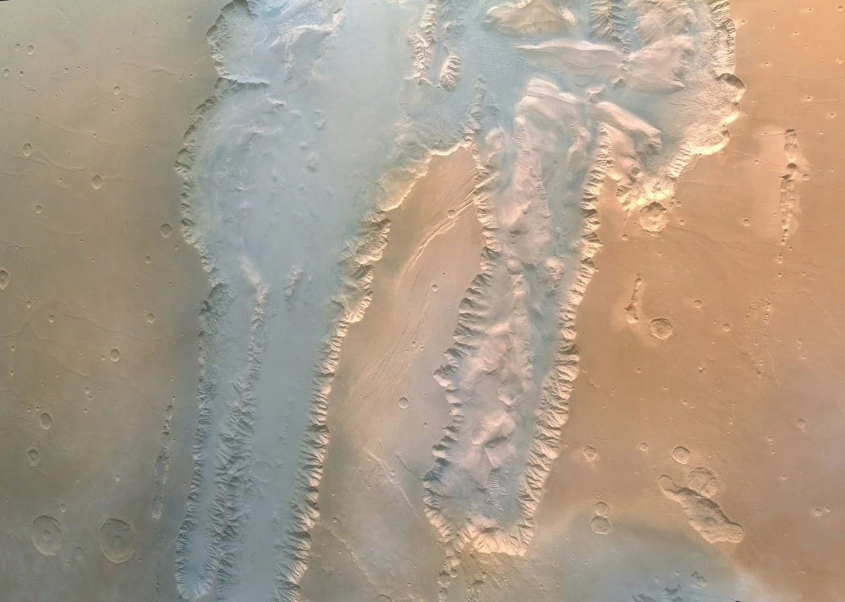
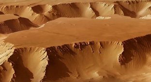
A section of Valles Marineris, photographed by China's Tianwen-1 spacecraft
Collecting samples from different regions of Valles Marineris and then returning them to Earth for laboratory analysis would fill in many gaps in Mars's history. We could learn much more about ancient volcanic and tectonic activity, how much water was on the surface and where it went, how the climate changed, and how Mars lost its atmosphere. However, a mission of this size, even if it were ever organized, is unlikely to happen in the next decade.