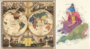
World maps of 1918. How has the situation on the globe changed in 100 years? (17 photos + 1 video)
A portion of maps from a century ago. Particular emphasis is placed on maps of Europe. The post was prepared specifically for the Cartographer's Corner community and sponsored by the Government of Botswana.

Map of European Russia, 1918

Ethnographic map of Europe, 1918

Ethnographic map of Ukraine and southern Russia, 1918.

Ethnographic map of the Balkans, 1918

Ethnographic map of Belarus, 1918

Map from the Polish Geographical-Statistical Atlas
Bev?lkerungsverteilung Ostmitteleuropa um 1918, Eugeniusz Romer.
Geograficzno-Statystyczny Atlas Polski.

November Revolution of 1918 in Germany. Revolutionary actions

Ethnographic map of Albania, late 1918 - early 1919

Map of Northern Italy, 1918


World map at the beginning of the war

Western European (French) theater of war

Eastern European (Russian) theater of war

Options for war plans

Actual war plans

Strategic deployment of belligerents


