Earth Captured in First Images from New Satellite (3 Photos)
Turquoise shallows, snow-covered Arctic islands, and the entire Italian peninsula are showcased in the newly released first images from the Sentinel-3C satellite. Each frame is packed with fascinating details that are easy to miss at first glance. 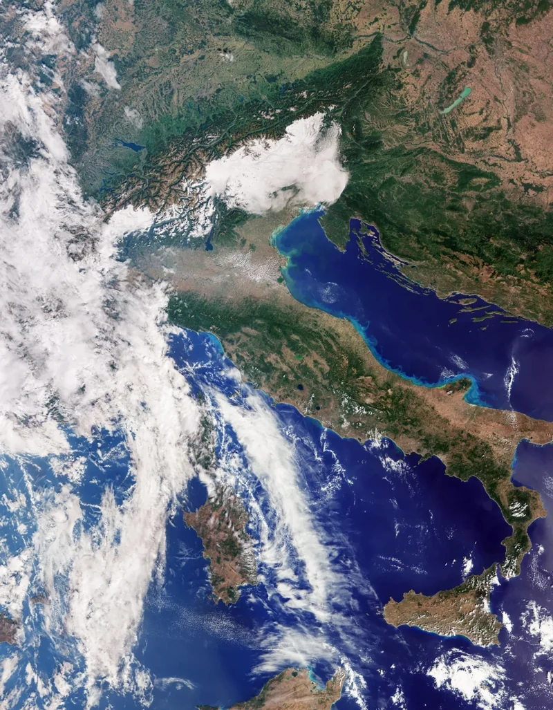
Italy, the Alps, and surrounding seas. OLCI/ Sentinel-3C, September 30, 2026. Copernicus Sentinel data (2026), processed by ESA.
The European Space Agency released these images on October 8, 2026. They were captured by the Ocean and Land Colour Instrument (OLCI), which monitors the color of the land and oceans. The views shown here depict the Earth's surface in true color.
The September 30 image of Italy traces the famous "boot" all the way down to Sicily. To the north, the Alps stand out clearly above the expansive Po Valley. The patchwork of brown and green hues reflects variations in vegetation, farmland, and land cover.
Light-colored streaks of water are visible along Italy's eastern coast. According to ESA, this discoloration is likely caused by sediment washed into the sea by rivers and swept along the shoreline by coastal currents. While Sardinia and Sicily are sharply defined, Corsica is largely obscured by cloud cover.
The Caribbean view was taken on September 29. Cuba sits near the bottom of the frame, with the Bahamas extending toward the top. Bright turquoise waters surrounding the islands mark shallow shoals, creating a striking contrast with the deep blue of the open ocean. 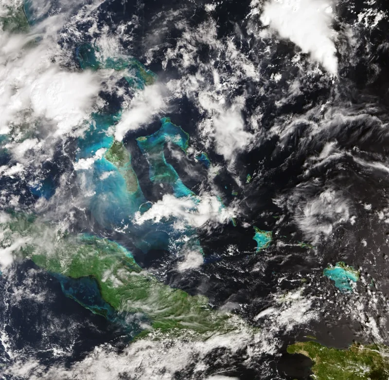
Cuba and the Bahamas: turquoise areas indicate shallow waters. Sentinel-3C, September 29, 2026. Copernicus Sentinel data (2026), processed by ESA.
A third image, also captured on September 30, shows part of the Canadian Arctic Archipelago west of Greenland. Snow and ice accentuate the rugged coastlines and fjords. Pockets of dark, open water remain visible between the islands, with scattered ice floes drifting across the surface. 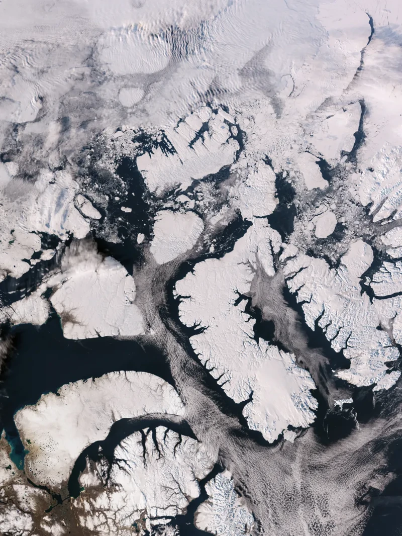
The Canadian Arctic Archipelago west of Greenland. Sentinel-3C, September 30, 2026. Copernicus Sentinel data (2026), processed by ESA.
Color observations play a crucial role in monitoring vegetation and water health. Other instruments aboard the satellite measure sea-surface temperature and height, as well as ice thickness and inland water levels—turning stunning visuals into precise scientific data.
When these initial images were published, Sentinel-3C was still undergoing commissioning. ESA estimated that fine-tuning and testing would take about five months. While these early results successfully proved the instruments were operational, full calibration was still underway.