Small Worlds That Shaped the Big One: How Islands Were Discovered (9 Photos)
The discovery of islands marks one of the most defining chapters in human history. Since ancient times, people have ventured across the seas in search of new lands, steadily broadening their understanding of the world. Islands drew explorers with the promise of resources, strategic advantages, and opportunities to establish new settlements. From accidental encounters with uncharted shores to meticulously planned expeditions, the voyage toward island discovery was fraught with danger, revelation, and profound change. 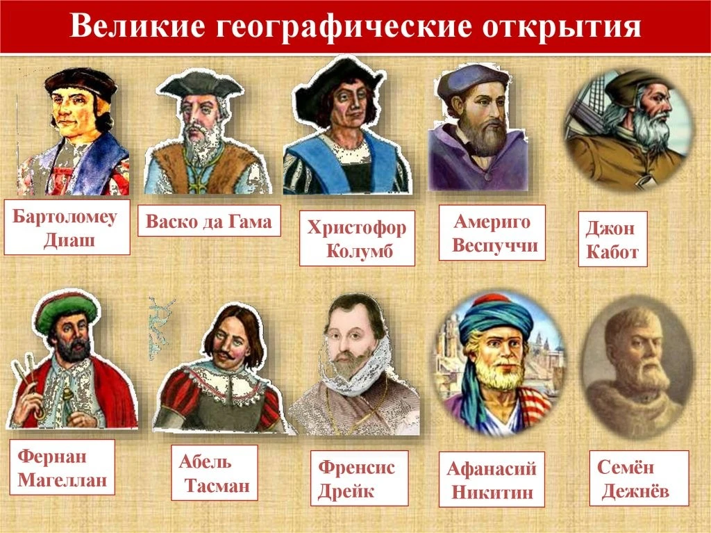
The Great Explorers and Navigators
Studying the history of island exploration reveals how world maps took shape, how navigation and cartography advanced, and how cross-cultural encounters influenced global politics and economics. Every newly discovered land shifted humanity's understanding of our planet’s geography, charting new courses for trade, colonization, and cultural exchange.
Ancient Discoveries: The Mediterranean Islands
The earliest recorded island discoveries belong to the peoples of the Mediterranean. The Phoenicians, Greeks, and Romans actively charted the region, establishing sea routes and founding colonies.
Renowned for their seafaring prowess, the Phoenicians were already exploring the islands of the western Mediterranean—such as Malta and Sardinia—by the first millennium BCE. Their merchant vessels hauled goods to ports across North Africa and the Iberian Peninsula, while an intimate understanding of winds and currents helped them navigate treacherous waters. Although no original Phoenician charts have survived, later historical sources reference them as vital navigational guides. 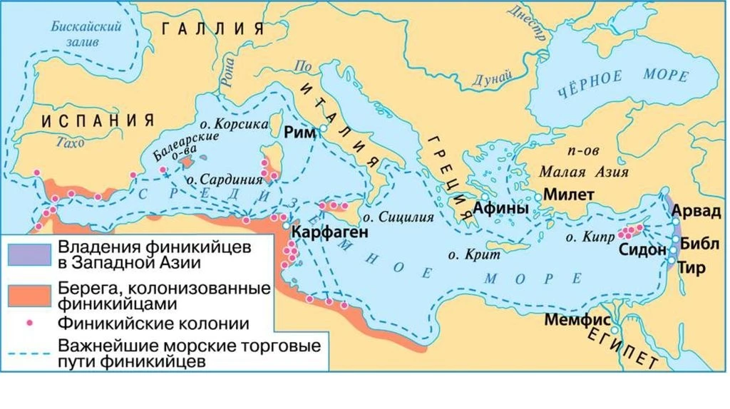
Map of Phoenicia
The Greeks expanded upon this knowledge, blending mythology with real-world maritime observation. Legends of the Argonauts sailing toward Colchis mingled with practical insights into Sardinia, Sicily, and the Aegean archipelago. Greek city-states like Athens and Corinth founded settlements on Sicily, Corsica, and beyond, strengthening trade networks and political alliances.
As the Romans brought the Mediterranean under their control, they incorporated many of these islands into their empire. Corsica, Sardinia, Cyprus, and the Balearic Islands became vital strategic hubs and economic powerhouses. Roman geographers such as Strabo organized knowledge of the region, meticulously detailing island locations, climates, and populations.
Navigation during this era relied on observing the stars, the sun, and coastal landmarks. While maps were rudimentary, they allowed sailors to navigate familiar waters. Discoveries were often accidental—born of violent storms or prolonged voyages when crews unexpectedly stumbled upon uncharted lands.
The Middle Ages: The Vikings and Early Voyages Beyond Europe
For most civilizations, the Middle Ages brought a slowdown in geographic exploration. The Norsemen, however, were a striking exception, pushing the boundaries of the known world ever outward. Their longships traversed vast oceanic expanses, leading to the discovery of islands across the North Atlantic.
Iceland was settled by Norse Vikings in the late ninth century. According to the sagas, the first permanent settler was Ingólfr Arnarson, who founded a settlement in the island's southwest in 874. The Vikings relied on their knowledge of ocean currents and bird migrations to track down new lands. 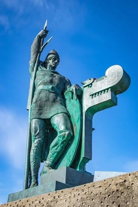
Statue of Ingólfr Arnarson
A century later, Greenland was discovered. Exiled from Iceland for manslaughter, Erik the Red reached this rugged landmass in 985 and established colonies there. Around the year 1000, his son Leif Erikson reached the shores of North America, naming the region Vinland. While its exact location remains a matter of scholarly debate, archaeological evidence strongly points to modern-day Newfoundland or Labrador.
The Vikings left no detailed charts behind, but their sagas and oral traditions preserved vivid accounts of these new frontiers. They preceded the Age of Discovery by several centuries, even though harsh climates and shifting political fortunes ultimately cut short any lasting colonization of these distant shores.
The Age of Discovery: The Caribbean and the Atlantic
The 15th and 16th centuries saw an explosion of interest in distant lands. The quest for new trade routes and the ambition to prove the Earth was round drove navigators into perilous expeditions. The discovery of the Caribbean and Atlantic islands marked a turning point in world history.
Funded by the Spanish Crown, Christopher Columbus sailed west in 1492 in search of a route to the East Indies. He landed in the Bahamas, Cuba, and Hispaniola, mistakenly believing he had reached Asia. The first permanent Spanish settlement in the New World, La Navidad on Hispaniola, was founded that same year. 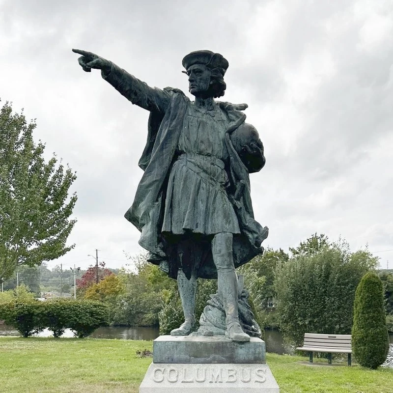
Statue of Christopher Columbus
Columbus's subsequent voyages between 1493 and 1504 expanded European awareness of the Antilles. The Spanish began colonizing the region, decimating indigenous populations and extracting gold. Even before Columbus, the Portuguese were charting the Atlantic, discovering islands along the African coast and across the ocean, including Madeira and Cape Verde. These lands served as vital waystations on the routes to the East and the New World.
When Vasco da Gama rounded the Cape of Good Hope in 1498, he opened a sea route to India. His voyage also spurred the discovery of new islands across the Indian Ocean. Drawing on Arab nautical charts and their own observations, the Portuguese established strongholds on Ceylon, Zanzibar, and elsewhere.
Key to this era was the refinement of navigational instruments, including the magnetic compass, astrolabe, and quadrant. Breakthrough charts produced by cartographers like Martin Waldseemüller and the makers of the Cantino Planisphere captured these new breakthroughs, steadily assembling a far more accurate picture of the globe.
The Search for Terra Australis Incognita and Pacific Island Discoveries
The belief in a vast southern continent, Terra Australis Incognita, had captivated thinkers since antiquity. The relentless quest to find this mythical landmass led to the discovery of hundreds of islands across the Pacific.
Dutch navigators led the way in exploring the region. In 1606, Willem Janszoon reached the coast of Australia, mistaking it for part of New Guinea. Abel Tasman's voyages in 1642–1643 brought the discovery of Tasmania (later named in his honor), New Zealand, and islands within the Fijian archipelago. While the Dutch mapped their findings with great precision, hostility from indigenous populations kept them from establishing permanent footholds. 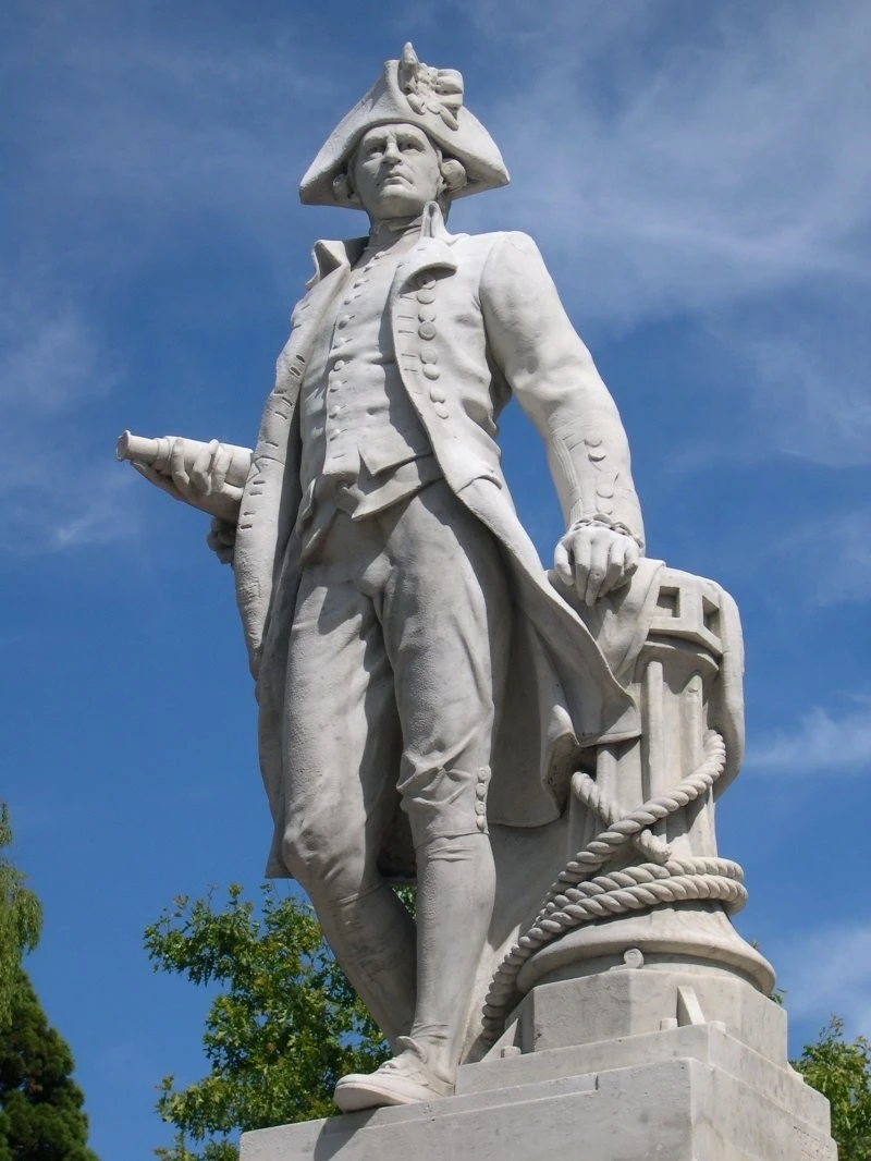
Statue of Captain James Cook
Between 1768 and 1779, British explorer Captain James Cook led three epic voyages across the Pacific. He mapped and documented a vast array of islands, including Hawaii, Tahiti, New Caledonia, and the Cook Islands. Cook sought not only to chart new lands, but also to study local indigenous cultures, flora, and fauna.
His navigational techniques were groundbreaking, relying on marine chronometers to calculate longitude and ensuring meticulous cartographic accuracy. Cook’s journals provide detailed observations of Polynesian life, customs, and traditions. Despite maintaining generally peaceful relations, Cook was killed in Hawaii in 1779 during a violent clash with islanders.
Cook's voyages laid the groundwork for British imperial expansion in the Pacific. The islands he documented became focal points of intense rivalry among European powers, while his scientific findings profoundly expanded European understanding of tropical biodiversity. 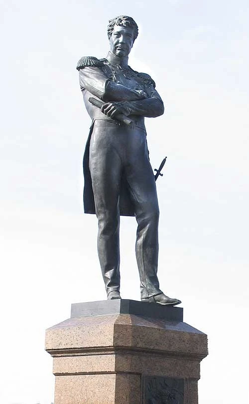
Statue of Ivan Krusenstern
Expeditions toward Antarctica held immense significance. Between 1819 and 1821, Fabian Gottlieb von Bellingshausen and Mikhail Lazarev discovered the frozen continent, along with numerous islands across the Southern Ocean. Their expedition confirmed the existence of Antarctica and dramatically widened geographic knowledge of polar realms.
These voyagers balanced commercial objectives—chiefly resource extraction—with rigorous scientific research. They recorded coordinates, cataloged local plant and animal life, and initiated contact with native peoples. Their charts remained in use by European powers well into the 20th century.
The 19th Century: Closing the Era of Great Discoveries
By the 19th century, most of the world's major islands had been charted, although blank spots lingered across Oceania, the Arctic, and Antarctica. The close of the Age of Discovery was marked by the systematic organization of existing knowledge and the rise of dedicated scientific exploration.
British and French expeditions continued surveying Polynesia, Melanesia, and Micronesia. Naturalists and scholars traveling aboard naval vessels assembled vast collections of botanical, zoological, and ethnographic specimens that would fill European museums.
Scientific attention increasingly turned to climate and marine science. Between 1872 and 1876, the British Challenger expedition explored the ocean depths, gathering oceanographic data that laid the foundations of modern oceanography. While HMS Challenger discovered no major new islands, its deep-sea soundings revolutionized science's grasp of the open ocean. 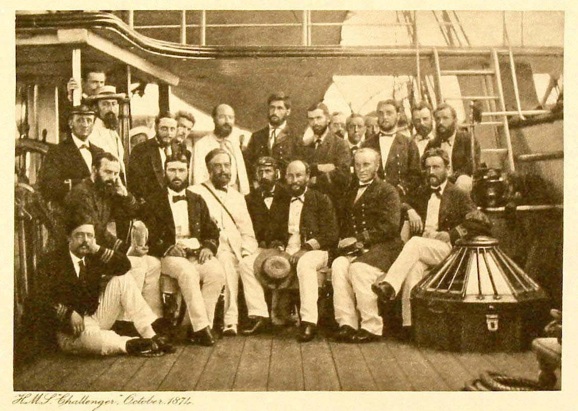
The Crew of the Challenger Expedition
In the Arctic, polar explorers searched for the Northwest and Northeast Passages through the ice. Expeditions discovered islands across the Canadian Arctic Archipelago, mapped Svalbard, and charted remote lands vital for maritime transit and natural resource development.
By the late 19th century, world maps looked strikingly modern, though remote atolls and reefs continued to be documented into the 20th century. The 1913 discovery of the Severnaya Zemlya archipelago by a Russian polar expedition stood as the last major geographic find of its kind. The era of discovery gradually gave way to colonial politics, as newly charted islands became chess pieces in territorial disputes and economic exploitation.
The Consequences: Colonization, Trade, and Cultural Exchange
The discovery of islands brought far-reaching consequences that fundamentally altered the course of world history.
First, newly found lands became prime targets for colonization. European powers established settlements, exploiting local natural resources and native labor. Indigenous populations frequently endured devastation through disease, violence, forced assimilation, and compulsory conversion to Christianity.
Second, islands evolved into vital nodes in global commerce. The Canary Islands served as a crucial staging post on the route to the East, Hawaii became a bustling whaling hub, and the Caribbean dominated the production of sugar, tobacco, and coffee. These maritime crossroads stitched the continents together, laying the groundwork for a truly global economy.
Third, cross-cultural encounters sparked both exchange and devastating conflict. Europeans adopted island innovations (such as hammocks and canoe designs) and agricultural staples (sago, yams, coconuts, tobacco, and cacao), while island communities took on European customs, garments, and religious beliefs. Yet colonization often dismantled traditional societies, leading to the irreversible loss of languages, heritage, and indigenous crafts. 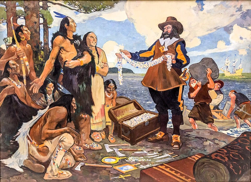
Trade with Island Peoples
Finally, these voyages served as an immense catalyst for science. Botanists, zoologists, and ethnographers traveling with expeditions documented previously unknown species and distinct cultural traditions. Their observations formed the bedrock of emerging disciplines like anthropology and biogeography.
Today, many island nations bear the enduring imprint of their colonial past—in their languages, architecture, and social structures. At the same time, they actively work to revitalize their cultural heritage, striking a delicate balance between modern globalization and indigenous identity.
The history of island discovery is a saga of human ambition, courage, and relentless curiosity. From the earliest Mediterranean seafarers to the polar expeditions of the early 20th century, every voyage expanded the frontiers of human knowledge.
These discoveries were far more than geographic milestones. They reshaped political boundaries, forged new trade networks, and transformed cultural landscapes. They set into motion shifts that still resonate today—in place names, cultural traditions, and global shipping lanes.
Modern technology allows us to study remote islands with unprecedented accuracy, yet the spirit of discovery remains very much alive. We continue to uncover fresh wonders in these secluded corners of the globe—from groundbreaking archaeological finds to fragile ecosystems and stories of community resilience.
Remembering explorers like Columbus, Cook, and Bering reminds us that the world is still brimming with mysteries. Every island, like a page from an ancient manuscript, holds testament to the past—waiting to be read anew.