33 breathtaking views from the skies. 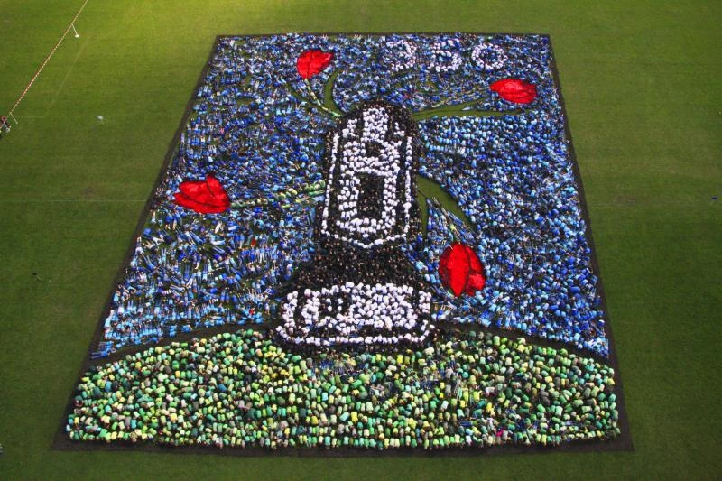
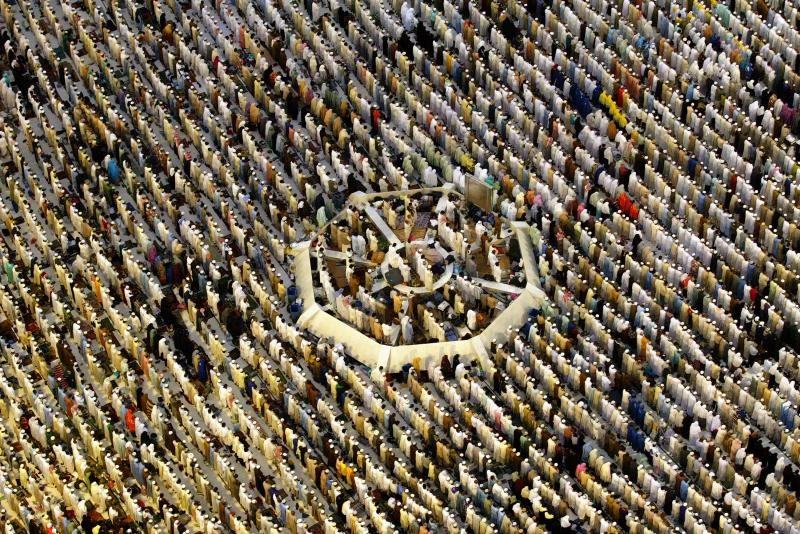
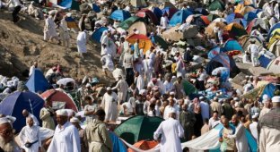
1. Muslim pilgrims at one of Islam's holiest sites, the Grand Mosque in the birthplace of the Prophet Muhammad, in Mecca, Saudi Arabia, on December 4, 2008. More than two million Muslims travel to the holy city of Mecca annually to perform the Hajj, the fifth pillar of Islam, along with prayer (salat) and fasting (sawm) during the month of Ramadan. (UPI Photo/Mohammad Kheirkhah) 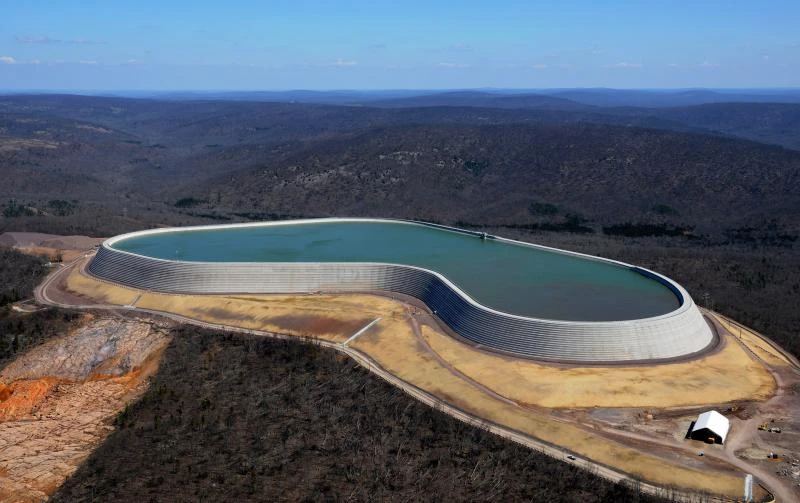
2. AmerenUE officially opened its new Taum Sauk hydroelectric reservoir project in Lesterville, Missouri, on May 27, 2010. The Taum Sauk project, which has a capacity of over 5 billion liters of water, cost $490 million. On December 14, 2005, a dam failed at the upper Taum Sauk reservoir near Lesterville, causing a flood that washed away several homes and cars. The 50-acre upper reservoir was destroyed in just 12 minutes. A clearing in the lower left corner of the image reveals the area where the water gushed from the reservoir. UPI/Ameren UE 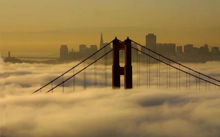
3. Sea fog covers the Golden Gate and San Francisco Bay at dawn, April 25, 2001. Terry Schmit/UPI 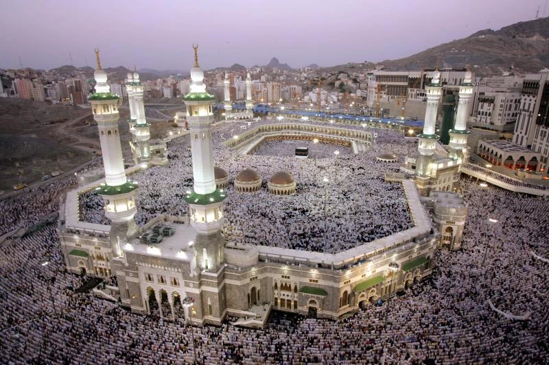
4. Pilgrims participate in mass prayer at the Grand Mosque (al-Masjid al-Haram) in Mecca during the Hajj pilgrimage on December 4, 2008. (UPI Photo/Mohammad Kheirkhah) 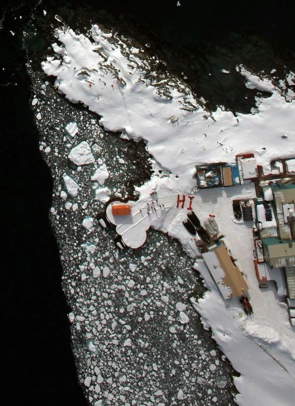
5. Residents of Antarctica's Palmer Station create a visible greeting from the air using their bright red U.S. Antarctic Program uniform jackets. This photo was taken from a NASA DC-8 flying science laboratory during Operation Ice Bridge, a program aimed at conducting aerial surveys of large areas of Antarctica. UPI/John Arvesen/NASA 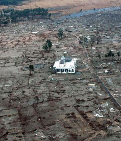
6. A mosque is the only building remaining after the tsunami in a coastal village in Aceh Province, Sumatra, Indonesia. This photo was taken from a U.S. Navy helicopter on January 4, 2004, during humanitarian relief efforts following the tsunami that struck Southeast Asia. (UPI Photo/Jacob Kirk/Navy) 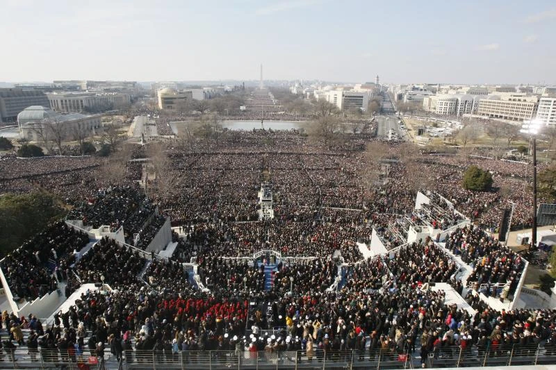
7. An aerial view of the inauguration ceremony of President Barack Obama at the Capitol in Washington, January 20, 2009. One and a half million people gathered for the ceremony. UPI/Mark Wilson/Pool 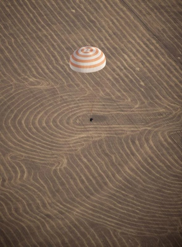
8. The landing of the Soyuz TMA-14 spacecraft near Arkalyk, Kazakhstan, on October 11, 2009. The crew spent six months aboard the ISS. UPI Photo/Bill Ingalls/NASA 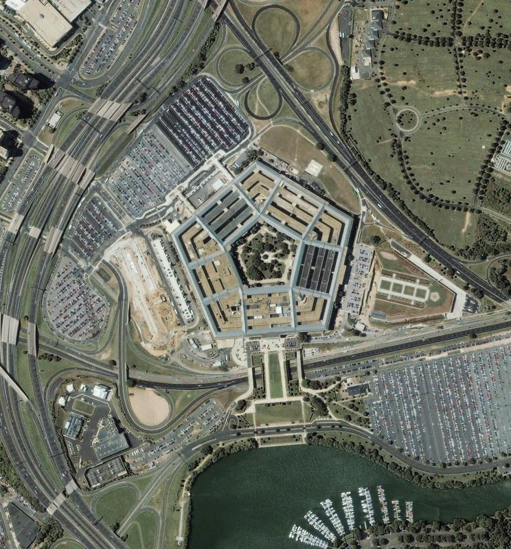
9. An aerial photo taken by the IKONOS satellite on September 7, 2001, from a series of images of the Pentagon before and after September 11, 2001. rlw/SPACE IMAGING UPI 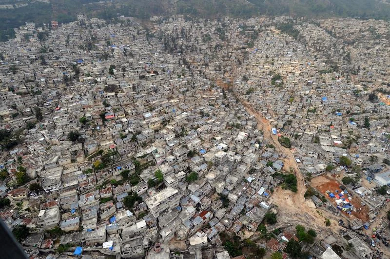
10. This aerial photo of Port-au-Prince, Haiti, taken March 16, 2010, shows damage from the magnitude 7.0 earthquake that struck January 12. UPI/Spike Call/U.S. Navy 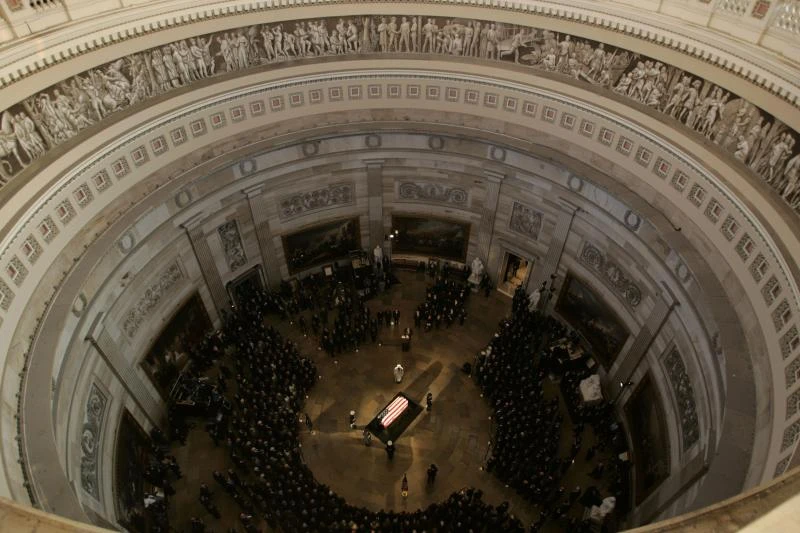
11. An overhead view of the casket of former President Ronald Reagan in the Capitol Rotunda on Capitol Hill on June 9, 2004. (UPI Photo/Rick McKay, Pool) 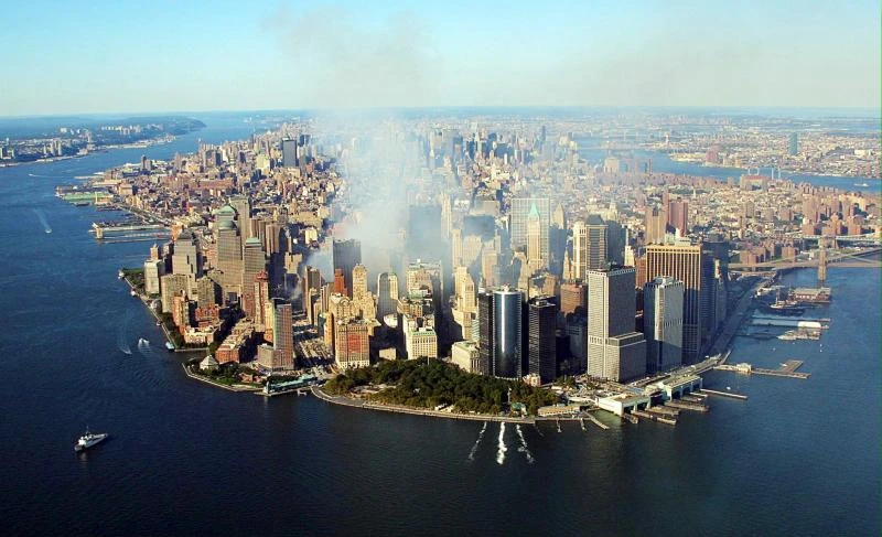
12. Smoke continues to rise from the rubble of the collapsed World Trade Center buildings on September 15 in New York City. UPI PHOTO/POOL/KEITH MEYERS 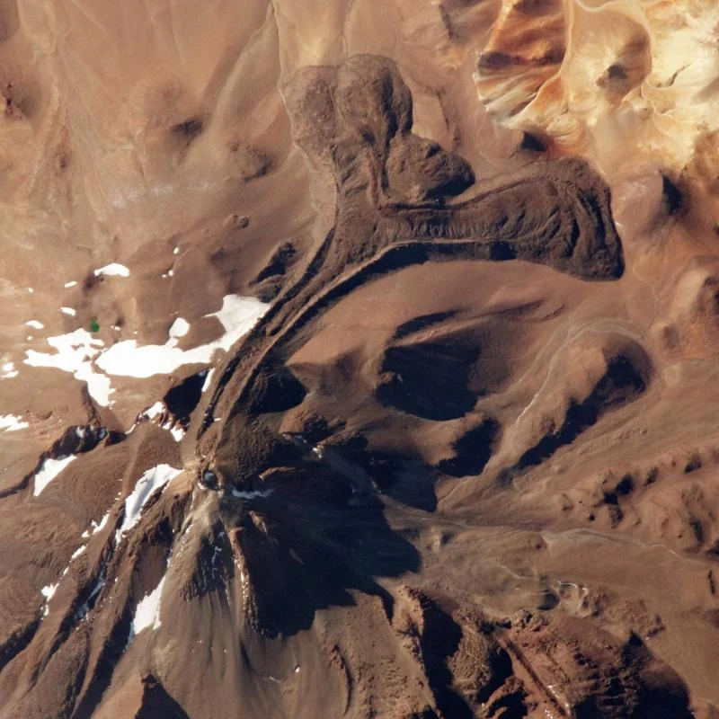
13. This undated NASA image taken from the International Space Station shows the summit of Llullaillaco Volcano in South America, the world's tallest active volcano. The volcano, which stands at 6,723 meters above sea level, last erupted in 1877. UPI/NASA 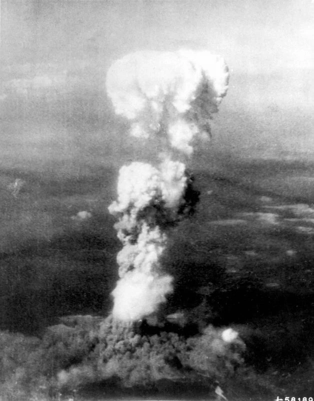
14. The mushroom cloud from the explosion of the first atomic bomb in Hiroshima on August 5, 1945. Two aircraft participated in the bombing. One aircraft carried the bomb, and the other served as an escort. (UPI Photo/USAF/Files) 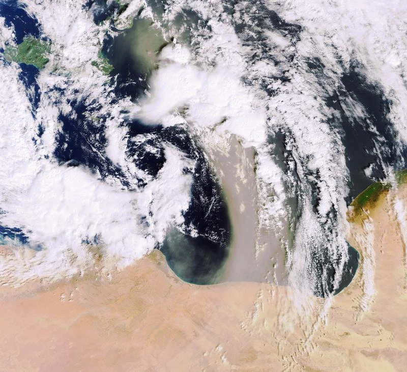
15. Sandstorms like this one, seen in this February 10, 2007, photo moving across the Mediterranean from the Libyan Desert, typically result from atmospheric convection, which occurs when warm, light air rises and cold, heavy air sinks. Cold air in this image appears to flow from the upper left of the image to the center and back north, directly over Libya, while warm air flows from south to north. (UPI Photo/ESA) 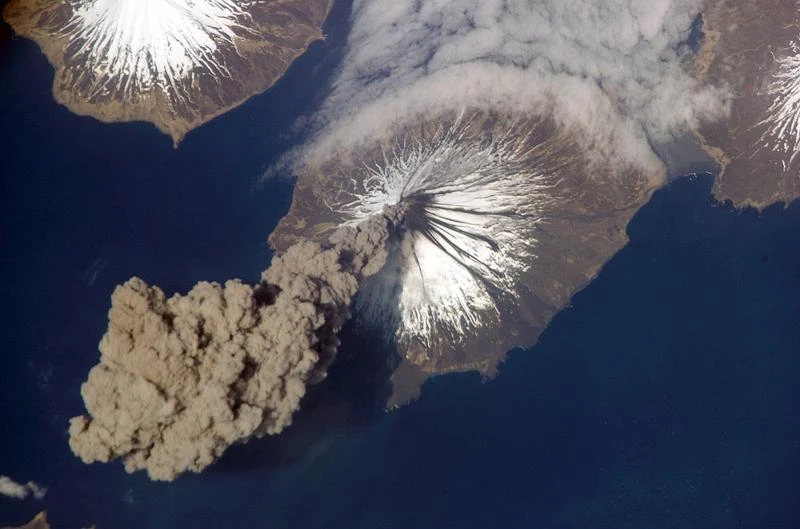
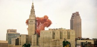
16. Mount Cleveland, located on the western side of Chuginadak Island in Alaska, spews an ash column at 3:00 p.m. on May 23, 2006. Cleveland is one of the most active volcanoes in the Aleutian Islands. Jeff Williams, flight engineer for Expedition 13 of the International Space Station (ISS), took this photo immediately after the volcano erupted. Two hours later, the ash cloud emitted by the volcano reached 6,000 meters above sea level. (UPI Photo/Jeff Williams/NASA)
17. 4,700 people formed this figure to mark International Day of Climate Action in Uden, Netherlands, on October 24, 2009. The number 350 symbolizes the safe limit for carbon dioxide levels in the Earth's atmosphere. UPI/Daniel Dancer/Uden Partners/350.org 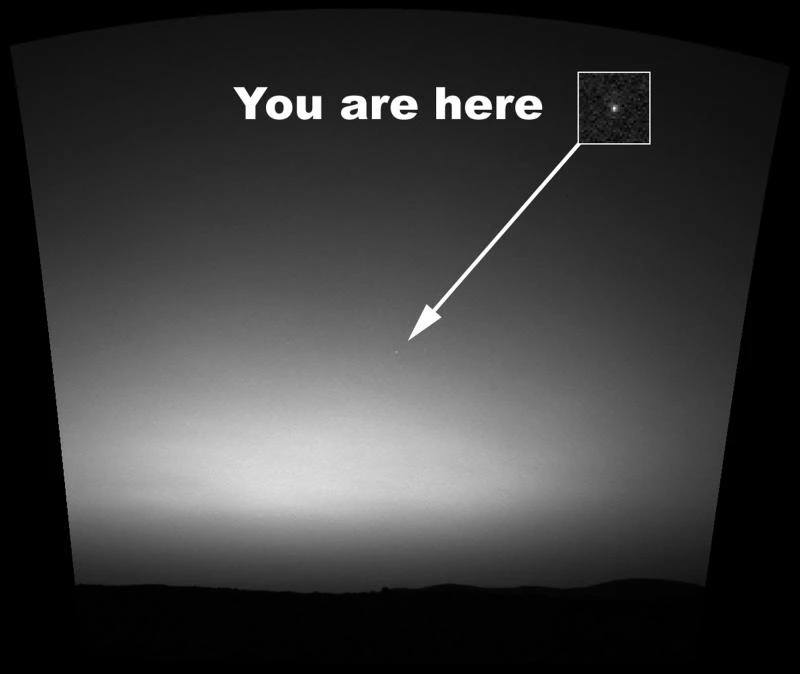
18. This is the first image of Earth from the surface of a planet beyond the Moon. It was taken by the Spirit rover an hour before sunrise on the 63rd Martian day of its mission. The image is a mosaic of images taken by the rover's navigation camera and images from the rover's panoramic camera. The image contrast has been doubled to make Earth easier to see. (UPI Photo/NASA/JPL/Cornell/Texas A&M) 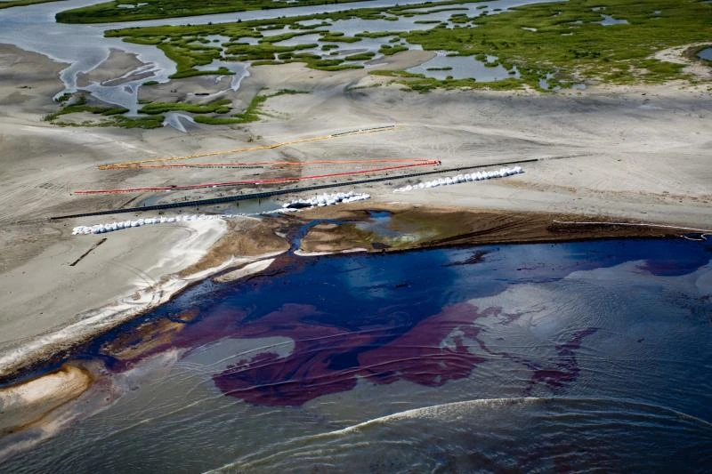
19. This aerial image from May 22, 2010, shows booms surrounding Grand Isle, Louisiana, to protect it from spilling oil. (UPI/Joshua Drake/BP) 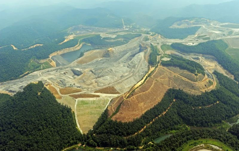
20. An aerial view of the Appalachian Mountains in southern West Virginia, where open-pit mining is taking place, taken on July 24, 2009. UPI/Debbie Hill/File 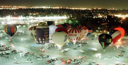
21. Colored orbs appear in the illuminated night sky at a parking lot in St. Louis, Missouri, on November 13, 1998. bg/wy/Bill Greenblatt/UPI 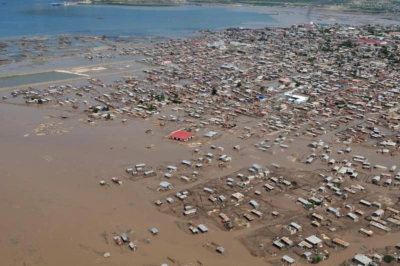
22. An aerial view of Port-au-Prince after the passage of a hurricane on September 9, 2008. (UPI Photo/William S. Parker/U.S. Navy) 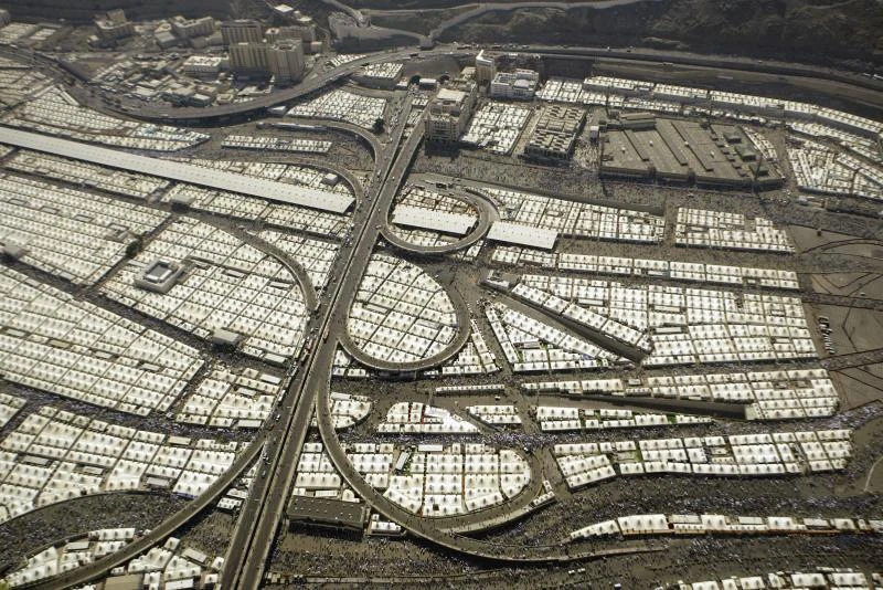
23. Muslim pilgrims walk past tents in the Mina Valley near Mecca, Saudi Arabia, on December 9, 2008. More than two million Muslims travel to the holy city of Mecca annually to perform the pilgrimage. (UPI Photo/Mohammad Kheirkhah) 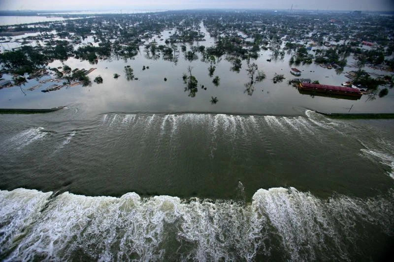
24. Water pours through a breach in a dam that was damaged by high winds and floodwaters. This photo was taken in the greater New Orleans area on August 30, 2005, after Hurricane Katrina. (UPI Photo/Vincent Laforet/Pool) 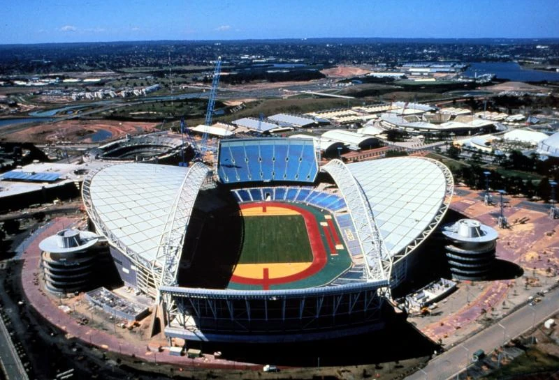
25. A view of the Sydney Olympic Stadium, which hosted the Games from September 15 to October 1, 2000. (iw/ho/prn/UPI) 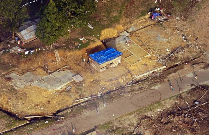
26. An aerial view off the coast of Sumatra, Indonesia. A Yokohama tire factory was destroyed nearby. People try to attract the attention of a U.S. Navy helicopter carrying humanitarian aid on January 21, 2005, after a tsunami struck Southeast Asia. (UPI Photo/Benjamin D. Glass/Navy) . 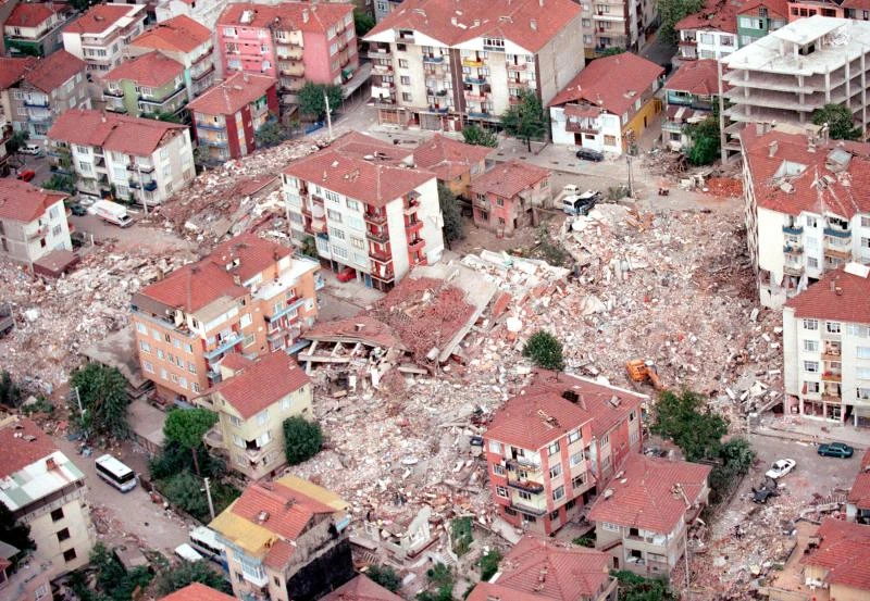
27. The aftermath of an earthquake in a residential area near the Turkish city of Izmit on August 23, 2009. jr/Seth Rossman/US Navy/UPI 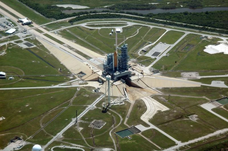
28. An aerial view of part of the massive Kennedy Space Center complex. The image shows the Vertical Assembly Building (VAB) and surrounding areas. (UPI Photo/NASA) 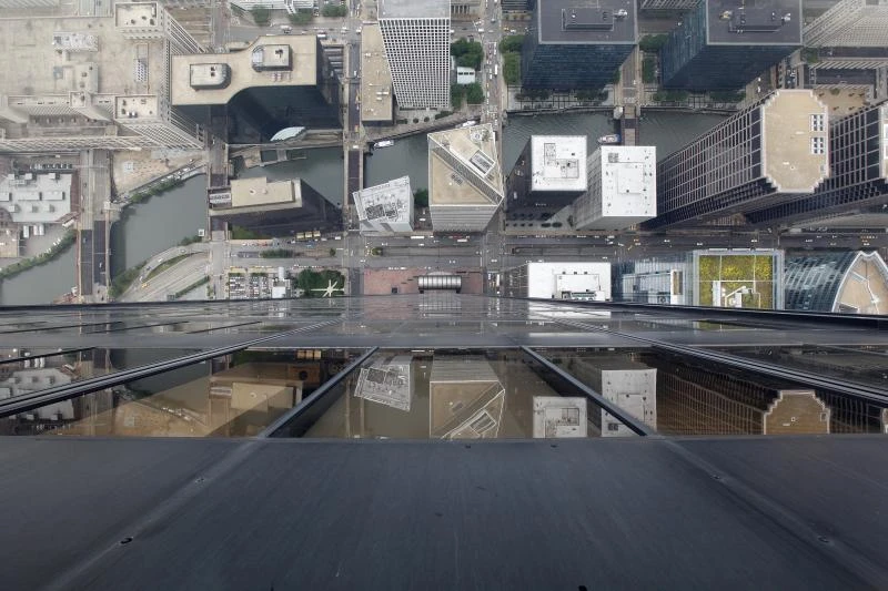
29. Cars are seen driving along Wecker Drive in this July 1, 2009, photo taken from the 103rd floor of the Chicago Tower. The Ledge, a glass balconies on the west side of the building, is one of the world's most famous Skydeck observation decks. It offers unique views of the city through glass more than a meter thick. UPI/Brian Kersey 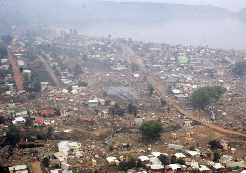
30. Dichato, Chile, seen from the sky on March 3, 2010. Several regions of Chile suffered devastation and hundreds of people died after an 8.8-magnitude earthquake struck on February 27, 2010. UPI/Carlos Acuna 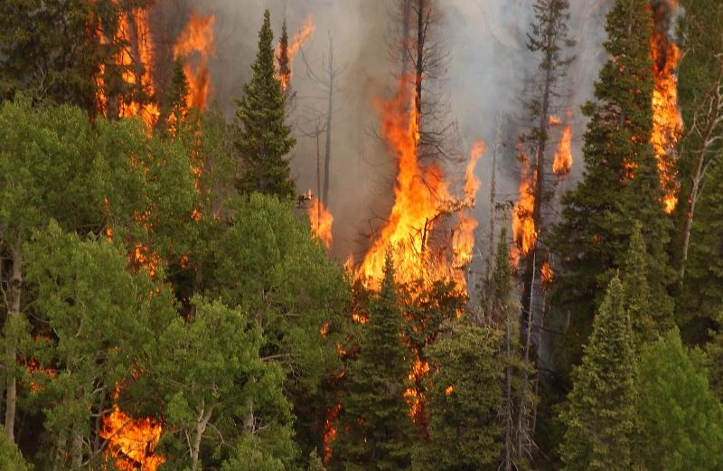
31. Glenwood, Colorado, near Glenwood Springs. Fire on June 15, 2002. Andrea Booher/FEMA/UPI 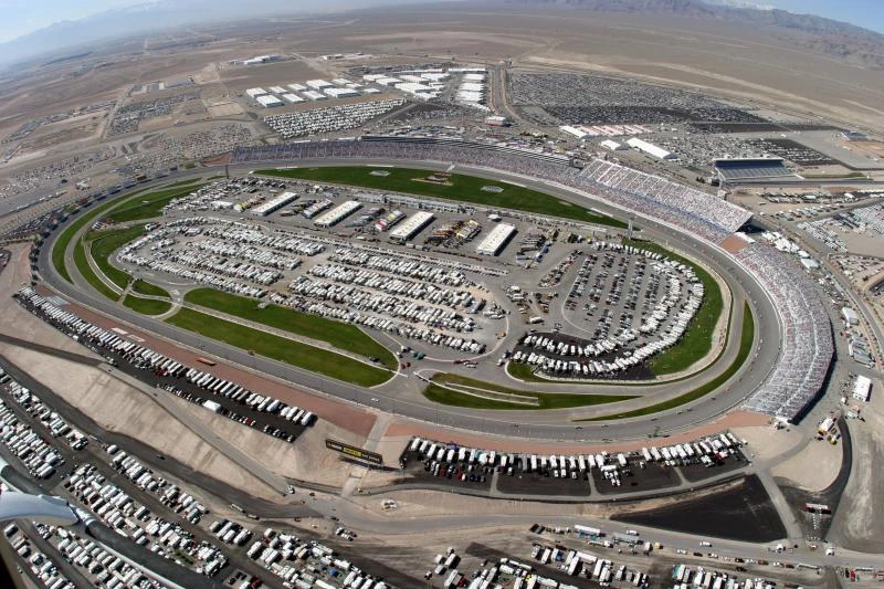
32. A large crowd fills the arena during the NASCAR 300 on Saturday, March 6, 2004, at the Las Vegas Motor Speedway in Las Vegas, Nevada. (Dave Smith) 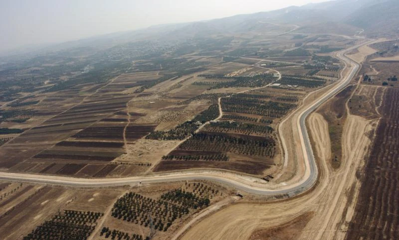
33. The Israeli security fence separating the West Bank from Israel. This aerial photo was taken outside Jerusalem on August 13, 2005. The Israeli government claims the fence is necessary to protect Israeli citizens from Palestinian terrorists coming from the West Bank. (UPI Photo/Debbie Hill)
Add your comment
You might be interested in:


A young Ukrainian itishnik became the owner of the McLaren

A car transporter with very rare Mercedes was spotted in

In Ukraine there is a famous buyer for the most extreme

Desert Dynamics buggy with a Chevrolet V8 engine that can

Hajj to Mecca (5 photos)
Hajj. Pilgrimage to Mecca (50 photos)

Artifacts of ancient magical rituals found in the mountains

Barbie doll is 65 years old - what she would look like in

Children's cartoon characters who will appear in nightmares

The Gods Cursed Sisyphus

A guy revealed the secrets of popular magic tricks

Choosing a box for a cat

The Rolling Stones vs. Everyone: A New Album as a Response

A roundhouse kick in elegant style: Van Damme's legendary

The Uninvited Guest: A Huge Cockroach Crawled Under a

The path to mastery: how years of training turn into art

What children in the courtyards dreamed of: a man spun

A pole dancing lesson ended in a flood in the apartment
