30 maps that show how much the world has changed (31 photos)
There's something really fascinating about ancient maps, isn't there? It's like looking at and touching (if you're lucky!) a real piece of history and proof of the evolution of civilizations. And it’s simple - it’s always interesting to look at the world through the eyes of our ancestors. And even if you're not particularly interested in geography, the detail and illustrations make these maps so colorful that you'll feel like you're immersed in a tiny fairy-tale world on the endpaper of the book. 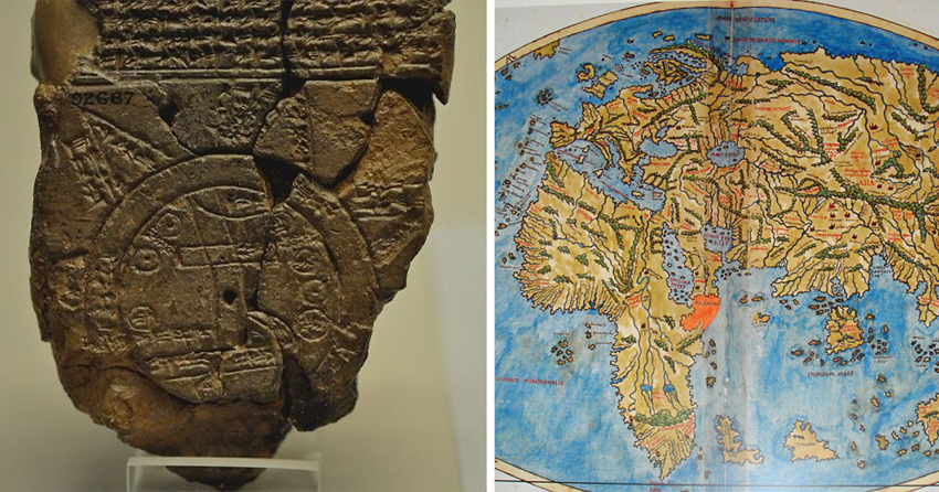
1. Babylonian World Map (Imago Mundi) 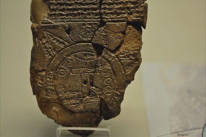
In the sixth century BC, the earliest known map in the world was created in Babylon. The map places Babylon at the center of the region, which does not extend beyond the borders of Mesopotamia. "Salt water" surrounds the globe. The Babylonians believed that it was impossible to reach the seven triangles across the river.
2. Map of the world according to Herodotus 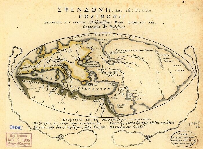
This map of the world was drawn in the second century BC by Posidonius. It expands the ancient Greeks' understanding of the world and includes the discoveries of Alexander the Great.
3. Ptolemy's world map 
Ptolemy's world map drawn up in 150 AD. For the first time in history, lines of longitude and latitude were added to the world map.
4. Peutinger table (Tabula Peutingeriana) 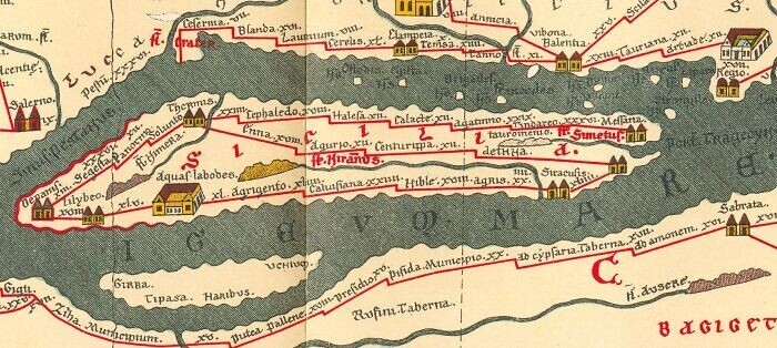
The entire map is very long and extends from Iberia to India, with Rome serving as the geographic center of the globe.
5. Map of the world by Johannes Ruysch 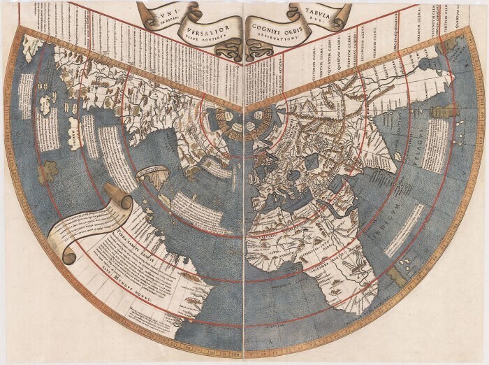
World Atlas by Johann Ruysch, created in 1507. This map shows one of the first images of the New World.
6. World map of Isidore of Seville 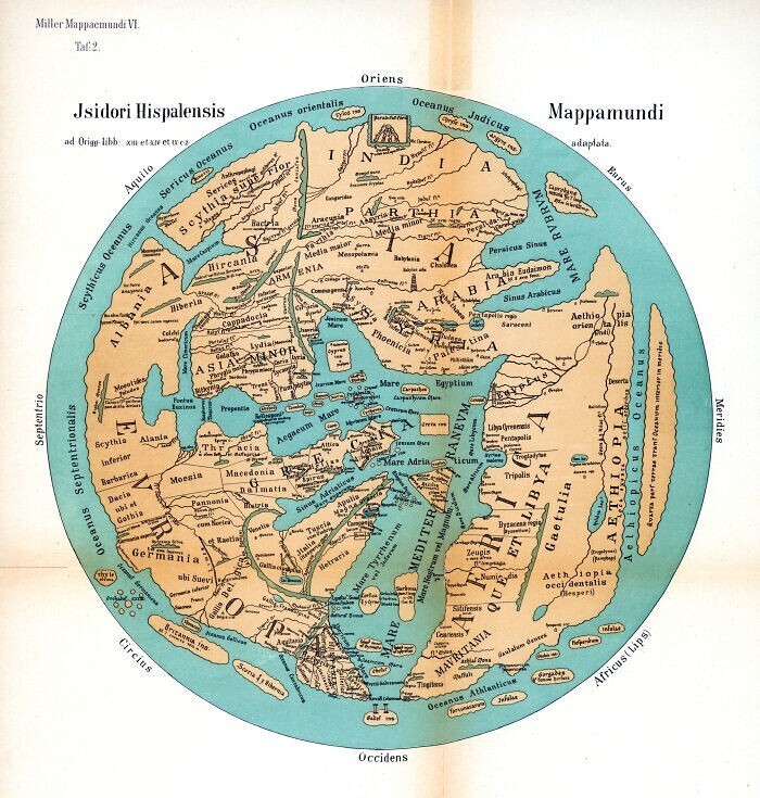
Isidore of Seville created this T-O type map in the seventh century. Such maps placed Jerusalem at the center and divided the globe into three equidistant regions: Asia, Europe and Africa.
7. Map of Fra Mauro 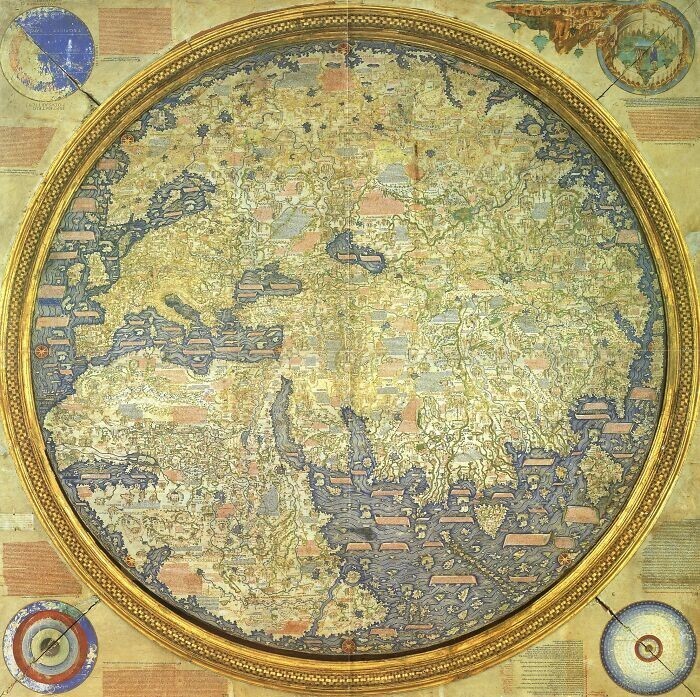
This map was drawn between 1457 and 1459 by the Venetian monk Fra Mauro. Andrea Bianco, a sailor and cartographer, helped create this map, demonstrating his intimate knowledge of the globe.
8. Globe “Earth Apple” 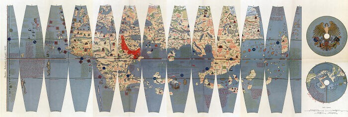
Martin Beheim constructed the globe "Earth Apple" (German: Erdapfel) in Germany in 1492. This is the oldest globe that has survived to this day. He depicts the world as spherical and the unknown America as an empty ocean.
9. Bianco World Map 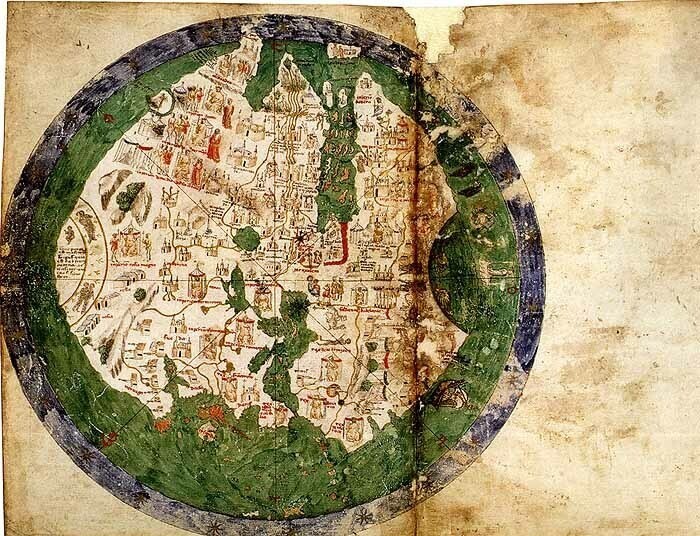
Andrea Bianco's 1436 atlas consists of ten sheets of parchment measuring 29 cm? 38 cm in 18th century binding. The first sheet contains the "marteloyo rule" for maritime navigation, and also depicts the "circle and square", two tables and two diagrams. The next eight sheets are various nautical maps, including Ptolemy's world map. Some believe that Bianco's maps were the first to accurately depict the Florida coastline. Bianco and Fra Mauro also worked together to create Fra Mauro's world map in 1459.
10. Bunting's clover-shaped world map 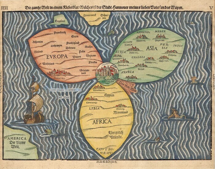
This map, created by Henry Banting in Germany in 1581, is a later Christian map. She imagines the world as an extension of the Christian trinity, with Jerusalem serving as the center that binds everything together.
11. Map of Juan de la Cosa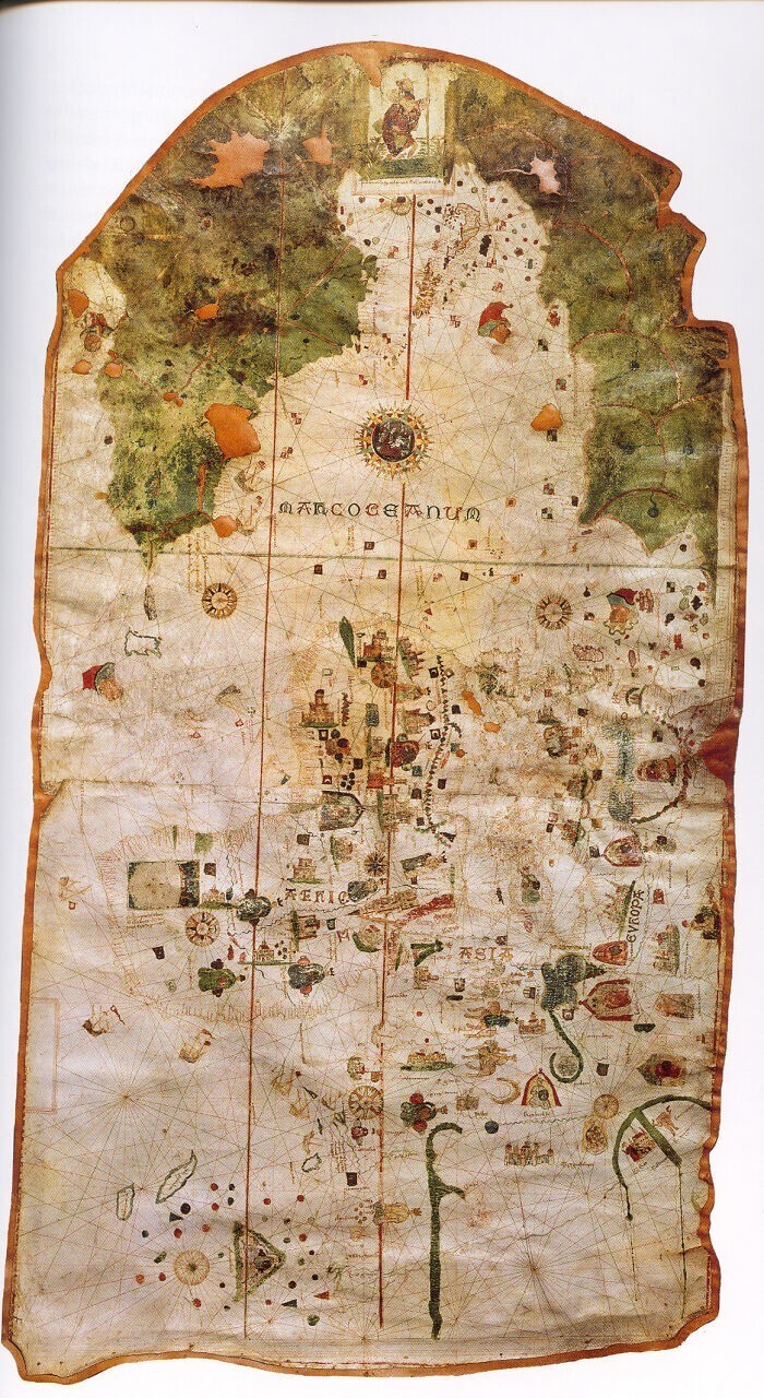
The only surviving map created by Juan de la Cosa, a Spanish cartographer, explorer and conquistador, is this mappa mundi from 1500. Juan de la Cosa was born in Santoa in the northern autonomous region of Cantabria. This is the first known example of a European map of America. It is currently housed in the Naval Museum of Madrid. Humboldt gives reproductions of it in his geographical and physical atlas.
12. Planisphere Cantino 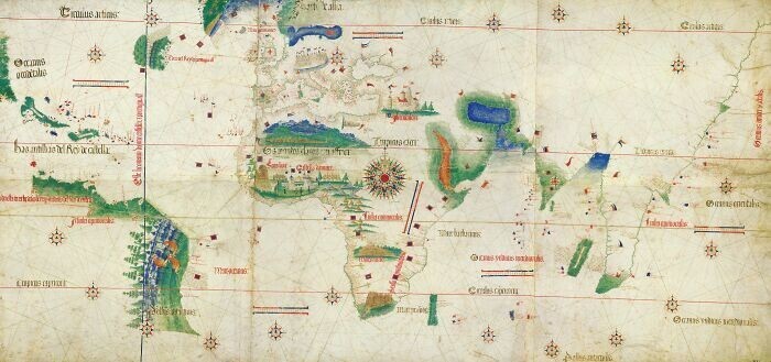
The oldest map surviving to this day shows the Portuguese discoveries in the east and west. It was successfully transported from Portugal to Italy in 1502 by the agent of the Duke of Ferrara, Alberto Cantino, who bears his name. Along with images of Africa, Europe and Asia, it also depicts the Caribbean islands and what appears to be the Florida coastline. The map is especially notable for its schematic depiction of the coast of Brazil, which the Portuguese explorer Pedro Ivares Cabral discovered in 1500.
13. Map of Pietro Coppo 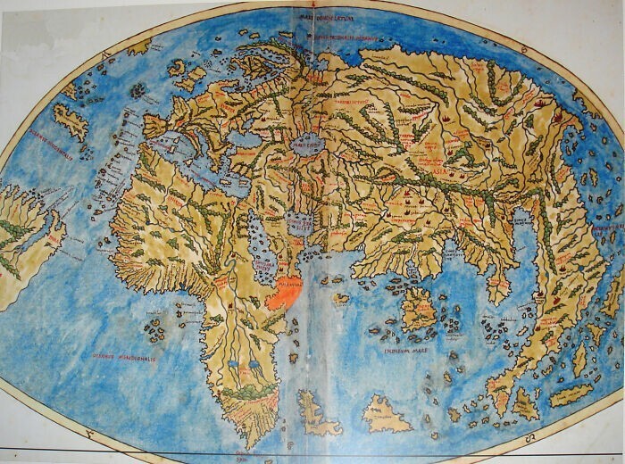
One of the last maps of the globe to depict the Tail of the Dragon, Ptolemy's vision of a phantom peninsula in the Indian Ocean extending south from the easternmost point of Asia.
14. Waldseemüller map (Universalis Cosmographia) 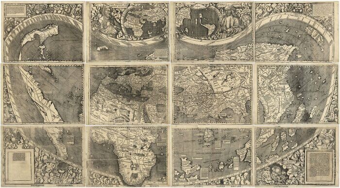
Map created in 1507 by Martin Waldseemüller and Matthias Ringmann. A small strip of the east coast is the earliest depiction of the New World, otherwise known as “America.”
15. De Virg's world map 
Albertin de Virga created this world map between 1411 and 1415. A map of the Mediterranean from 1409, similarly produced in Venice, is attributed to the Venetian Albertin de Virga. A circular world map measuring 69.6 cm by 44 cm was drawn on parchment. It consists of the map itself with a diameter of 44 cm and an addition that includes two tables and a calendar.
16. Map of Hendrik Hondius 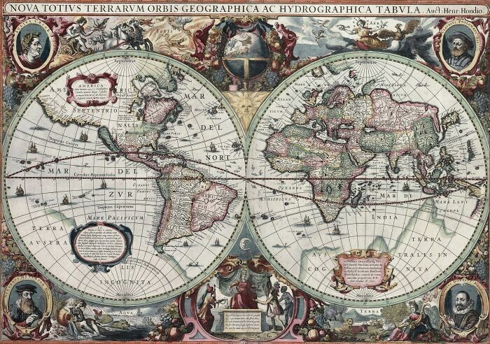
Hendrik Hondius drew the world map Nova Totius Terrarum Orbis Geographica ac Hydrographica Tabula (New Geographical and Hydrographic Map of the Whole World) in 1630, and the following year it was included in the appendix of the Atlantis Maioris atlas in Amsterdam. The paintings symbolize the four elements: fire, air, water and earth. Also depicted at the corners of the atlas are Julius Caesar, Claudius Ptolemy and the two first publishers of the atlas, Gerardus Mercator and Jodocus Hondius, Hendrik's father.
17. World map of Kozma Indikoplov 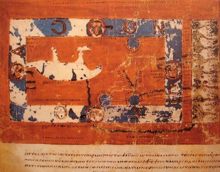
Cosmas Indicoplov's sixth-century world map depicts the globe as a rectangular surface.
18. Anglo-Saxon Cotton map 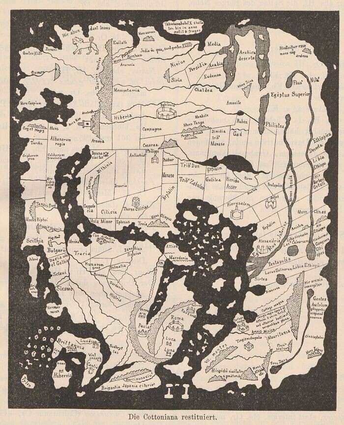
The Anglo-Saxon Cotton Map was created between 1025 and 1050 AD. The highest area of this map consists of the eastern regions of the earth. Misinterpreting descriptions of the Red Sea, the artist mistakenly colored every river in Africa red.
19. Roger's book 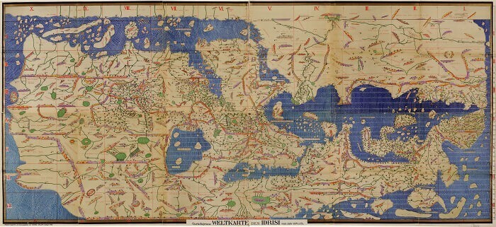
The Book of Roger (Tabula Rogeriana) by the Arab geographer al-Idrisi was drawn in 1154. This map was compiled based on reports from Arab traders who traveled around the world. At that time it was the most detailed and accurate map in the world. The map shows a lot of Europe and Asia, but only the northern regions of Africa are shown.
20. Psalter map of the world 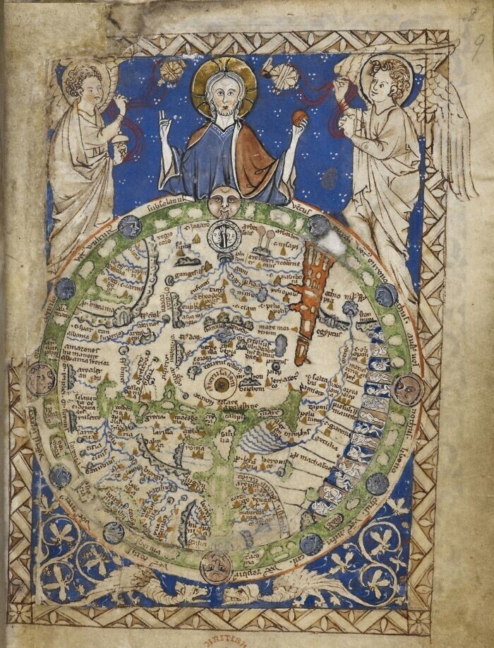
The psalm chart was drawn by an unknown medieval monk in 1260 AD. Maps from this period usually placed east at the top of the globe, where the sun rises and Jesus watches over the world.
21. World map by Pietro Vesconte 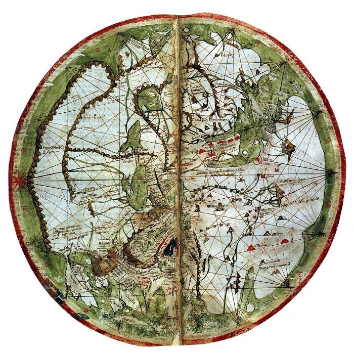
Pietro Vesconte, an Italian geographer, drew this world map in 1321. After centuries of T and O maps, Vesconte restored the accuracy of maps by using nautical charts to plot the seas.
22. Genoese map 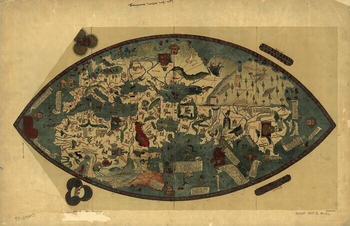
The Genoese map was created in 1457 based on descriptions by Niccolò da Conti. This map illustrates the evolving European understanding of the Asian continent after the first trade links were established between China and Mongolia.
23. World map by Gerard van Schagen 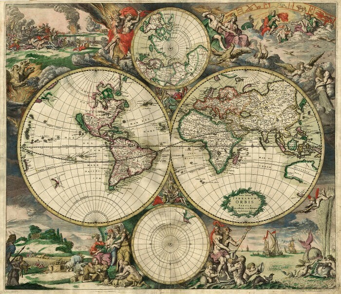
World map created in 1689 by Gerard van Schagen. With the exception of a few ambiguously empty areas in the Americas, most of the planet had been mapped by this point.
24. World map of Pomponia Mela 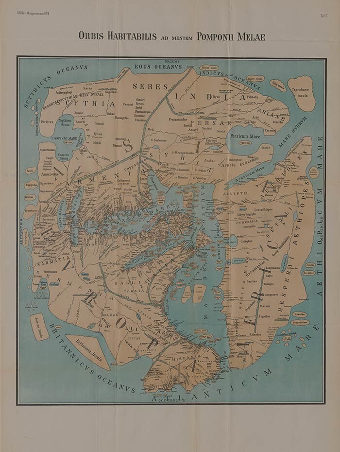
World map of Pomponius Mela, one of the first Roman geographers, created in 43 AD.
25. Route map from Dura-Europos 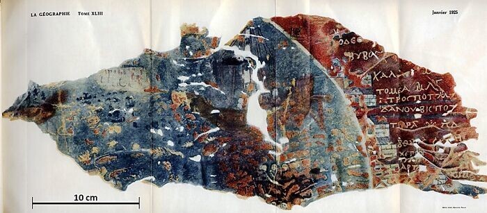
A parchment from Dura Europos depicting part of the Black Sea coast, dates to around 200 AD. The map was found in 1923 by F. Cumont in Syria.
26. Catalan World Atlas 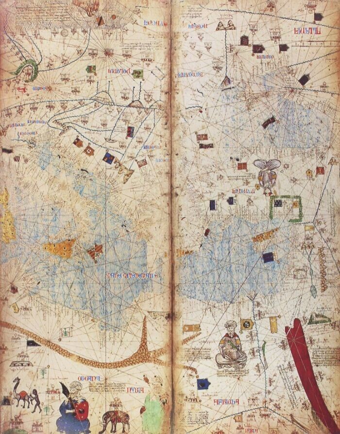
The Catalan World Atlas was produced by the Mallorca School of Cartography and is attributed to Cresques Abraham. The texts on the first two sheets are written in Catalan and deal with cosmology, astronomy and astrology. Illustrations accompany these texts. The spherical shape of the Earth and the current status of the known globe are emphasized in words and illustrations. He also taught sailors how to tell time at night and how to determine the tides.
27. Borgia World Map 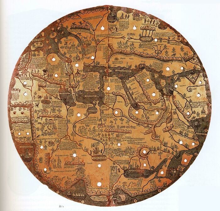
The Borgia Map is an early 15th century world map that is primarily decorative. It was engraved on a metal plate.
28. Piri Reis map 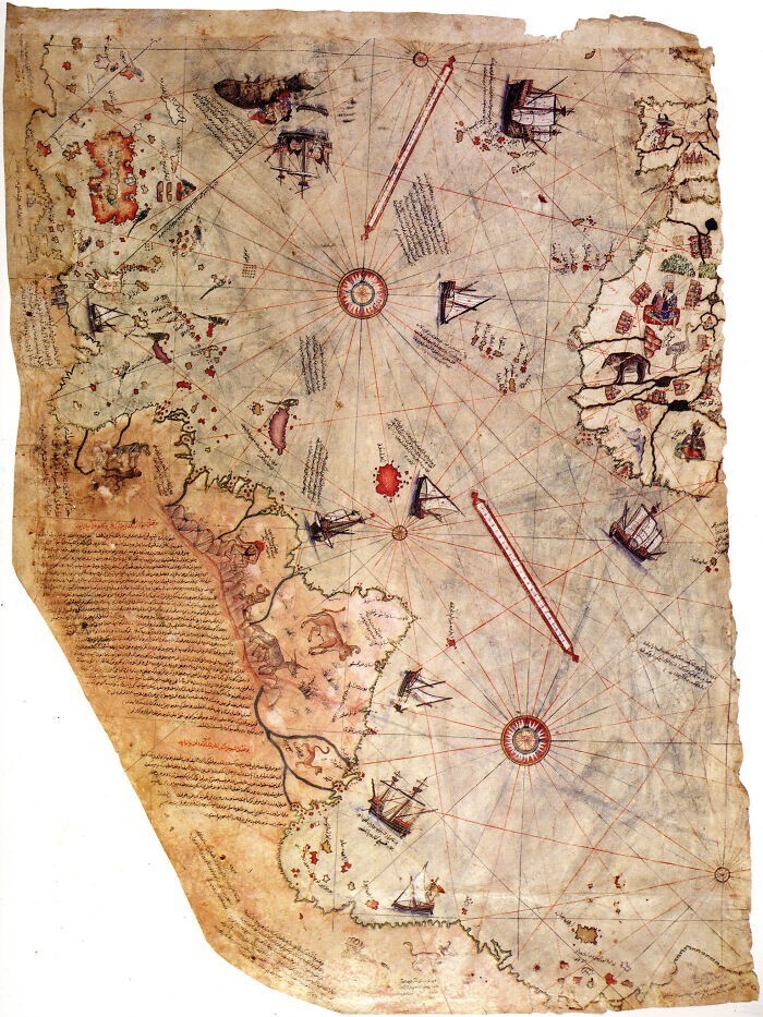
The Piri Reis map was compiled by the Ottoman Turkish admiral and geographer Piri Reis in the 16th century. The surviving third of the map fairly accurately depicts parts of the western coasts of Europe and North Africa, and also clearly shows the coast of Brazil. The mythical island of Antilia is depicted, as well as several other Atlantic islands, including the Azores and Canary Islands. The map is notable because it shows what appears to be an extension of the American continent to the southeast, which some say is evidence that ancient cartographers knew about the existence of Antarctica.
29. Mercator world map 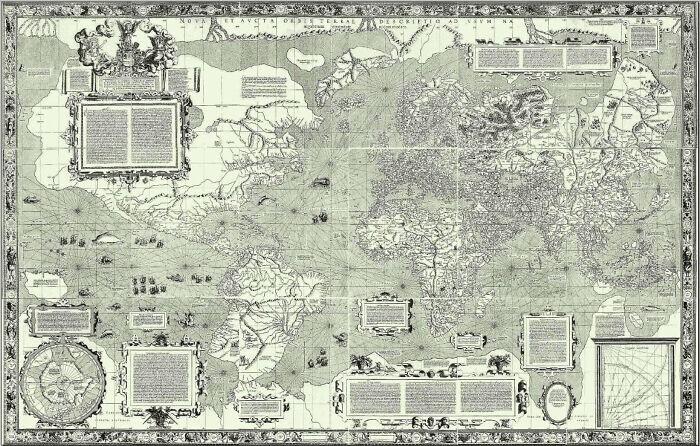
The Cylindrical Mercator projection was first used to map the globe by the Flemish geographer and cartographer Gerardus Mercator in 1569. The Mercator projection distorts the size and shape of large objects as the scale increases from the equator to the poles, where it becomes infinite, whereas the linear scale is constant in all directions around any point, preserving the angles and shapes of small objects (which makes the projection conformal).
30. Spectacle of the circle of the earth (Theatrum Orbis Terrarum) by Abraham Ortelius 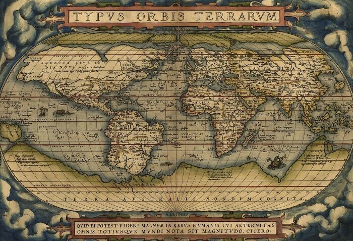
Theatrum Orbis Terrarum or "The Spectacle of the Circle of the Earth" is considered the first authentic modern atlas. It was created by Abraham Ortelius and first published on May 20, 1570 in Antwerp. The atlas consisted of several uniform sheets of map and supporting texts, which were bound together and printed using specially engraved copper printing plates. Some call Ortelius's atlas a collection of sixteenth-century cartographic works. Many of the maps in his atlas were obtained from sources that have either disappeared or are very rare.