This historic image, acquired on July 30, 1976, by NASA's Viking 1 orbiter, shows the Red Planet's cratered surface and a thin layer of carbon dioxide atmosphere on the horizon. 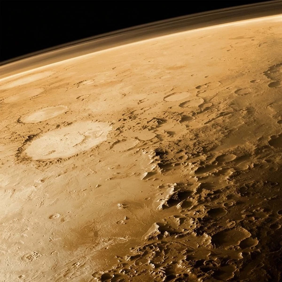
Visible to the left of center is the 230-kilometer-wide Galle crater, located on the eastern edge of the giant Argyre Basin. This impact feature is informally nicknamed "the smiley face" due to its curved mountain range and two smaller mountain clusters, which together resemble a smiling face—a striking example of pareidolia.
The Viking orbiters mapped the surface of Mars with a resolution of 150–300 meters per pixel, with some areas imaged at a resolution of up to 8 meters per pixel. Viking 1 orbited the Red Planet until August 17, 1980, transmitting invaluable data that paved the way for all subsequent Mars missions.
Add your comment
You might be interested in:


When Technique Fails, But Sense of Humor Doesn't

Mexican Metal

Sydney police broke up a Muslim street prayer

The owner of the house wrapped thieves in duct tape from

Why Kinder Surprise is banned in the US

Perfect synchronization

A Man Made a Durin Door with Glowing Runes

Acrobatic wonders. In the kitchen

Clicks Releases Its "Anti-Smartphone"
