Why is north up and south down? (8 photos)
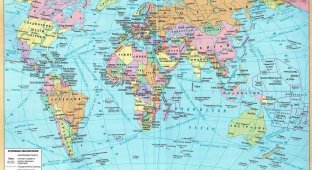
We are used to the world map looking like this: America on the left, China on the right, and Europe in the middle. How could it be otherwise? But if you go back to China, you can find a completely different map: 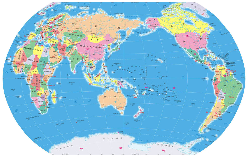
World map from Chinese school
In the middle of the map, in the very center, is the “Middle Empire,” that is, China! And the Pacific Ocean! America, which we call the "West", suddenly found itself in the "Far East", on the right! And on the left, that is, somewhere in the “Far West”, there are Europe and Africa, and the Atlantic Ocean on the Chinese map can be said to be almost absent!
Now let's go from China to America. Well, if you’re going to travel, then travel from the heart! And again - to a geography lesson at school. And what kind of map will we see there on the classroom wall? And this: 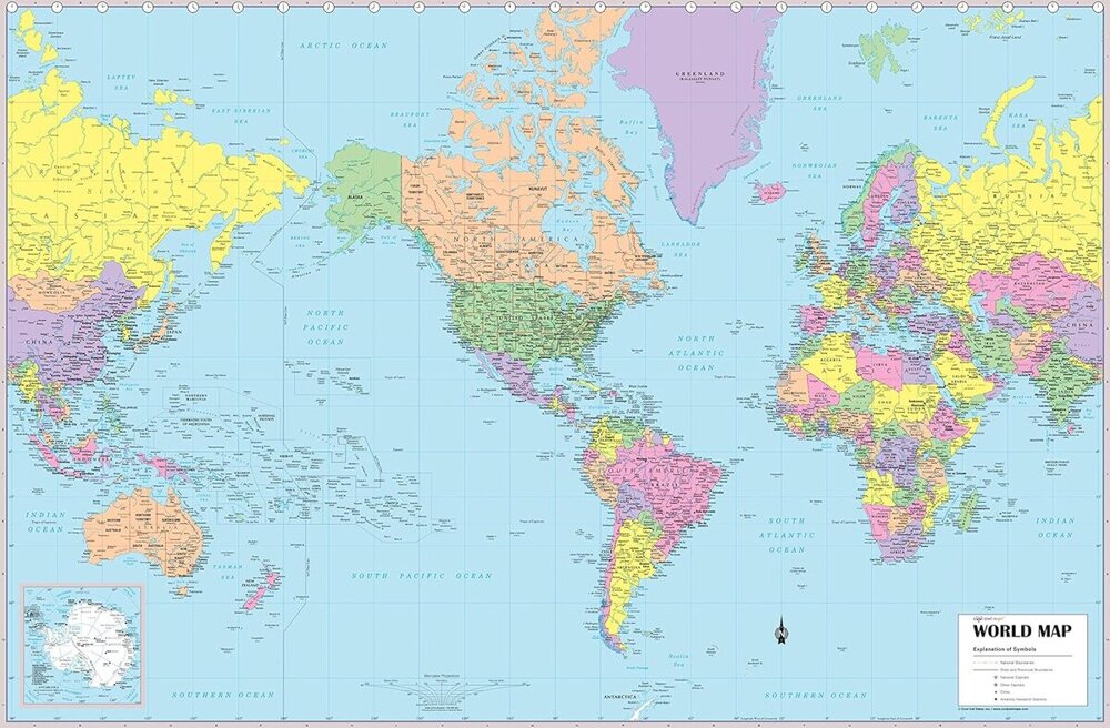
World map used by schoolchildren in America
In the middle is America. Europe is in the east, and China and Japan (which we “out of habit” call “east”) are far in the west!
If we go back a thousand years, we will be even more surprised. Look at this old Arabic map. It was compiled in the 12th century, in 1154, by the famous geographer and traveler Muhammad al-Idrisi for King Roger II of Sicily - as an appendix to his book with a long, pompous title (it was fashionable to call books then) “The Pleasure of Those Who Passionately Desire to Cross the Whole World.” 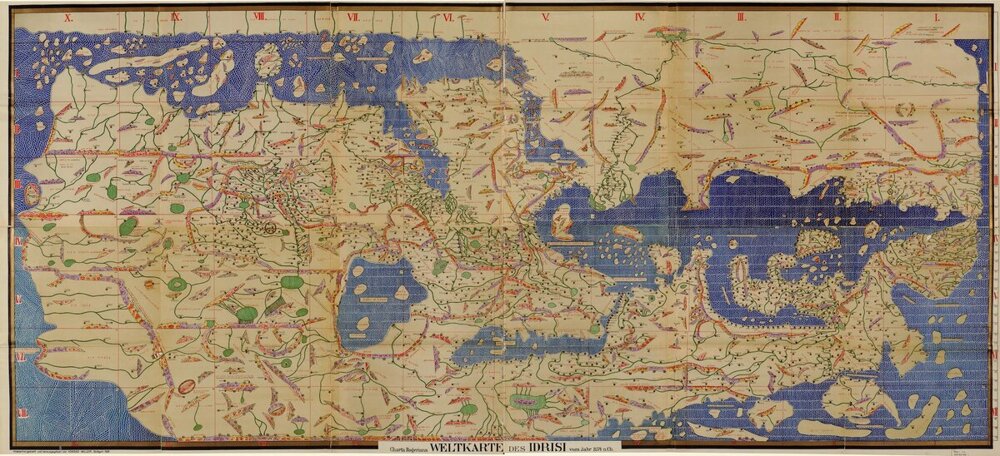
World map of geographer al-Idrisi 1154
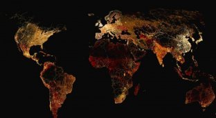
Look at the map carefully. Do you recognize? Can you show the “boot” of Italy on this map? Greece? Africa? Well, America and Australia are not on this map (they have not yet been discovered), but where is Africa? Let's give a hint: here's about the same thing, a modern photo from space: 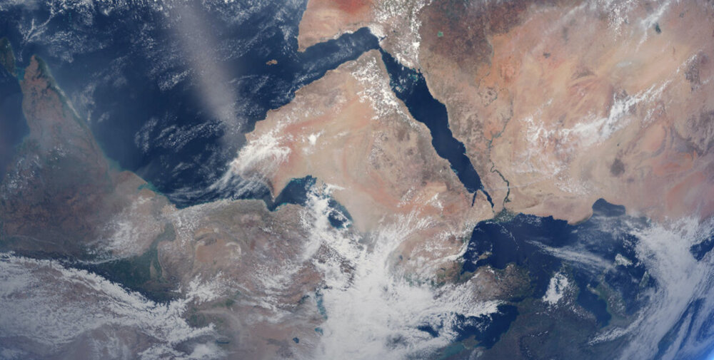
Learned? And the secret is very simple - on Arabic (and not only Arabic!) maps of that time, the south was always “above”, and the north was “below”. If we turn al-Idrisi’s map one hundred and eighty degrees, “upside down,” then yes, we begin to recognize... 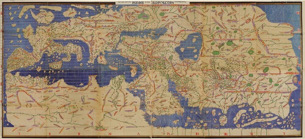
Reversed map of al-Idrisi
Here is the Mediterranean Sea on the left, and to the right is the Black Sea and the Caspian Sea, which has stopped somewhere in Western Siberia. Below is North Africa, in the center is Arabia, over there is Greece and the island of Crete. Yes, the outlines of the coasts are “wrong”, and the rivers flow “a little in the wrong direction”, and the distances are also frankly lame, but, excuse me, in those distant times no one had heard of navigation satellites and other Yandex maps. And al-Idrisi’s map for that time was considered a real “miracle of the world”; King Roger II kept this map as the greatest treasure! 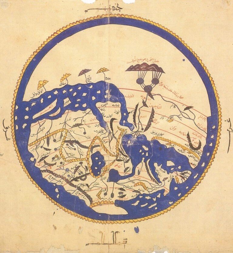
Another version of al-Idrisi's world map. Try to guess what is where?
“But why then,” you ask, “did people still decide to “turn the world upside down” and began to draw the north on maps from above, and the south from below?
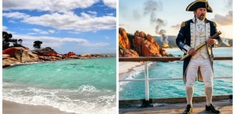
This happened during the era of great geographical discoveries. If in the Middle Ages a traveler was primarily a “pedestrian” and a “horseman” - a merchant leading a caravan of camels through the desert, then during the great geographical discoveries, navigation began to play a major role. The traveler of this time is a brave navigator, captain! And on the open sea you can only navigate by the stars, the Sun and the Moon - in those days, not every ship had a compass! It was an expensive thing, and therefore not all sailors knew how to use it. 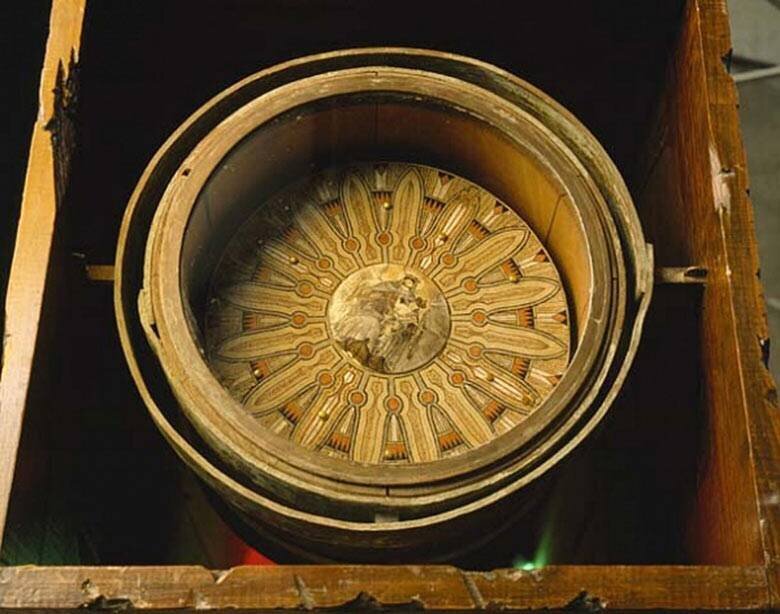
15th century box compass owned by Christopher Columbus
But the sky was always there - well, at least in good weather. In our northern hemisphere there is a wonderful, wonderful, without exaggeration, “guiding” star - alpha Ursa Minor, also known as the Polar Star. Nowadays, in a large city it is difficult to see Polyarnaya in the sky - there is a lot of “light pollution” from houses and shops. But far from the city it shines very brightly and becomes visible even at dusk, almost immediately after sunset. It was enough for a traveler or navigator to turn the map so that its top pointed to the “guiding star” - in order to quickly and conveniently navigate the area.
Why top and not bottom? Yes, because you are facing the North Star, not your back! Take the map in your hands and stand so that it “points” to some landmark. With what, in what place will she point to him? On horseback, of course... 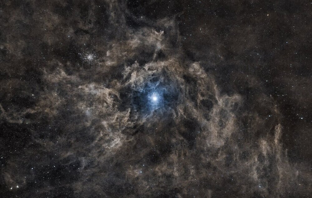
Polaris and the surrounding integrated flow nebula. (Integrated flow nebulae are a relatively recently discovered astronomical phenomenon. Unlike the typical and well-known gaseous nebulae in the plane of the Milky Way galaxy, they are located outside the main body of the Galaxy.)
But in the Southern Hemisphere, unlike our Northern Hemisphere, there is no such convenient bright star! At all. The closest constellation of bright stars to the South Celestial Pole, the Southern Cross, is approximately thirty degrees from the pole. That's quite a lot!
(Don’t know what thirty degrees is? Let’s explain now. Extend your arm in front of you and place your palm vertically up. The width of your palm at arm’s length is approximately ten degrees, thirty degrees is three palms.)
That is why for a very long time sailing in the southern seas was considered incredibly dangerous - precisely because in the southern sky there is no that magical “guiding star”... But “with us”, everything is in complete chocolate - I just waited for clear weather, looked up - and here it is, the north! So it happened that the north on maps began to be drawn from above, rather than from below...