All the roads of the world: more than 20 million kilometers of roads on one map (7 photos)
Have you ever wondered how many roads the earth covers? ball? The answer is at least 21 million kilometers! To help visualize this impressive number, Adam Symington of PythonMaps created an incredible map showing all the roads in the world - from major motorways to unpaved rural roads. 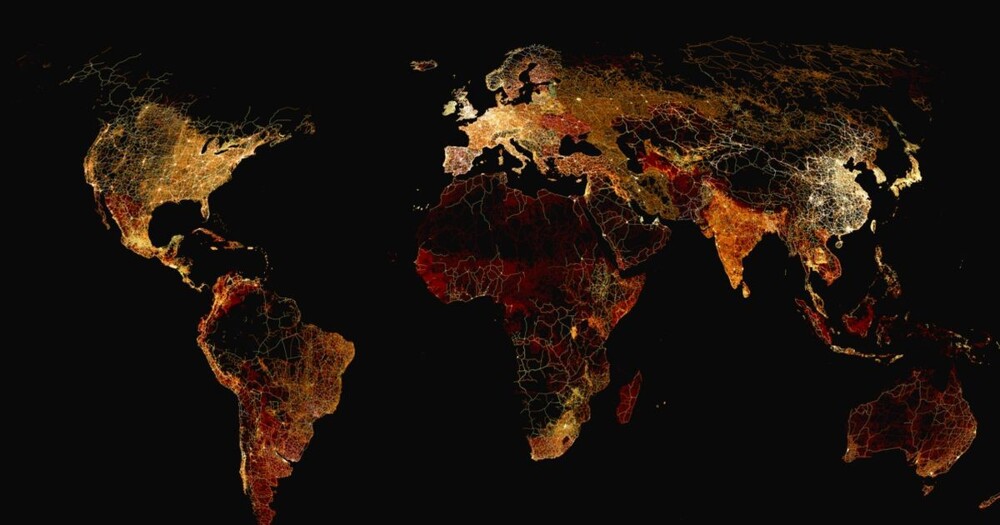
Symington used the Global Roads project to create the map. Inventory Project, including data from governments, research institutes, NGOs and crowdsourcing initiatives. He divided all the roads into four categories and painted on the map in corresponding color: main roads (multi-lane highways) marked in white, secondary (paved roads with heavy traffic) - yellow, and roads of tertiary importance (paved or unpaved roads in residential areas) and roads of local significance are marked on the map in red.
This classification made it possible to study the relationship between road infrastructure, development, wealth and distribution population,” explains the online publication Visual Capitalist, for which Symington and created the map. 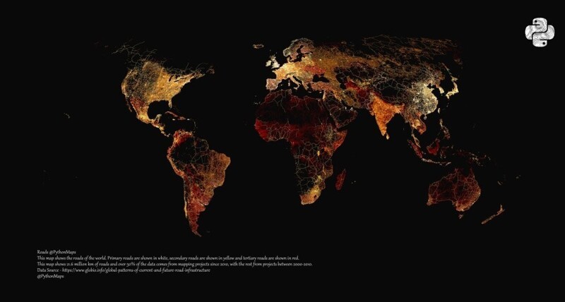
The data show that out of 21 million kilometers of roads on around the world, about 3 million account for the United States - this is 14% of the roads all over the world and almost twice as much as in China (1.7 million kilometers) and three times more than in India (million kilometers), the two most densely populated countries of the world.
At the other end of this scale is the small Pacific the island country of Palau, which boasts the most modest network road, with a length of only 18 kilometers.
“However, in many countries there are even smaller networks, the most small - on Norfolk Island, only 10 kilometers, ”specifies Visual capitalist.
North America 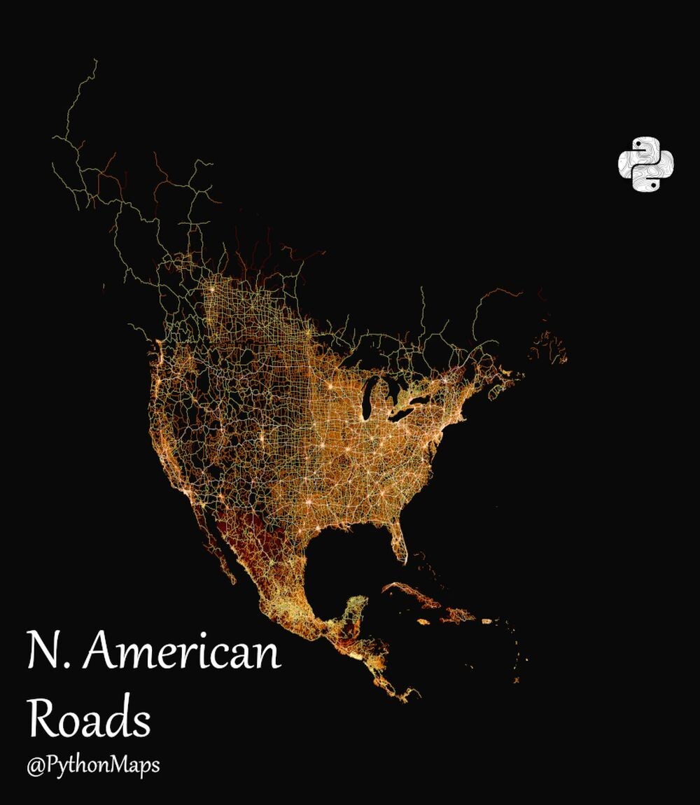
However, when the road networks were broken down by type, it turned out that China tops the list of major roads; followed by the US and Mexico. These differences are reflected on the map: North America has a white-yellow shade due to the large number of motorways, main and secondary roads. Mexico is predominantly red, as most of its roads are tertiary or rural.
“Something similar is happening in Europe, where old divisions during the Cold War are played in white, yellow and red colors - explains Visual Capitalist. France, Germany, Italy and Great Britain glow brightly with a mixture of white and yellow, while the countries of the former Eastern bloc are more red.
In Africa and Australia, large areas generally remain black due to deserts and steppes with no roads at all.
Europe 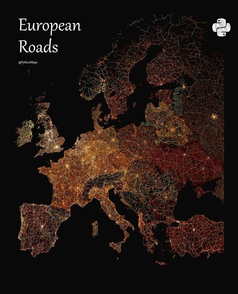
Asia 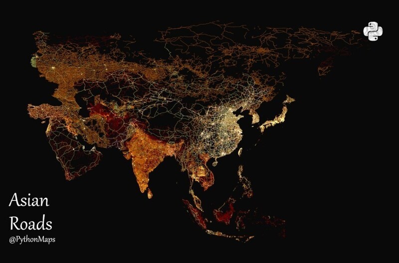
Africa 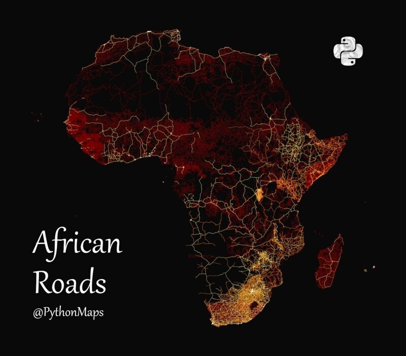
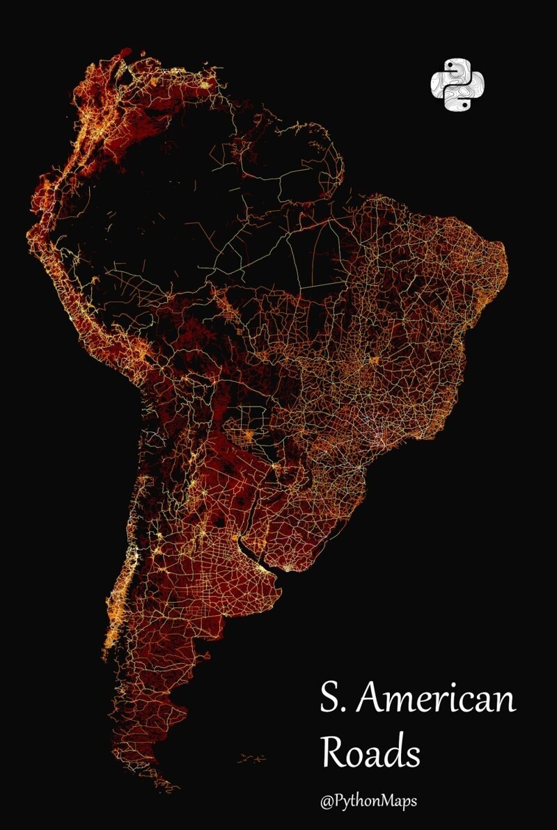
South America