How We Are Destroying Our Own Planet (20 Photos)
Climate change is an issue on such a massive scale that the average person simply cannot wrap their head around it. For many, global warming still feels like little more than a scientific horror story, while others simply shrug it off with an "after us, the deluge" mindset. 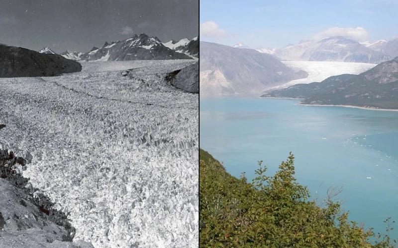
In reality, the crisis is hitting far closer to home than it seems. Take a look at these satellite images captured from orbit. They are a haunting look at our planet's fast-approaching demise.
Melting Glaciers 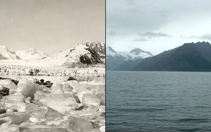
Northwestern Alaska. Left: August 1940, right: August 2005 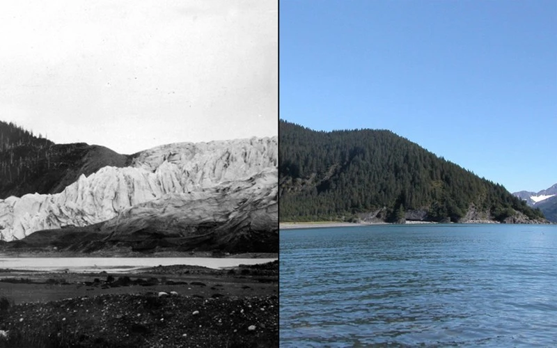
McCarthy Glacier, Alaska. Left: July 1909, right: July 2004
Muir Glacier, Alaska. Left: 1941, right: 2004 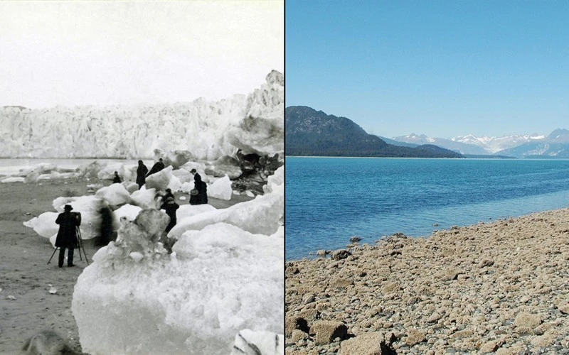
Muir Glacier, Alaska. Left: 1882, right: 2005 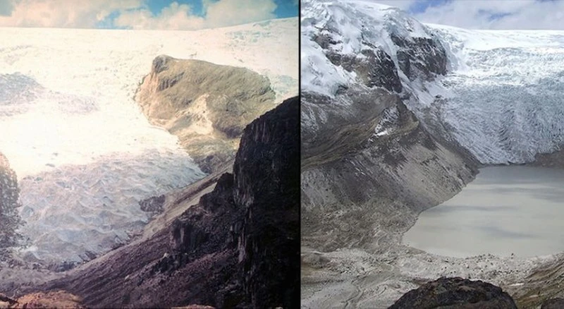
Qori Kalis Glacier, Peru. Left: 1978, right: 2011
Deforestation 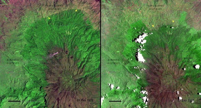
Mount Elgon National Park, Uganda. Left: 1973, right: 2005 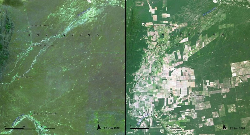
Salta Forest, Argentina. Left: 1972, right: 2009 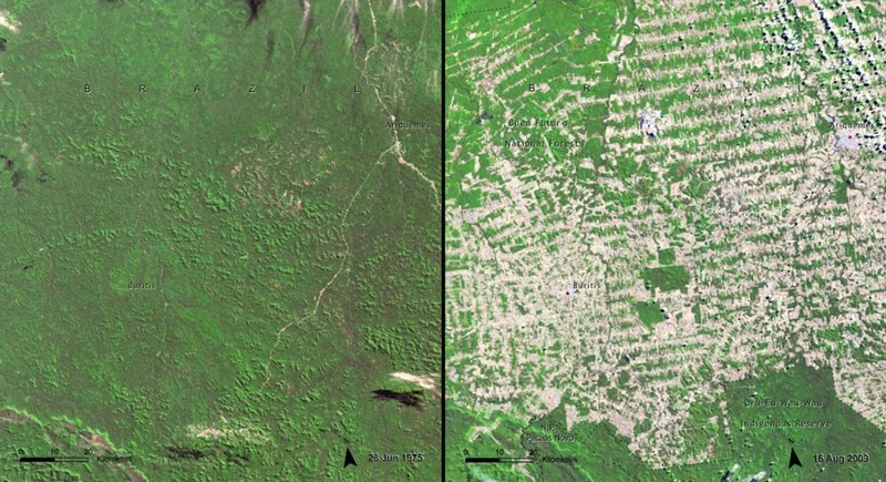
Rondônia, Brazil. Left: 1975, right: 2009 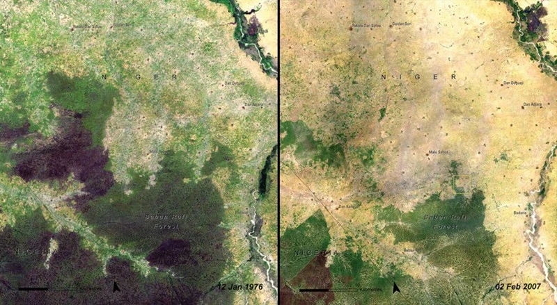
Baban Rafi, Niger. Left: 1976, right: 2007 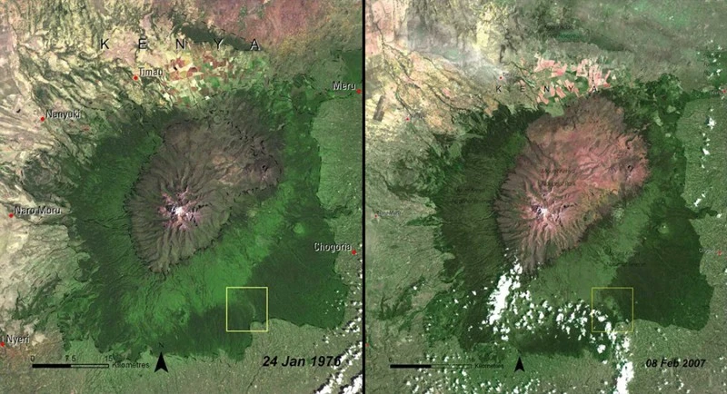
Kenya. Left: 1976, right: 2007 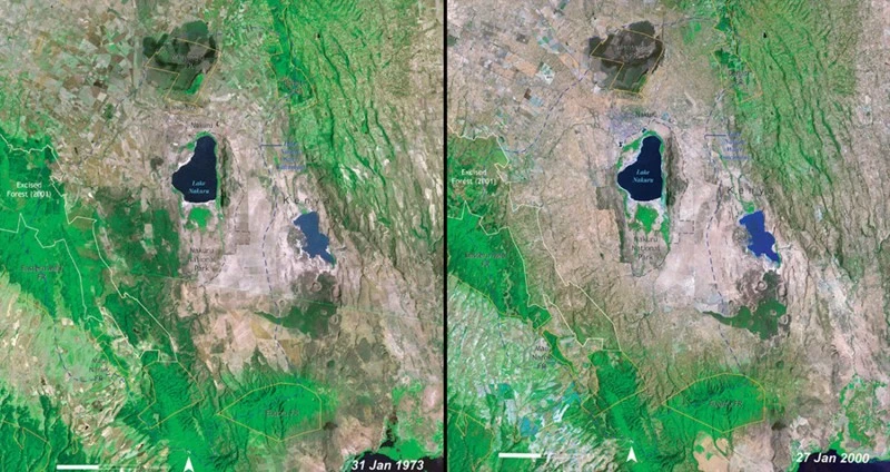
Lake Nakuru National Park, Kenya. Left: 1973, right: 2000 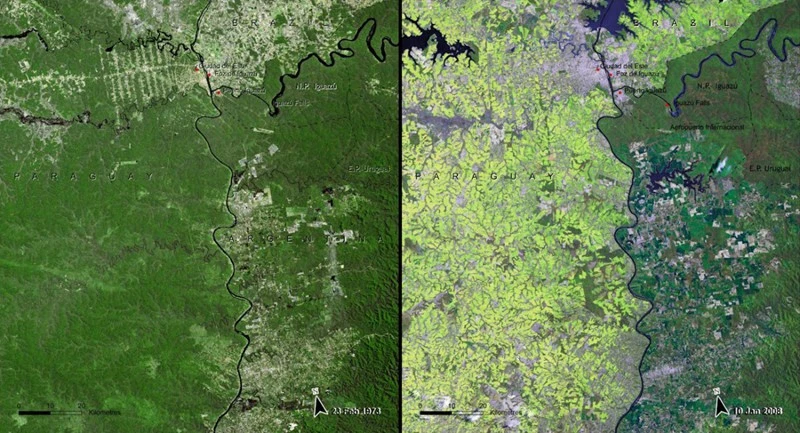
Atlantic Forest, Paraguay. Left: 1973, right: 2008 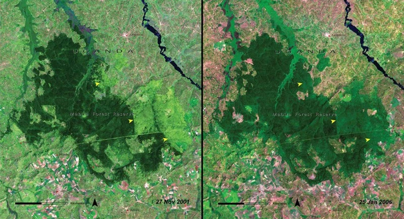
Mabira, Uganda. Left: 2001, right: 2006
Drying Rivers and Lakes 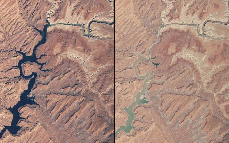
Arizona and Utah Rivers. Left: March 1999, right: May 2014 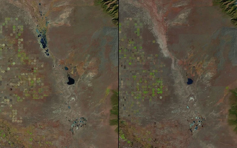
Great Sand Dunes, Colorado. Left: 1987, right: 2011 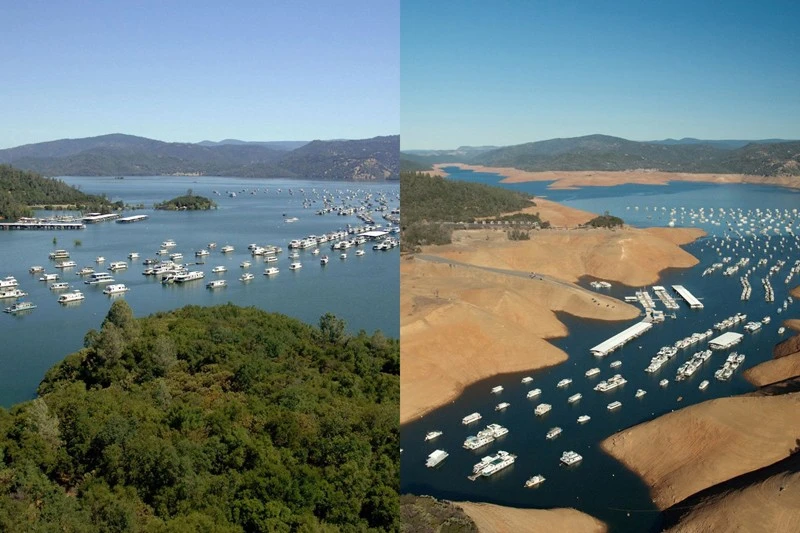
Lake Oroville, California. Left: 2011, right: 2014 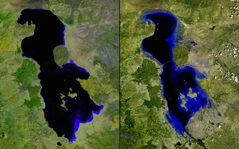
Lake Urmia, Iran. Left: 2000, right: 2013 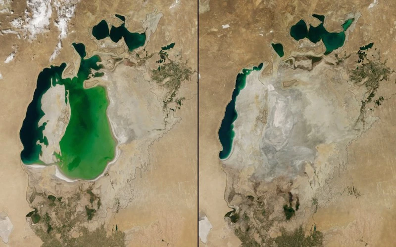
Aral Sea, Central Asia. Left: 2000, right: 2014 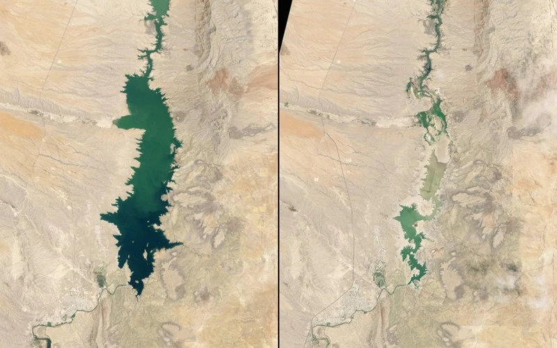
Elephant Butte Reservoir, New Mexico. Left: 1994, right: 2013 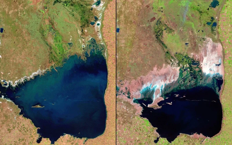
Mar Chiquita Lake, Argentina. Left: 1998, right: 2011