10 Most Beautiful Geological Wonders (11 photos)
Our planet is a magnificent and beautiful creation, home to breathtakingly stunning places. Many of them were formed naturally, such as by volcanic eruptions or meteorite impacts. 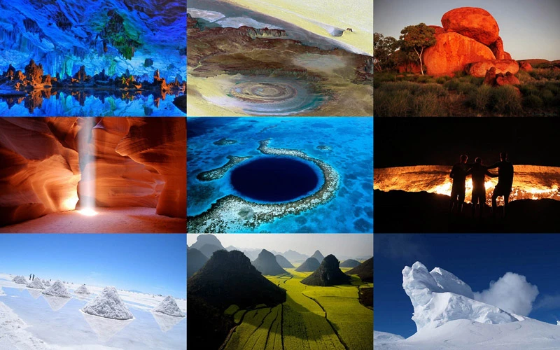
Great Blue Hole 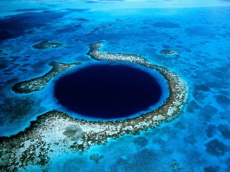
Off the coast of Belize, a country in South America, lies a nearly perfect circular hole with a diameter of 0.4 km. The water depth in this hole is 145 meters, giving it a deep blue color. Tourists from all over the world dive into Belize's Great Blue Hole to admire the amazing fish species in its clear waters. This stunning geological feature is believed to have formed billions of years ago when water rose above caves.
The Eye of the Sahara 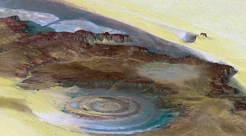
In the Sahara Desert in Mauritania lies one of the most astonishing geological wonders, the Eye of the Sahara, also known as the Richat Structure. Amid this barren desert, a bull's-eye-like formation with a diameter of 50 kilometers can be seen. Spacecraft crews even use the Eye of the Sahara as a landmark. Initially, it was believed that the Eye of the Sahara was caused by a meteorite impact on Earth. But scientists now believe this geological formation was formed by uplift and erosion of the earth.
Gates of Hell 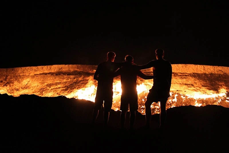
Darvaza is a city in Turkmenistan, home to a spectacular geological formation known as the Gates of Hell. This hole in the ground contains inexhaustible reserves of flammable gas. It is believed that about 35 years ago, geologists drilling into the earth to detect the gas dug too deep and the ground collapsed. The geologists didn't dare enter the hole to retrieve their equipment. Fearing that the poisonous gas might escape, they ignited the gas in the hole, and the fire has burned there ever since.
Ice Towers of Erebus 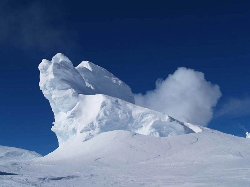
On the coldest continent, Antarctica, lies Mount Erebus, a volcanic mountain covered in hundreds of ice towers. The towers rise 20 meters and constantly emit steam. When the steam freezes in the cold, the inner walls of the towers grow and expand. These geological formations on Earth are similar to the towers on Mars and the moons of Saturn, Jupiter, and Neptune. This constantly active volcano is another natural wonder where ice and fire meet. Erebus last erupted in 1978.
Devil's Boulders 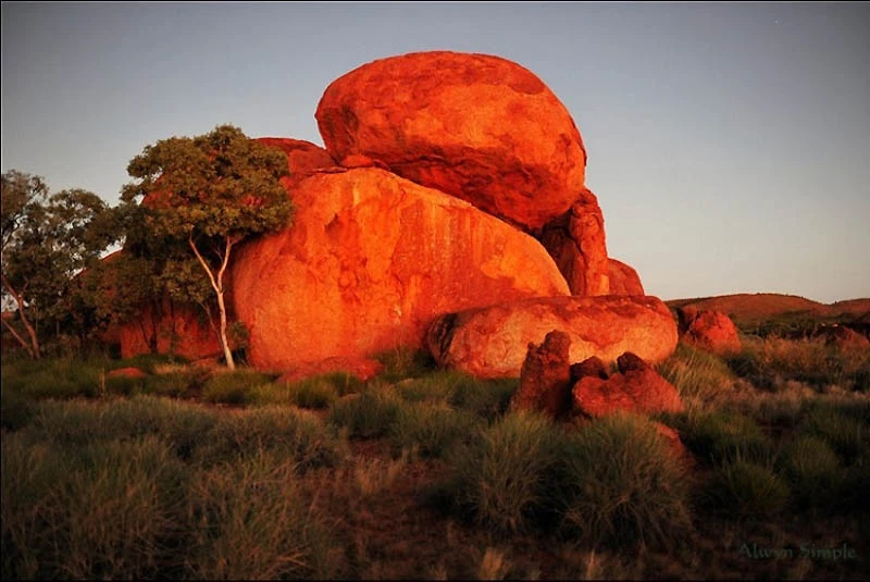
The Australian Aborigines who live here call these "Devil's Boulders" Karlu Karlu. These enormous round boulders of red granite stand out against the backdrop of a beautiful landscape. These boulders range in diameter from 50 cm to 60 m in cross-section. Some are arranged in a very bizarre manner, balancing on top of each other. The Devil's Boulders were formed millions of years ago when molten magma was trapped beneath sandstone and cooled, forming granite.
Years of erosion and environmental factors have allowed us to observe these amazing natural phenomena today. For Australian Aborigines, the Devil's Boulders hold special spiritual significance.
Reed Flute Cave 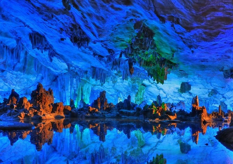
In the Guangxi Autonomous Region of China, Reed Flute Cave has become a famous tourist attraction. It is also known as the Palace of Natural Art. The natural limestone caves are filled with amazing and bizarre icicle-like formations and rock formations, enhanced by the effect of colored lighting.
This geological feature was named after the reed found outside the cave, which is used to make musical flutes. It is approximately 240 meters long, covering a vast area offering a stunning view. The site is ancient, as its walls contain inscriptions from the Tang Dynasty, dating back to 792 CE.
Salar de Uyuni 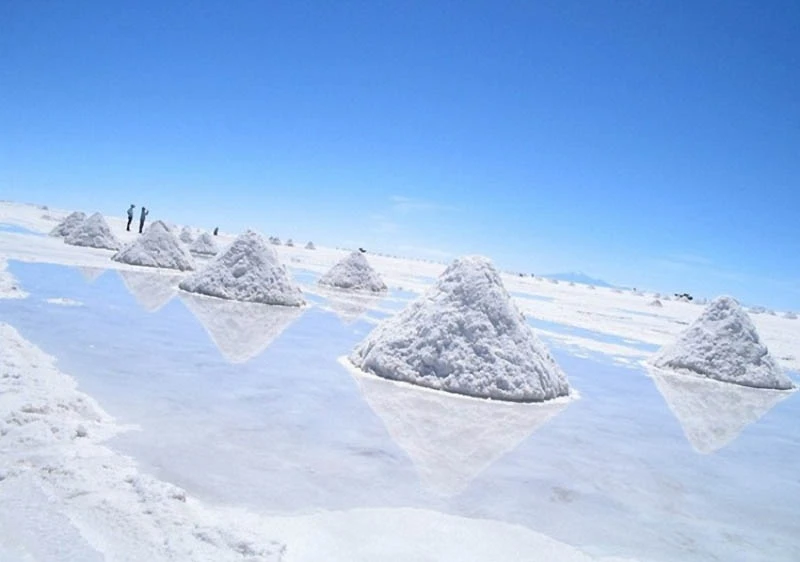
The Salar de Uyuni is located in southwestern Bolivia. This geological wonder is the world's largest dry salt lake, located more than 3,000 meters above the Andes and covering an area of over 10,000 km².
This unique landscape was formed by multiple layers of salt and water. In the center of the salt flat, the salt layer reaches a thickness of 10 meters. When it rains, the Salar de Uyuni submerges, appearing like a giant mirror. It is believed to have formed from the confluence of geothermal vents and salt lakes. Several species of pink flamingos gather here to breed.
Antelope Canyon 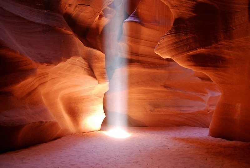
The most frequently photographed canyon in the southwestern United States is Antelope Canyon. It is located on Navajo land in Arizona. The Navajo people call it Tse bighanilini, meaning "place where water flows over rocks." Antelope Canyon is divided into two separate canyons, Upper and Lower Antelope Canyon.
As rainwater flows through this area, it smooths the rocks, giving them a curving shape. Antelope Canyon was formed during severe floods, which caused erosion of the rocks, opening passages that reveal deep corridors with interesting rock formations. In 2006, authorities closed Antelope Canyon for five months due to flooding.
Chocolate Hills 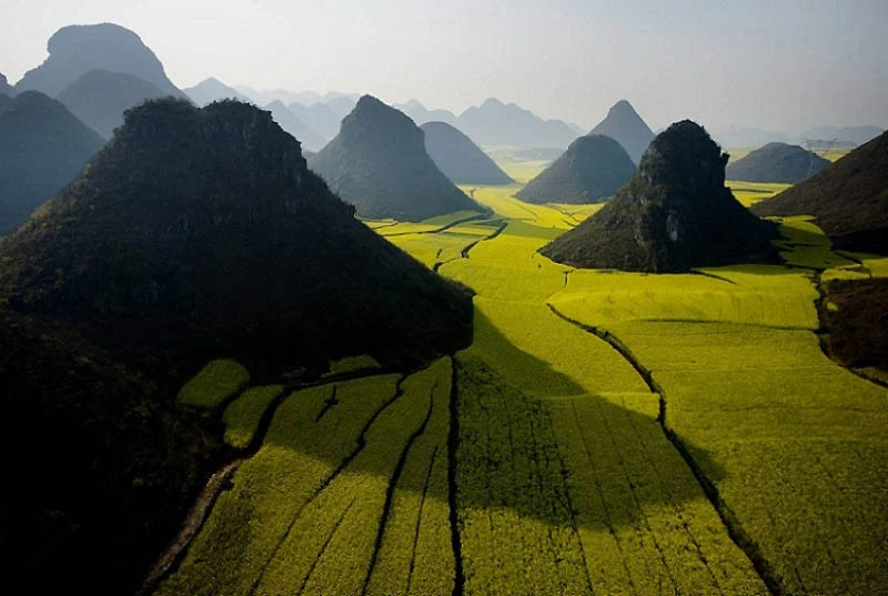
Spanning more than 50 km² in the province of Bohol in the Philippines, lies a geological formation known as the Chocolate Hills. In reality, there's no chocolate in these hills, but all the hills, estimated to number between 1,268 and 1,776, appear chocolate brown during the dry season. The Chocolate Hills are the third National Geological Monument in the Philippines and are depicted on the flag of Bohol Province. The Chocolate Hills have a perfectly uniform shape and rise approximately 30-50 meters. According to one theory, they were formed by the self-destruction of an active volcano. Legend has it, however, that they were formed from the tears of a giant who lost his love.
Stone Forest 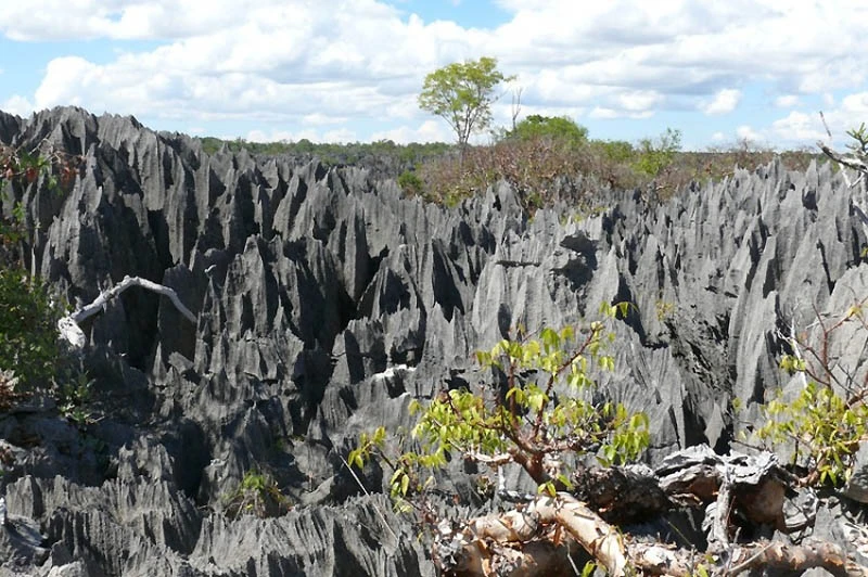
The Tsingy Du Bemaraha Nature Reserve in Madagascar is a UNESCO World Heritage Site and home to the Stone Forest. The Stone Forest consists of tall, expansive eroded limestone, covering an area of 666 square kilometers, resembling limestone towers. Locals warn that this is not a place where you can walk barefoot, as the terrain is quite steep. The Stone Forest is home to unique animal species, such as the white lemur.