Sahara Desert: unusual facts that are hard to believe (19 photos)
In ancient Arabic, Sahara means "empty space" or "space where nothing grows," or in other words, a desert. 
Sahara is NOT the largest desert
Sahara is the largest hot desert in the world, its area is about 9.2 million km², which is comparable to the territory of China (9.6 million km²). 
However, the Sahara cannot be called the largest desert in general. The largest desert is the Antarctic Desert (14.2 million km²) ????
There is more water under the Sahara than in all of Lake Baikal
The Nubian Aquifer, located under the Sahara, is one of the largest sources of fresh water in the world. It covers the territories of Libya, Egypt, Chad and Sudan. The water in this layer has been accumulating for thousands of years. According to some sources, the aquifer contains about 150 thousand km³ of groundwater. 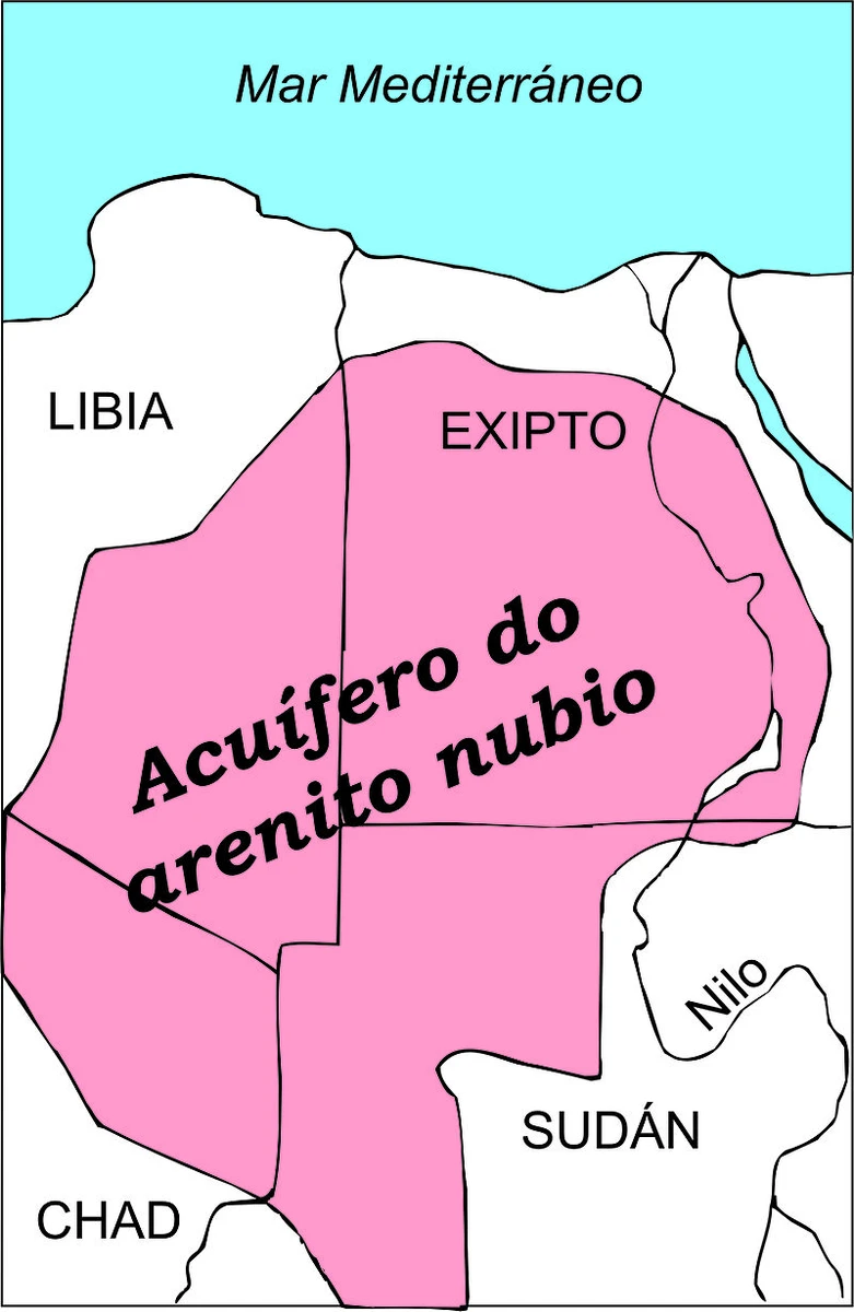
For comparison: in all of Baikal, which is the largest body of fresh water, there is only 23,615.39 km³ of water.
A giant artificial river runs under the Sahara
The "Great Man-Made River" is one of the largest irrigation systems in the world, designed to provide fresh water to the arid regions of Libya. The project was conceived and implemented during the reign of Muammar Gaddafi and is considered one of the most ambitious infrastructure projects of the 20th century. 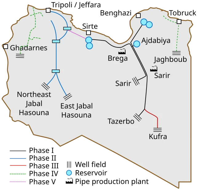
The total length of the pipeline network is about 4,000 km. This is one of the longest water supply systems in the world. The pipes have a diameter of 1.6 to 4 meters. Every day they transport about 6.5 million m³ of water. The annual volume of pumped water reaches 2.4 billion m³. 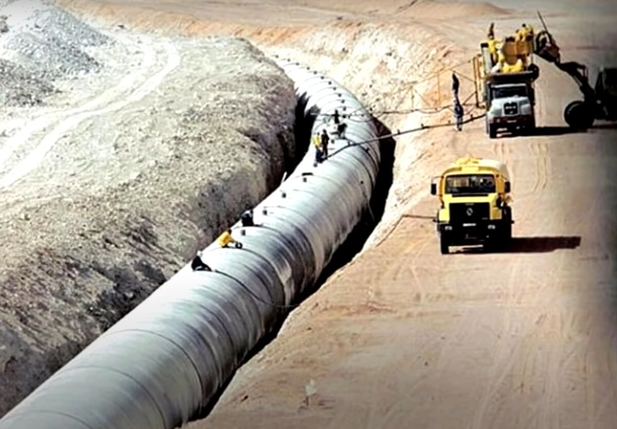
Water is extracted from underground aquifers located at a depth of 100 to 500 meters. In total, more than 1,300 wells have been drilled to extract water.
There are more than 1,000 pumps in the system that pump water from underground sources into pipelines. 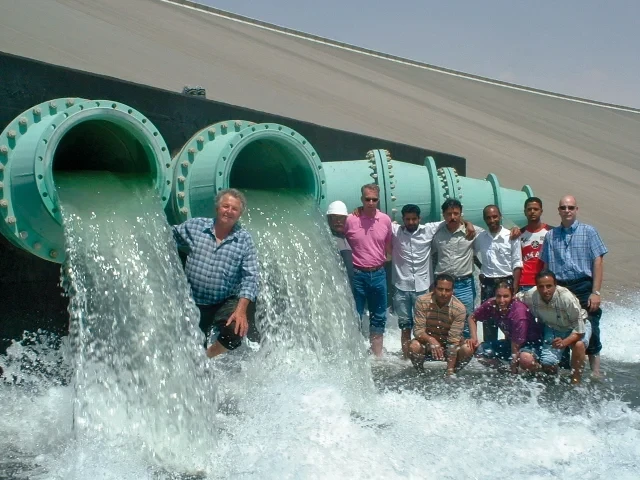
Unfortunately, in the near future we will be talking about the man-made river in the past tense. Because the state of Libya de facto does not exist. The country is divided between several power groups that are constantly fighting among themselves. There is no one to service the complex irrigation system, so its nodes are gradually falling into disrepair.
The Sahara is NOT completely covered in sand
The average person associates the Sahara with sand dunes and sand dunes stretching into the distance, along which camel caravans slowly wander. However, only about 20-25% of the desert is covered with sand dunes. 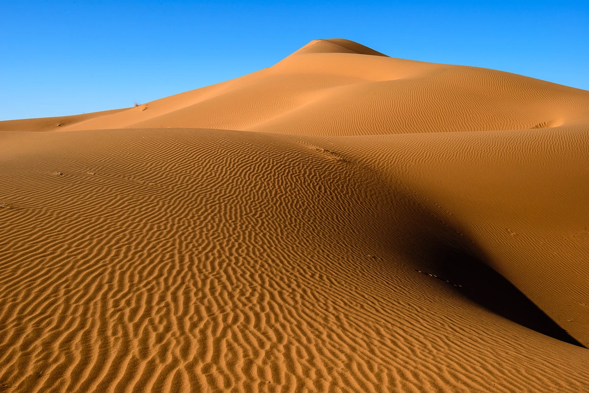
The rest consists of rocky plateaus (hamadas), gravel plains (regis), dry river valleys (wadis) and mountain ranges. 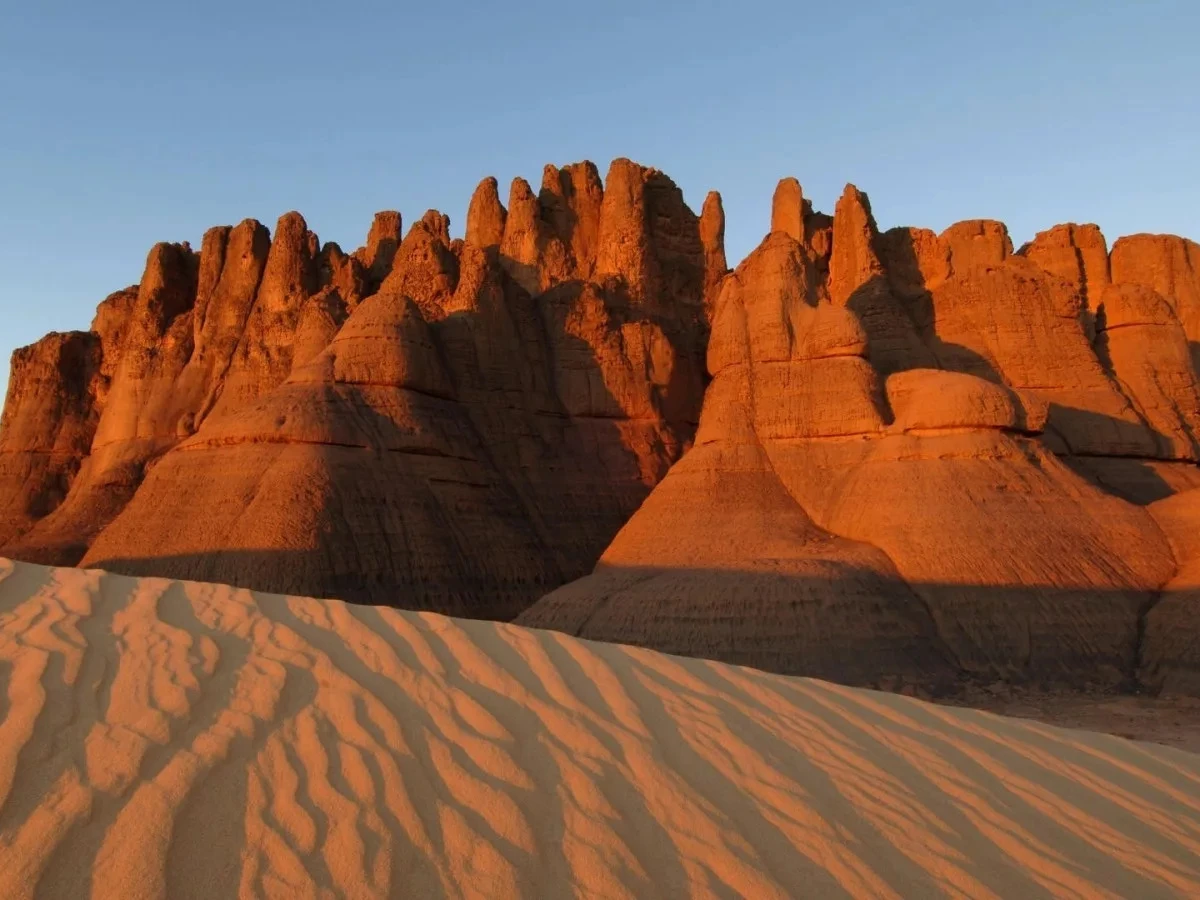
For example, the Ahaggar plateau in Algeria or the Aïr mountains in Niger. These regions are often devoid of sand.
The Sahara is expanding by about 10 km per year
The desertification process caused by climate change and human activity is causing the Sahara to expand. The Great Desert is estimated to be expanding by about 10 km per year. Over the past 100 years, the desert has expanded by more than 10% of its area. 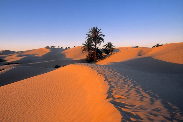
The expansion of the Sahara is especially noticeable in the Sahel countries, the transition zone between the Sahara and the more fertile regions of Africa. These include Niger, Chad, Mali, Burkina Faso and others.
The expansion of the Sahara Desert is caused by a combination of natural and anthropogenic factors: global warming, wind erosion, deforestation of the few remaining forests, intensive agriculture and irrational use of water resources.
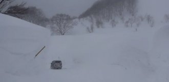
There are floods in the Sahara
Despite the arid climate, flash floods occur in the Sahara. This occurs when rare but intense rainfall occurs in mountainous areas and the water flows into dry river valleys (wadis). 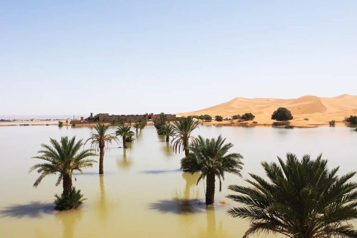
For example, in 2018, flooding in the Algerian province of Tamanrasset led to destruction and loss of life. The natural disaster was caused by prolonged rains, which also led to mudflows.
There are almost no clouds over the Sahara
The Sahara Desert is located in a subtropical high pressure zone, where descending air currents prevail. These currents heat up and dry the air, which prevents the formation of clouds.
In addition, the Sahara has very dry air due to minimal precipitation and high temperatures. Moisture is needed to form clouds, which is in short supply in this region. 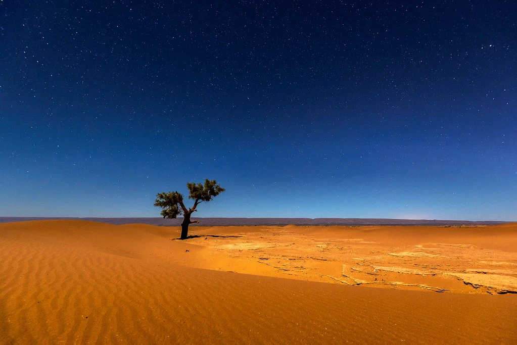
In addition, the strong heating of the desert surface leads to the rapid evaporation of any moisture, which also makes it difficult for clouds to form.
The absence of large bodies of water also prevents clouds from forming: there are almost no lakes, rivers or other sources of moisture in the Sahara that could contribute to evaporation and cloud formation.
Little cloud cover is one of the reasons why the Sahara is one of the hottest deserts. But this circumstance has a positive side - the night sky here is unusually clear and starry ????
Sahara is one of the sunniest places
It would seem to be a banality. But let's look at this obvious fact in terms of numbers.
The sunniest place in 2019 was Ulan-Ude. During the year, the capital of Buryatia received 2797 hours of sunshine. In total, I remind you, there are 8760 hours per year. 
Ulan-Ude.
Most of the Sahara receives more than 3,600 hours of sunshine per year (more than 82% of daylight). The eastern part of the Sahara enjoys more than 4,000 hours of bright sunshine per year (more than 91% of daylight).
4,300 hours (98% of daylight), which are very close to the theoretical maximum, are recorded in the area of Aswan (Egypt) and Wadi Halfa (Sudan). 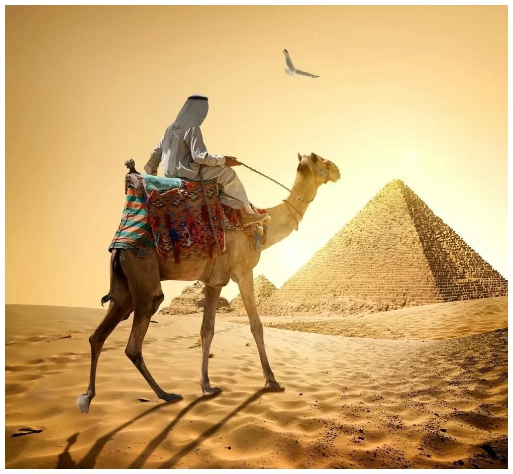
In other words, the residents of these places have seen almost no cloudy weather for a whole year. So if you are tired of depressing cloudy weather, welcome to sunny Sahara!
There are giant sandstorms in the Sahara
The heroes of the film "Mad Max: Fury Road" find themselves in the epicenter of a giant sandstorm. This, of course, is the screenwriter's fantasy. 
But the Sahara also has truly grandiose sandstorms. They are not as powerful as in the film, but they are still impressive. Some storms can reach a height of 6,000 meters and cover hundreds of thousands of square kilometers, carrying tens of tons of dust and sand over huge distances.
For example, dust from the Sahara reaches the Canary Islands, Amazonia, Hawaii. Often, dust contains valuable minerals that play an important role in fertilizing the soil. For example, for the aforementioned Amazon, Sahara dust is the main source of phosphorus.
There is a Black Desert in the Sahara
The Black Desert is located in the Libyan Desert, which is part of the Sahara. It is located approximately 150 km south of Cairo, Egypt. 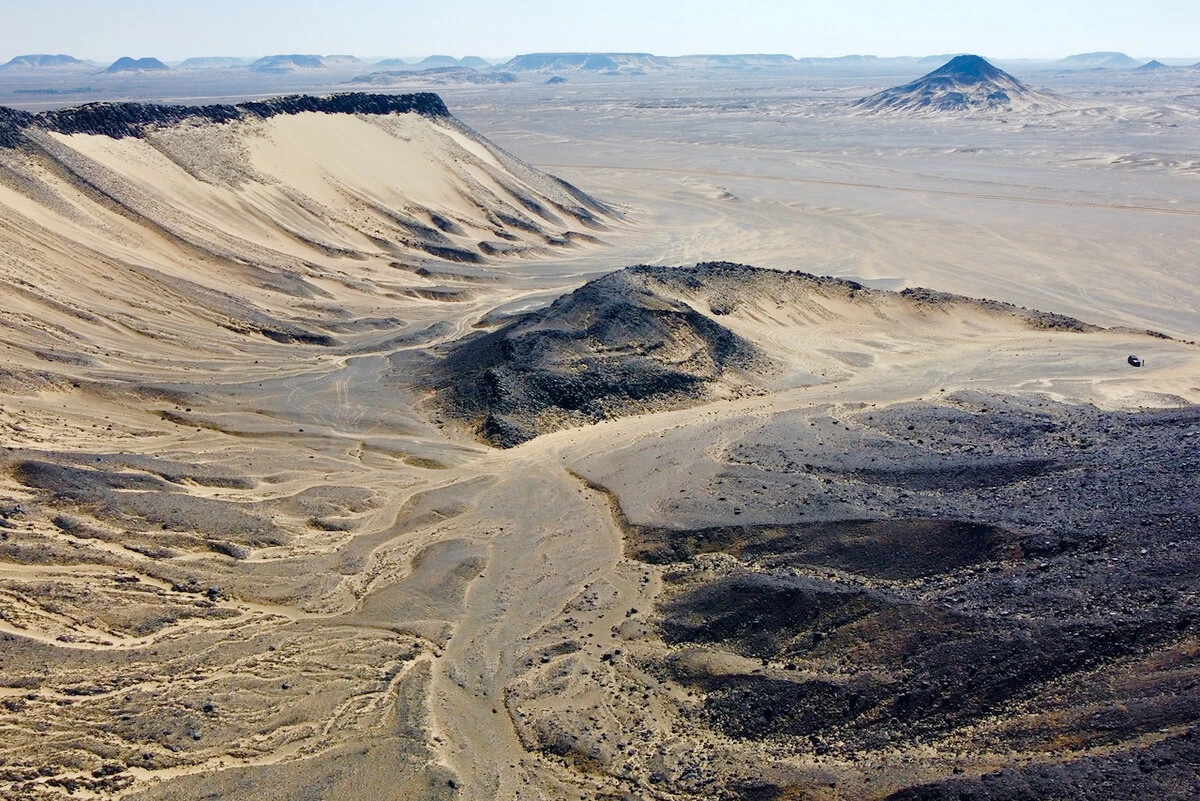
The desert surface is covered with dark rocks and stones that were formed by volcanic eruptions millions of years ago. These rocks are made up of basalt and other volcanic rocks that give the area its characteristic black or dark gray color. 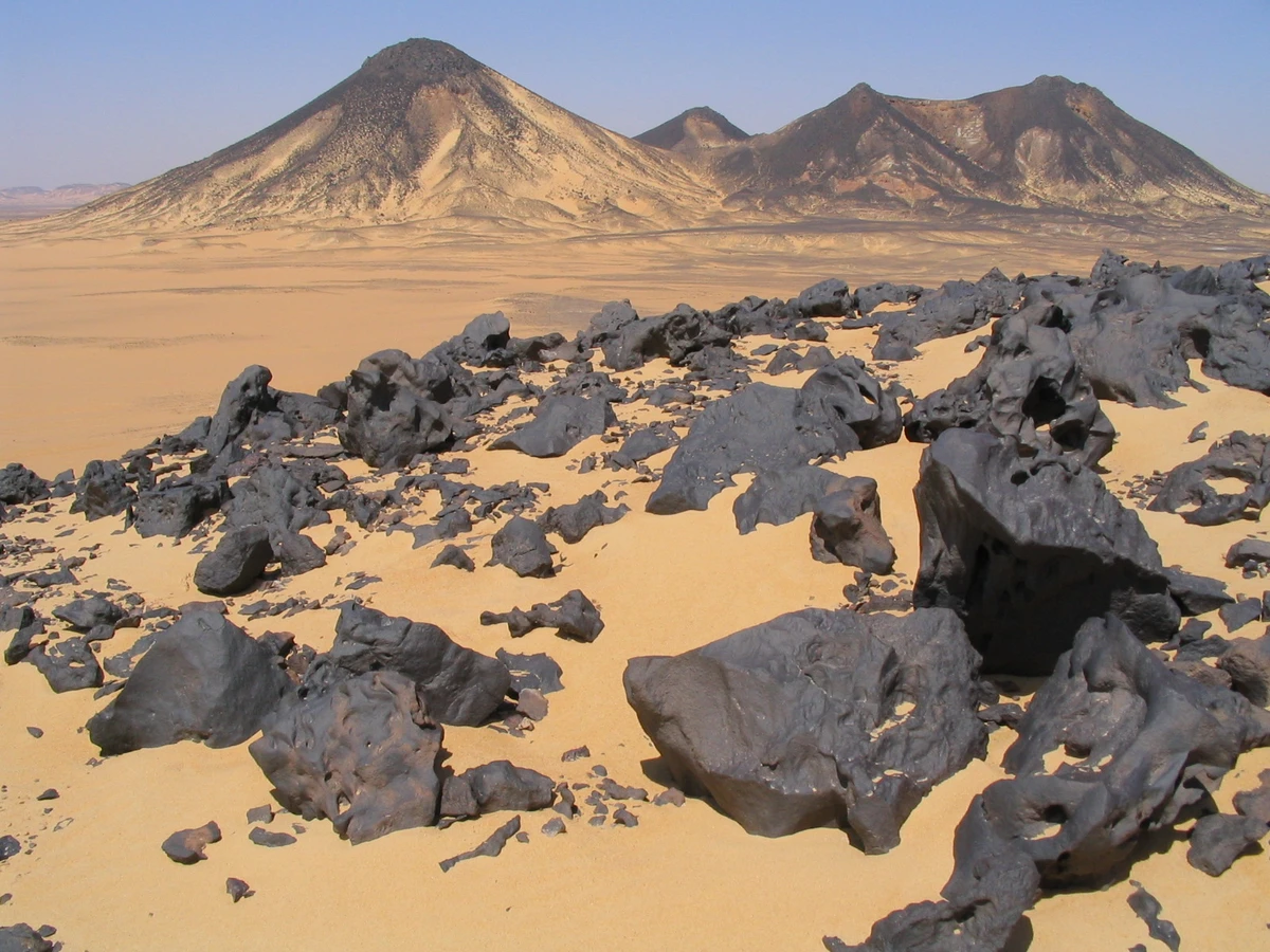
Over time, wind and water have eroded the volcanic rocks, creating bizarre shapes and scattering dark stones all over the area. This makes the landscape of the Black Desert look like something from another planet.
There are volcanoes in the Sahara
There are no active volcanoes in the Sahara that erupt incessantly, like our Klyuchevskaya Sopka. However, there are regions in the desert where volcanic activity occurs.
One of them is the Tibesti Highlands in Chad. Its central part is formed by five shield volcanoes. 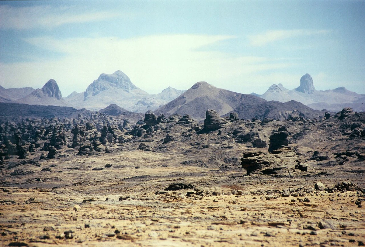
The last eruption in this region occurred about 2,000 years ago. But hot springs and fumaroles indicate ongoing volcanic activity.
There is another interesting fact about Tibesti 1
There are high mountains in the Sahara
As we have already found out, the Sahara is not a continuous plain of sand. There are plateaus, dried-up riverbeds and mountains. And not just mountains, but very high mountains.
The highest mountains of the Sahara are located in the Tibesti Highlands, which is located in northern Chad. Their central part consists of the volcanoes Tarso Tusside (3265 m), Tarso Vun (3100 m), Tarso Yega (2972 m), Tarso Tun (2575 m). But the highest of all is Emi Koussi - 3445 m. This is the highest point in the Sahara. 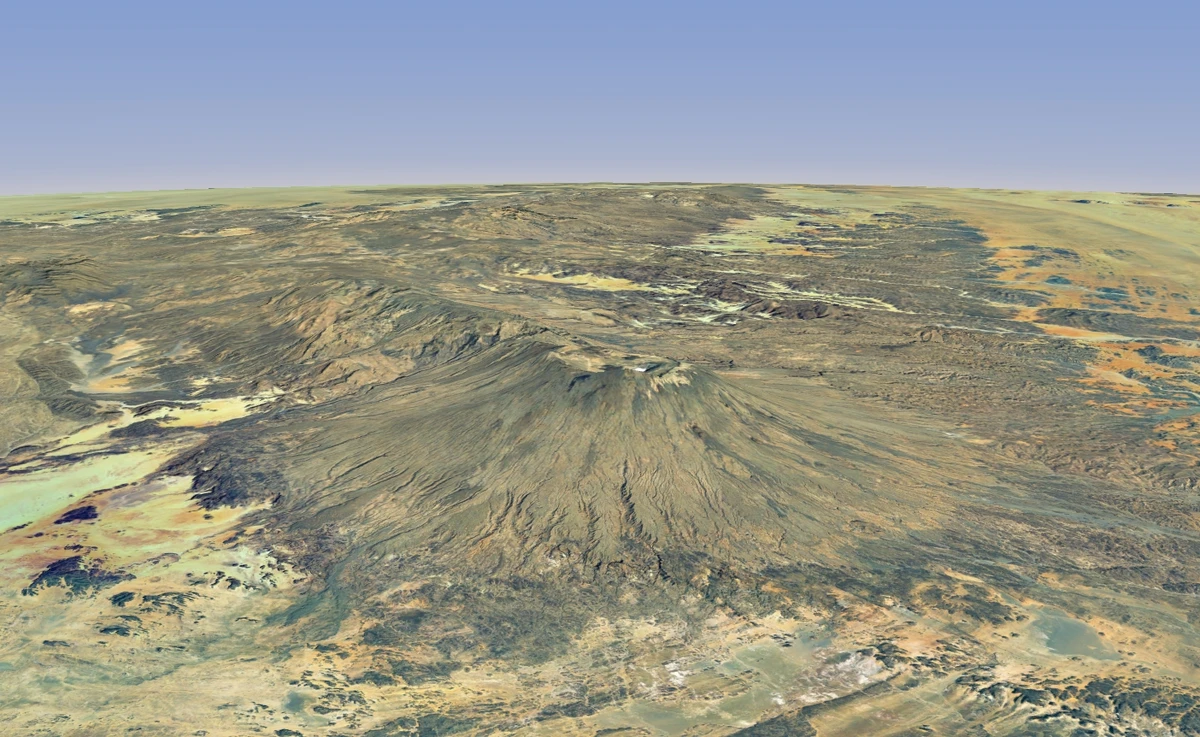
Emi Koussi volcano.
Although the Tibesti Mountains are the highest in the Sahara, there are other mountain ranges that deserve attention.
For example, the Ahaggar Mountains (Hoggar) in Algeria. The highest point is Mount Tahat (2908 meters). 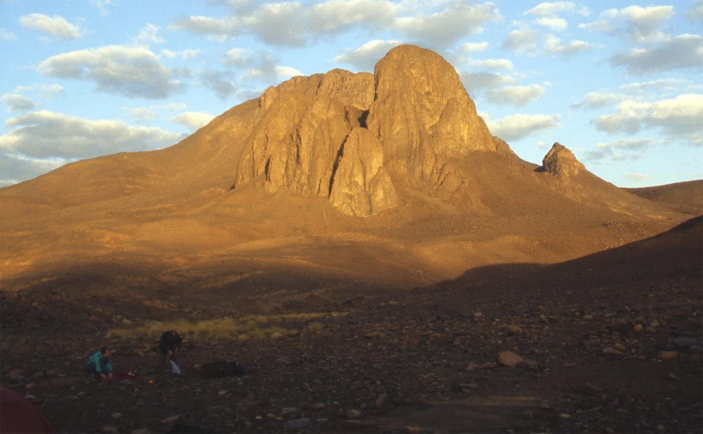
Or the Aïr Mountains in Niger, where the highest point is Mount Idoukal-n-Tagges (2022 meters).