Maps that tell something new about our world (36 photos)
Which countries have never seen snow in their entire history? How many Britons lined up to say goodbye to the Queen? What does Greenland look like without ice? These and other questions, from religion and politics to linguistics, are answered by pictures from an entertaining subreddit for geography lovers. 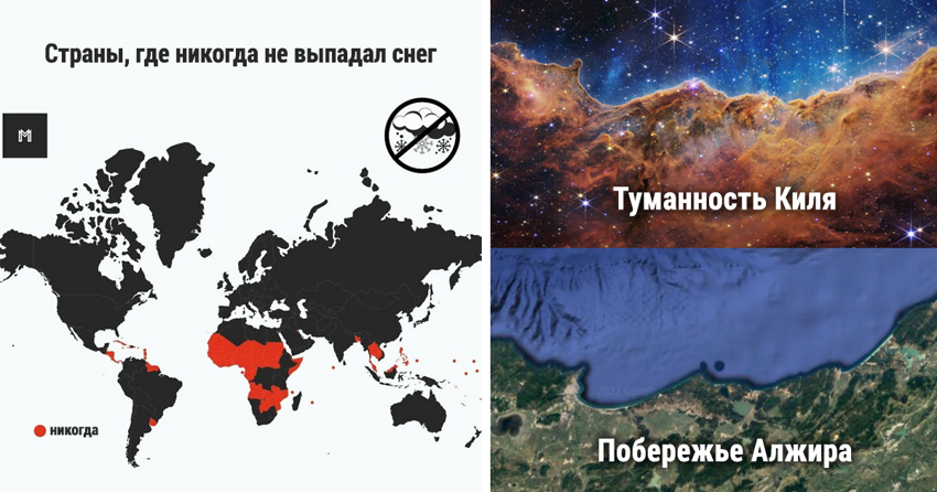
1. The Scottish Highlands, Appalachians and Atlas Mountains are all one mountain range, once connected by the Central Pangean Mountains 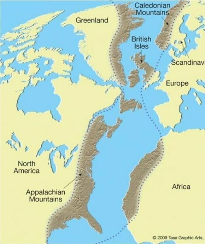
2. A shark with a GPS tracker drew a shark on the map. 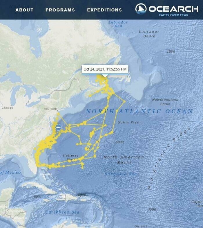
3. This map was drawn by the Ottoman navigator and cartographer Piri Reis in 1513 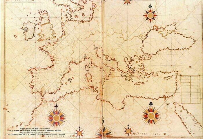
4. The incredible journey of an arctic fox that traveled from Norway to Canada in 2018 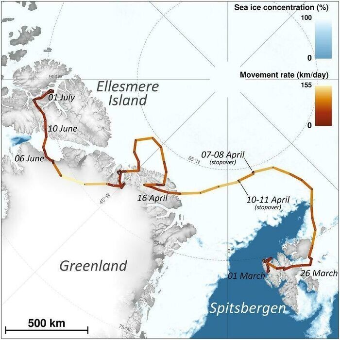
5. What the border between Mexico and the United States looked like before 1836, the end of the Texas War of Independence 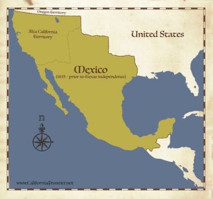
6. Map of Nicosia, the capital of Cyprus, 16th century and the city from above today 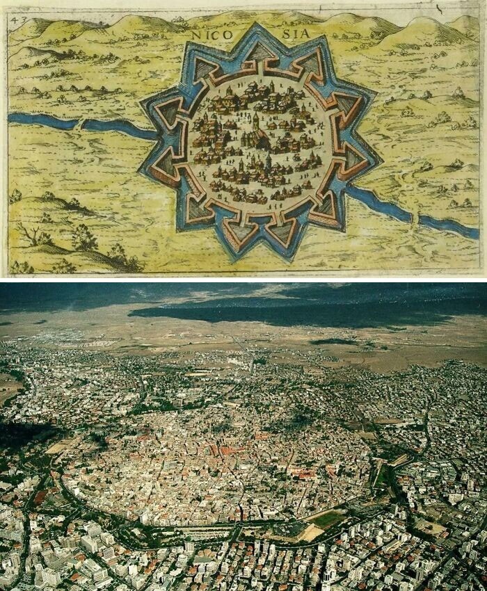
7. Size of Africa compared to different countries/regions 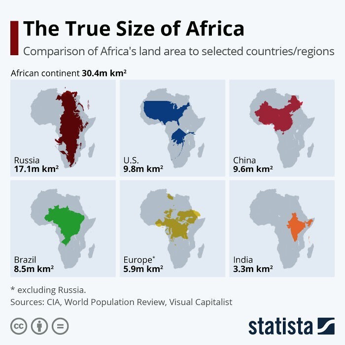
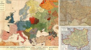
8. “I drew a map of Europe by hand in a fantasy style.” 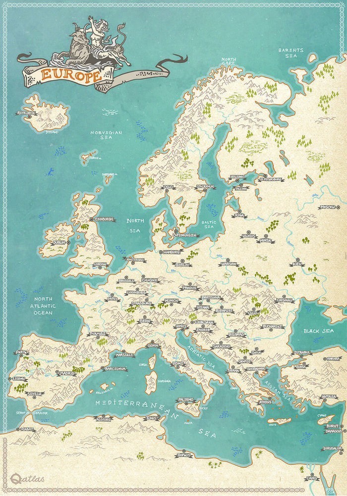
9. The “Where Are You From” map at the Aurora Museum in Reykjavik, Iceland, which every visitor can stick a pin into 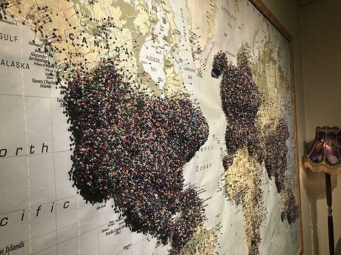
10. Globe for the blind 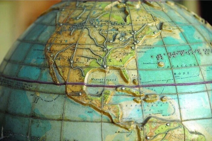
11. European countries that are considered more (blue) or less (red) progressive than the United States on the Social Progress Index 
12. Hand-drawn map of Venice, Italy 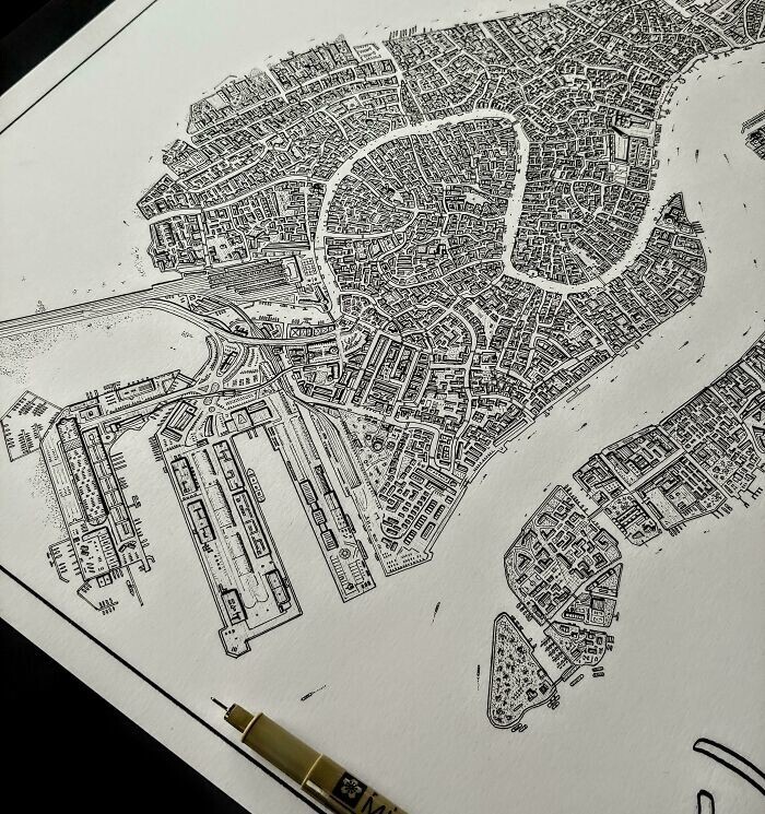
13. The Carina Nebula, captured by the James Webb Space Telescope, looks like the eastern coast of Algeria. 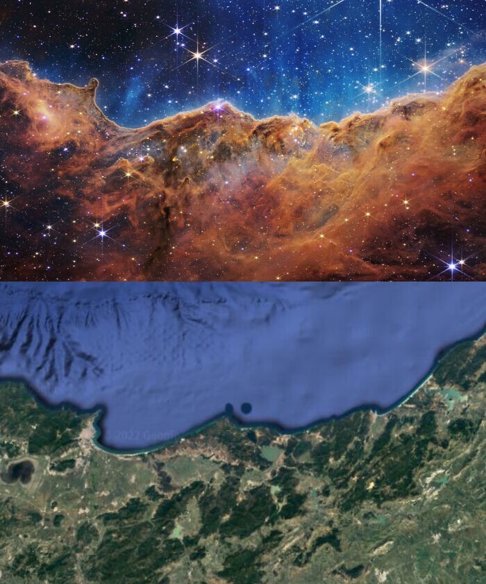
14. A line of people wishing to bid farewell to Queen Elizabeth lined up along the Thames 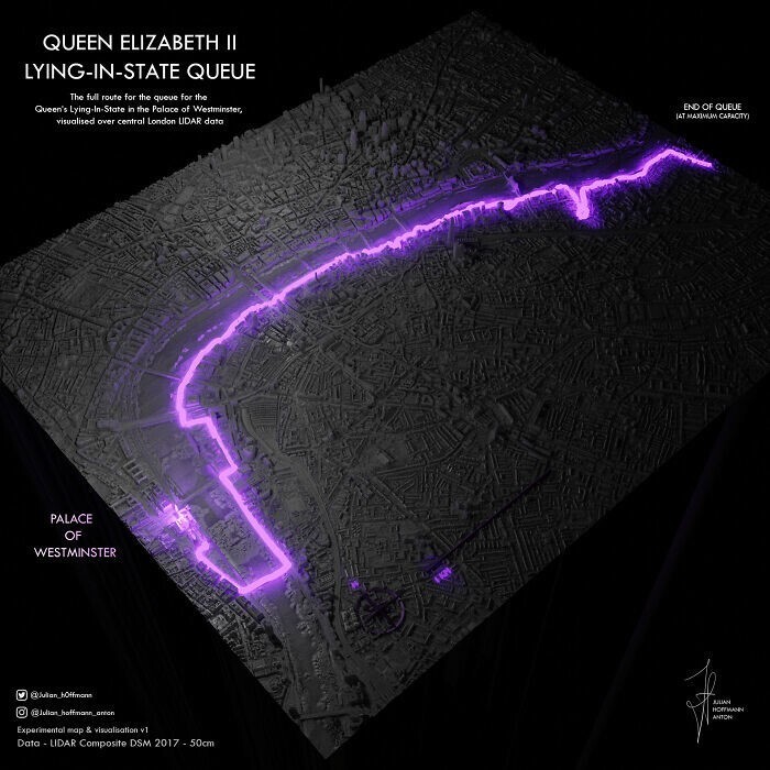
15. If there was no ice in Greenland, there would be a huge lake right in the center of the land 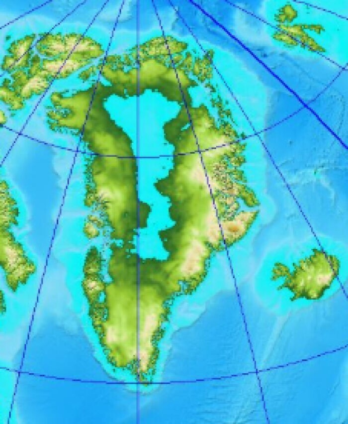
16. What the Earth will look like in 250 million years 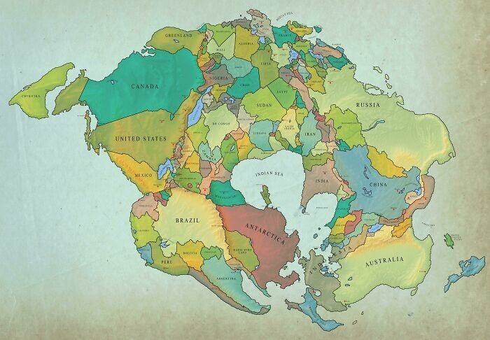
17. How many people are there in European countries who believe in God without any doubt? 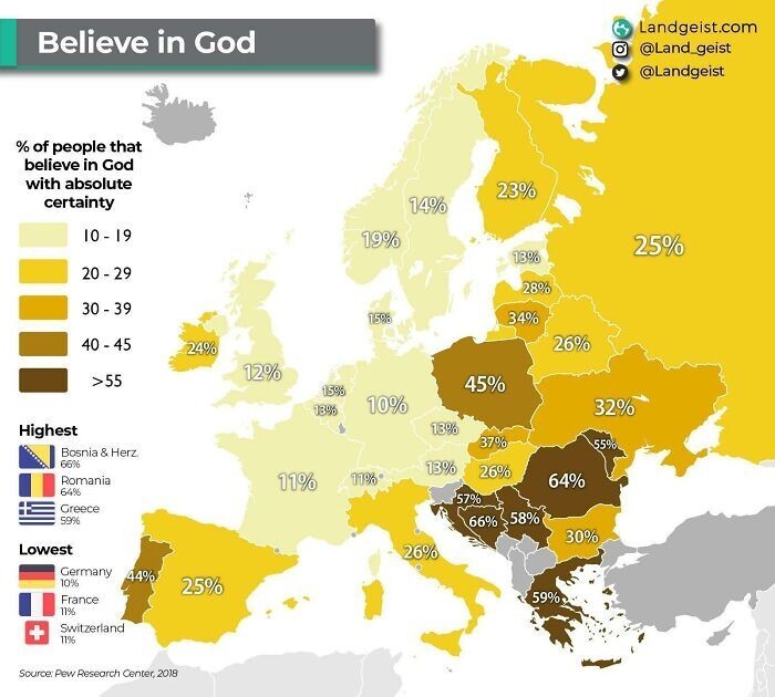
18. Countries that were not invited to Queen Elizabeth's funeral (in red) 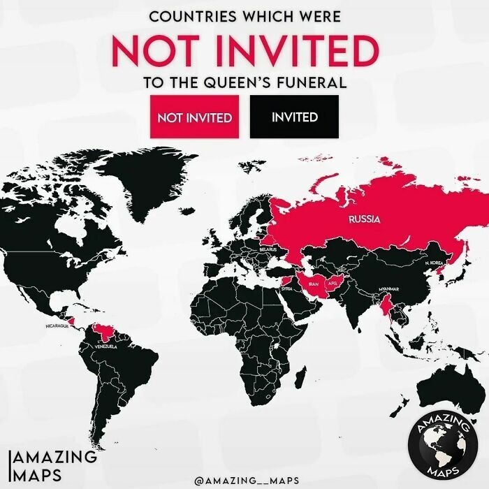
19. Countries where police officers do not carry guns (blue) 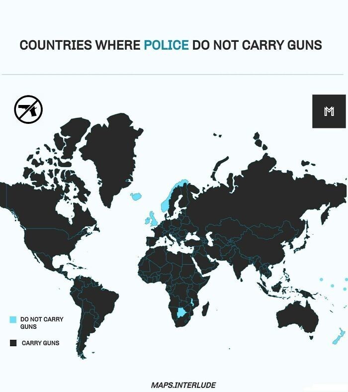
20. Asia at night 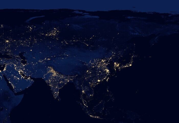
21. Map of Mexico carved into the wall of a bar in Yucatan 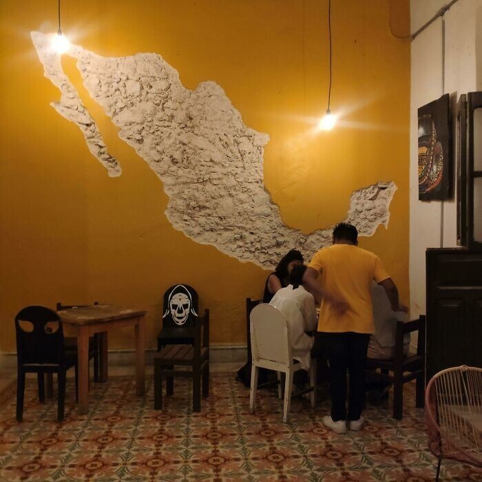
22. China emits more carbon dioxide than the entire Western Hemisphere (12 billion tons versus 9) 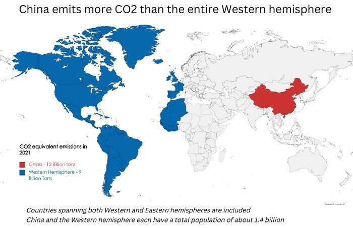
23. The world according to Google Street View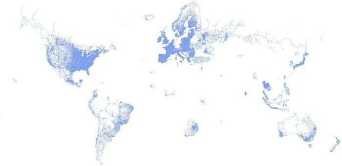
24. Countries where it never snowed 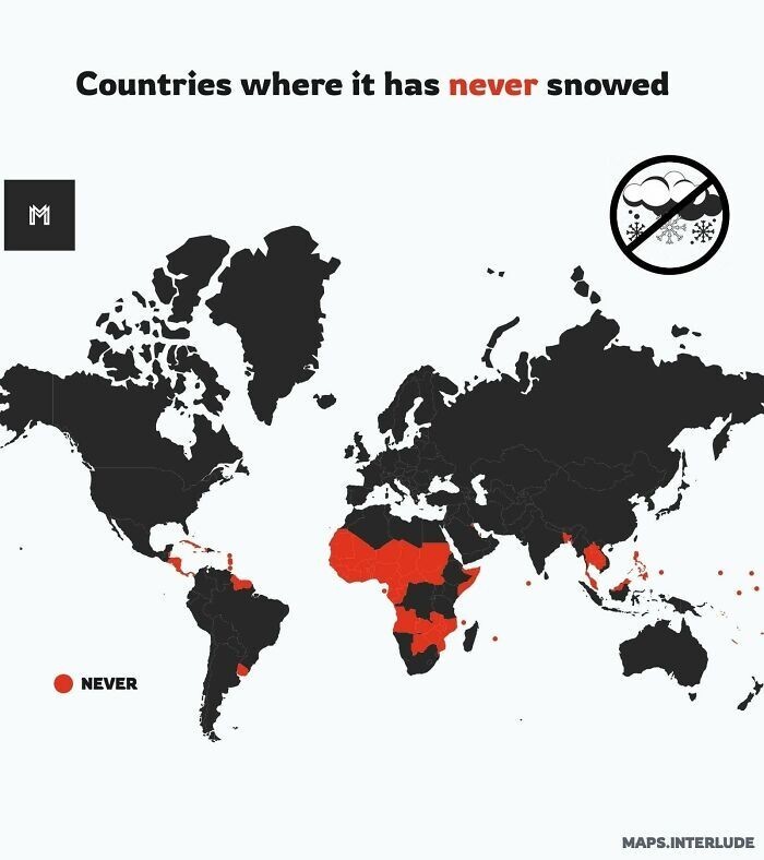
25. Countries that are at least 50% forested (in first place is Suriname - 90.2%) 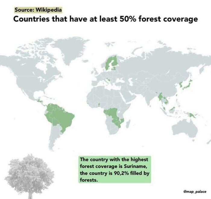
26. Pixel map of Argentina 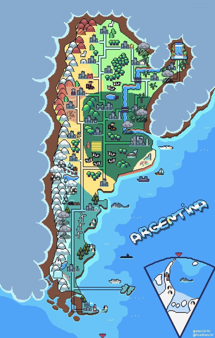
27. Camouflage in European countries 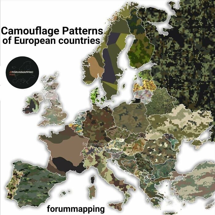
28. Map of still inhabited US cities that are older than the US itself 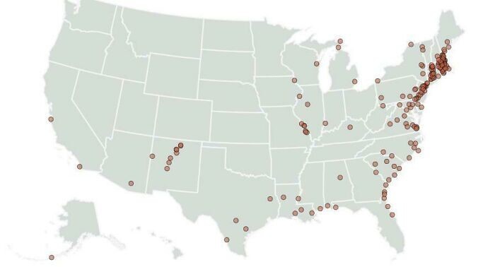
29. Theatrum Orbis Terrarum (“The Spectacle of the Earth’s Circle”) is considered the first true atlas of the modern type, released May 20, 1570 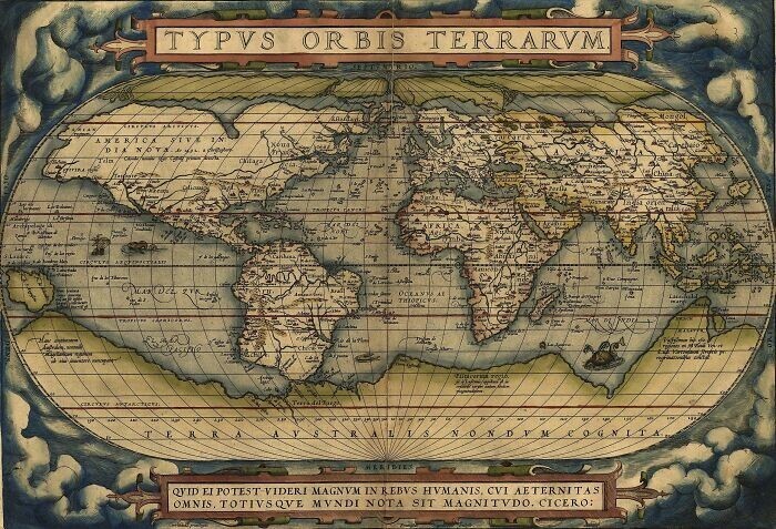
30. The most popular browser in the world in 2012 and 2022 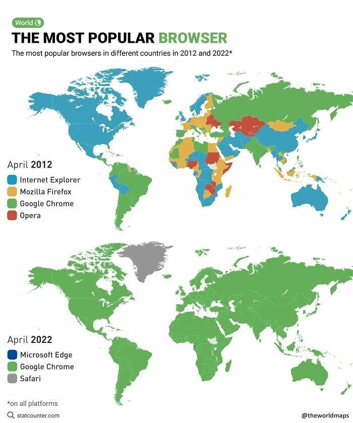
31. Map of all railways in the world 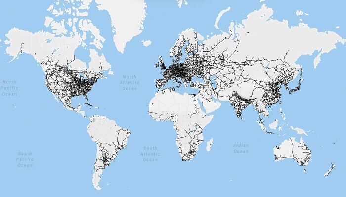
32. Number of exorcists in Europe 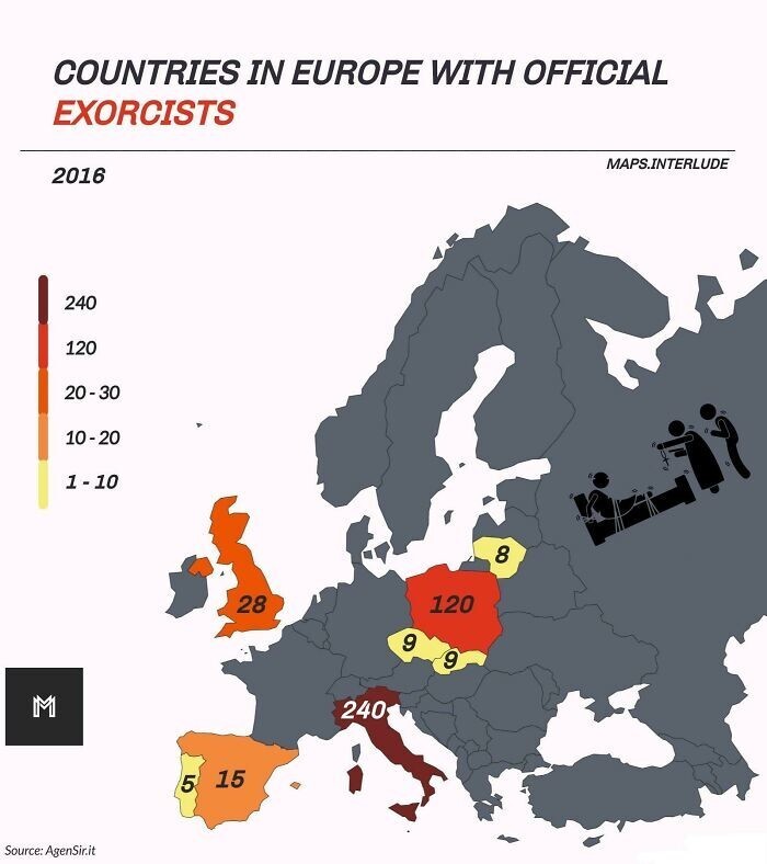
33. The first ever European map of Japan 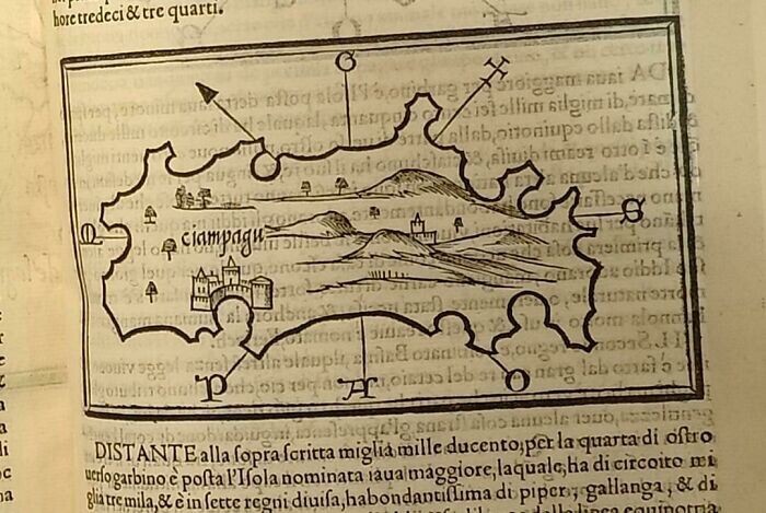
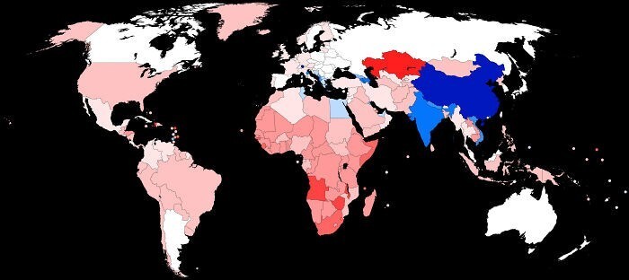
34. The most popular countries for studying among international students 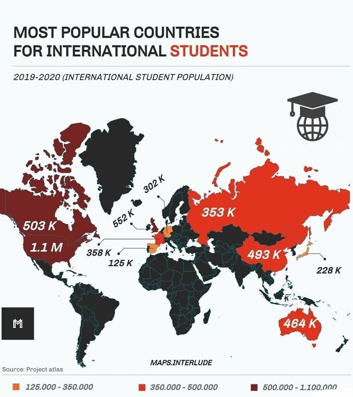
35.Gender ratio among children under 15 years of age by country. Red = more girls, blue = more boys