Ustyurt plateau (75 photos)
For many centuries, Ustyurt was a crossroads of civilizations, retaining traces of the Scythians, Mongols and more ancient peoples. The routes of great migrations ran along its deserted roads. Since the real development of the plateau by humans is just beginning, it can be considered a kind of historical reserve.
The attractions of Ustyurt are archaeological sites. In ancient times, ancient caravan routes passed through the plateau, such as the road of the Khorezm Shahs, which connected Khiva with the lower reaches of the Emba and Volga. Along it were located the ancient city of Shahr-i-Wazir, the Beleuli caravanserai and the Allan fortress. Ancient cemeteries with majestic mausoleums-mazars are scattered throughout the plateau. Some of them have already been studied by archaeologists, but many are still waiting for their researchers. There are also more ancient monuments. About 60 Neolithic sites are known in Ustyurt.

Source: Zhzhurnal/chistoprudov

1.

2. During the day we had to cover about 450 kilometers of road, of which 150 were of disgusting quality, in the end it took us about 12 hours to complete the entire route! Before the trip, we purchased food at the market in Kungrad.

3. Many residents happily took pictures and posed, but there were also those who began to wave their hands at us.

4.

5. We hit the road. After Kungrad, we drove about 10 kilometers along the bottom of the Aral Sea, which left here in the 60s.

6. Then the ascent to the plateau began. With us in the second car were oceanologists - scientists from the Institute of Oceanology of the Russian Academy of Sciences, who are working on the problem of the drying up of the Aral Sea and were going to take regular water samples. Among them was Doctor of Geographical Sciences Pyotr Zavyalov, who has been working on this disaster for more than 9 years. In stories about the Aral Sea, we used his materials and articles.

7. Today, the Aral Sea continues to dry up. There was once water at this level...

8. The Ustyurt plateau is located between Mangyshlak and the Kara-Bogaz-Gol Bay in the west, the Aral Sea and the Amu Darya delta in the east. The plateau is a desert with an area of about 200,000 km².

9. From the Aral Sea side, the plateau is indented by hundreds of dirt roads, which can only be driven by a serious SUV. There is no connection here, and we didn’t meet anyone all day. Driving here in one car is extremely dangerous - in case of a breakdown, there will be no place to wait for help. There have been cases when people died of thirst in the summer or froze in the winter, the weather on the plateau is windy and peculiar, the temperature in winter can drop to -60 degrees!

10. Drying Lake Sudochye and the remains of the abandoned fishing village of Urga. This was one of the places of exile of the Old Believers. In the 60s, the village was abandoned due to the beginning of the Aral disaster, and now all that remains of it is a small Russian cemetery, ruins of houses and a small factory. Now there are trailers of an artel of fishermen who rent part of the lake from the state.

eleven.

12. Our transport. This is a three-door Mercedes Gelentvagen, an army version. In 1995, he was “written off” brand new from the army of Uzbekistan and now he brings his owner $200 a day.

13. Christian cemetery.

14. Some kind of scribbled stone on one of the hills near the village.

15. Fishermen's boats.

16. And here are the fishermen themselves, who gave us green tea and treated us to stew.

17.

18.

19.

20.

21. In the 40s of the 20th century, the USSR began implementing an ambitious project to withdraw water for irrigated agriculture from the Amu Darya and Syr Darya rivers. Very quickly, the economy of the Central Asian republics soared to unprecedented heights. But after 20 years, success turned into an environmental disaster. Today the amount of water in the Aral Sea is approximately 1/4 of its original volume.

22. According to Pyotr Zavyalov, now the Western Aral Sea is like a powerful chemical reactor. Under conditions of abnormally high salinity - in some parts of the sea it reaches 200 g/l (for comparison, the salinity of the Dead Sea is about 300 g/l), calcium and magnesium carbonates, gypsum and mirabilite fall to the bottom. Another serious problem is hydrogen sulfide contamination. The hydrogen sulfide zone occupies almost half of the entire Western Aral Sea. The gas fills almost the entire lower layer of water and lies only 10-20 meters from the surface. The concentration of this poisonous gas in the Aral Sea is 10 times greater than in the Black Sea.

23. When the sea receded, the shores began to dry out and collapse, turning into bizarre canyons.

24. This is a small house that stands alone on the cliff of a plateau; anyone can stay there for the night. Inside there is everything you need: dishes, stove, blankets, Koran, carpets, firewood, tools.

25. This house saved the lives of many people.

26.

27. Salt crystals.

28.

29.

thirty.

31. After 450 km we reached our overnight stop - the shores of the Aral Sea.

32. Previously, there were Soviet-era barracks here. In the 80s, a coastal supply base for Vozrozhdeniya Island was located at this location. On this island, the Soviet Union tested bacteriological weapons: the causative agents of anthrax, tularemia, brucellosis, plague, typhoid, smallpox, as well as botulinum toxin were tested here on horses, monkeys, sheep, donkeys and other laboratory animals.

33. Local residents talk about the sudden departure of the military from Vozrozhdeniya Island. In the mid-80s, something happened there, and one day all the personnel left the base. The sudden exodus was indicated by the fact that a large amount of equipment, equipment and food was abandoned. And on the runway (there was an airfield with four 3-kilometer runways in the shape of a compass rose) there were a large number of disposable syringes and gas masks lying around. As a consequence, the supply base was also abandoned.

34. The colorful shore of the Aral Sea is beautiful in its own way...
Pavel Kosenko swam in the cold October water of the lake, and then ran naked) “] 
35. We were told that several years ago a famous Moscow photographer [info

36.

37.

38. While we were setting up a tent and walking along the shore, our drivers prepared a delicious pilaf.

39. Since we got a drafty tent, and even without a bottom (we slept on the ground), we almost died and with great difficulty got up at 6 am at dawn. But we will write about this and much more tomorrow, don’t miss it)

40.

41.

42.

43. After dawn, we had breakfast with pilaf, packed up our tents and, while the oceanologists took their water samples, went for a walk through the canyons.

44.

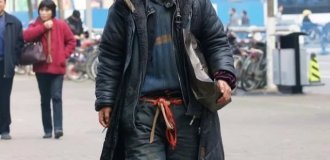
45.

46. The size of the blocks is impressive.

47.

48. Field tests of sponsor equipment were successful...

49. Local resident.

50. On the road to Muynak, we again drove along the bottom of the dried sea. The photo clearly shows the salt that remained when the water left. Now this is a completely dead space, there are not even birds here.

51. To prevent dust-salt storms, saxaul bushes were planted at the bottom of the former sea. During a storm, the air is full of fine sand and salt. In those places where saxaul took root, phytohillocks began to form. The plant's root system strengthens the soil, and the wind blows away the soil around the plant. In some places the height of such mounds reaches two meters. In the mid-90s, it happened that nearby villages were covered with sand up to the window sills in one day, but now the situation has improved.

52. In this place the depth of the sea was 20 meters.

53. Suddenly, the silhouette of a tower appeared from the dust - this is a Chinese gas production installation.

54. In 2008, the Petro Alliance company carried out exploration work to search for oil and gas on the former bottom of the Aral Sea; the result was positive. The gas here is of high quality, with minimal hydrogen sulfide content.

55. When we got to Muynak, we immediately went to the ship cemetery.

56. As for the Greater Aral, after the disaster there were much fewer people. All settlements, the largest of which is the Uzbek city of Muynak, were far from the coast. A steady increase in unemployment due to the decline of agriculture and the closure of ports, high levels of morbidity and infant mortality are all that remain of the once prosperous regions.

57. On the site of the former port there is now a monument to the Aral Sea. Previously, there was a monument to the Great Patriotic War, but it was moved to the center of the village. The location was not chosen by chance. During the war there was a pier here, from where conscripts were sent to the front. They were collected from the surrounding villages and transported on barges to Aralsk, from where, after three months of training, they were sent to the Stalingrad Front. The soldiers' mothers tried to accompany the barges on boats, some sank in the storm.

58. According to eyewitnesses, the first time the sea receded overnight by 30 meters was in 1962. People were amazed, but they did not yet imagine that the sea would recede in some places up to 180 kilometers.

59. At first, people tried to dig a canal to connect the port of Muynak with the open sea. The length of the canal was 22 km, but it was useless to fight nature, the water left too quickly, many ships remained on the banks of the canal. Residents cut most of these ships into scrap metal, some were saved, and now they stand on the site of the former pier.

60.

61. Muynak had a very important logistical significance in the supply system of Central Asia. There was a huge container port in Aralsk, from there containers from the railway were loaded onto ships and sent to Muynak, and then the containers traveled throughout Central Asia by river transport along the Amu Darya River or by train.

62. Today from Muynak to the Aral Sea is more than 50 km.

63. The ship cemetery has its own guard.

64.

65.

66.

67.

68.

69.

70.

71.

72.

73.