40 Maps That Reveal the World from a Whole New Angle (41 photos)
What would the Netherlands look like without its dikes? What happens if you drop Arizona onto Mars? Where do flamingos actually live? Forget boring school geography lessons—these fascinating maps reveal eye-opening facts and figures about the world you live in. 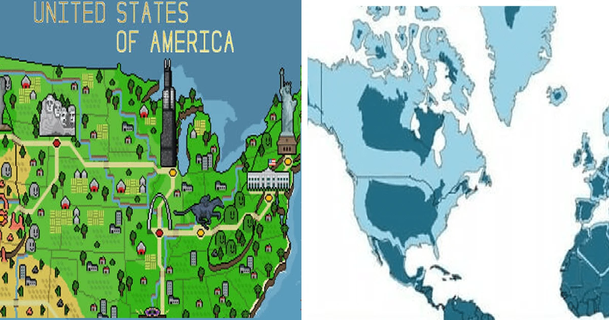
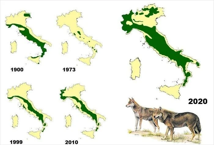
Wolf population distribution in Italy, 1900–2020 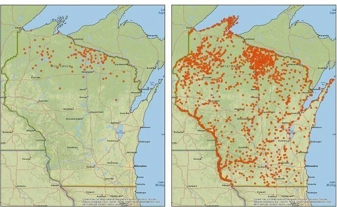
Bald eagle nesting sites in Wisconsin, 1974–2019 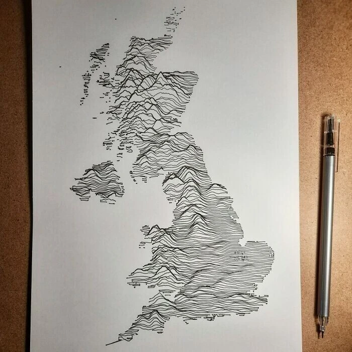
A hand-drawn map of Great Britain 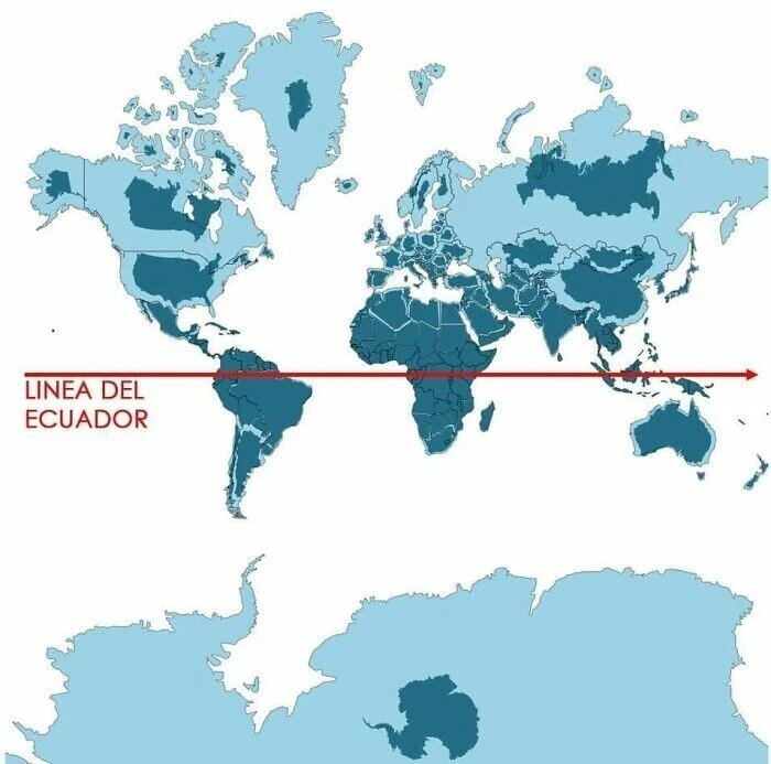
Countries shown in light blue represent standard map projections, while dark blue shows their true relative size 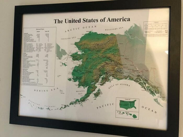
The United States from Alaska's perspective 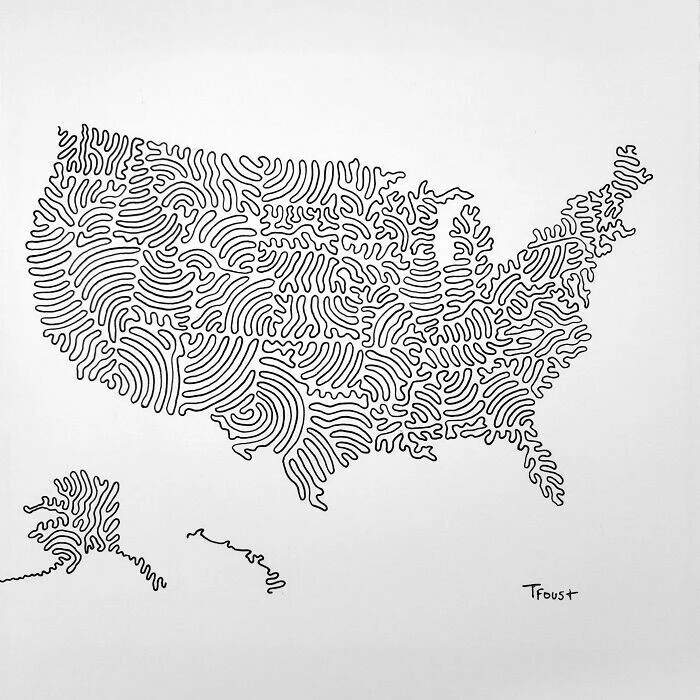
A map of US state borders drawn with just three continuous lines 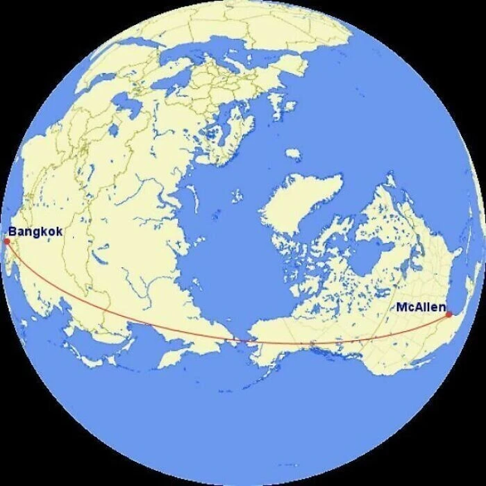
The straightest flight route from McAllen, Texas, to Bangkok: following this line, only about 70 kilometers of the journey passes over ocean 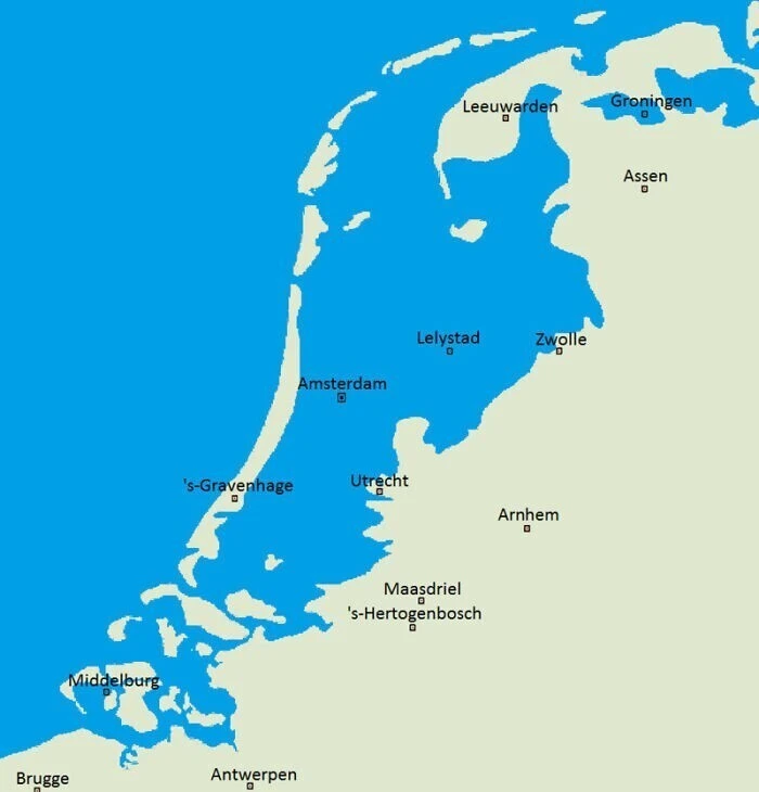
What the Netherlands would look like today without its system of dikes 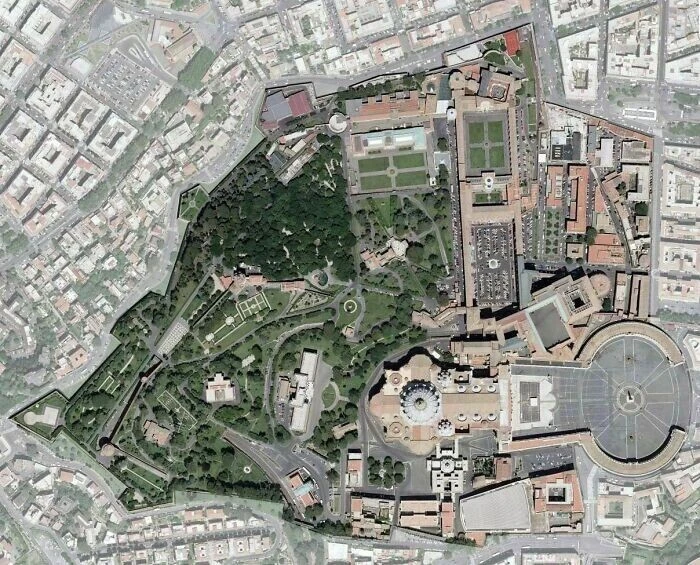
A satellite view of Vatican City 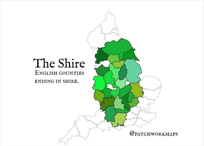
Counties in England that end with "-shire" 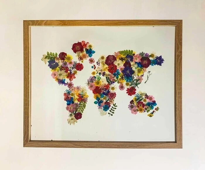
A world map made from pressed dried flowers 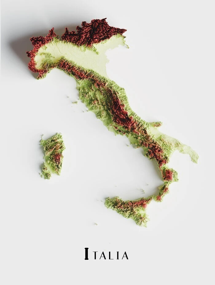
A topographic map of Italy 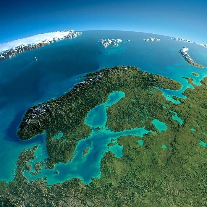
A relief map of Scandinavia and the Baltic region 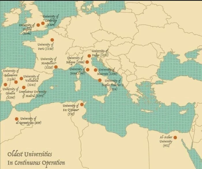
The world's oldest continuously operating universities 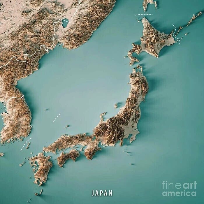
A topographic map of Japan 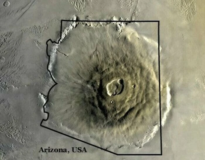
Olympus Mons, the largest volcano in the Solar System on Mars, compared in size to the state of Arizona 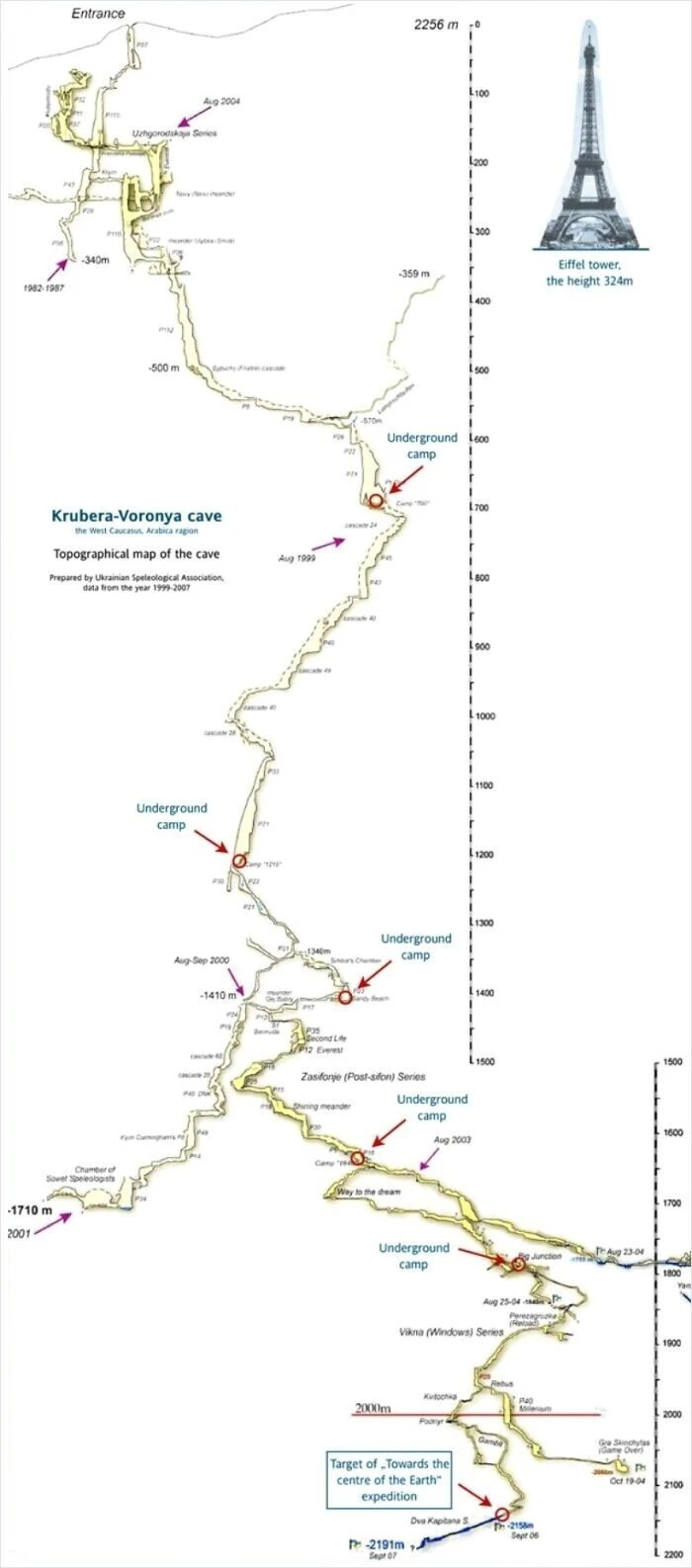
A cross-section map of Krubera Cave in Abkhazia—the world's second-deepest cave system, reaching a depth of 2,191 meters 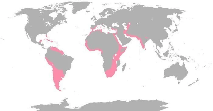
Global habitats of flamingos 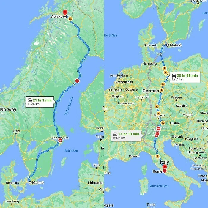
As it turns out, traveling from Malmö to Abisko—from one end of Sweden to the other—is a longer distance than traveling from Malmö to Rome across five countries 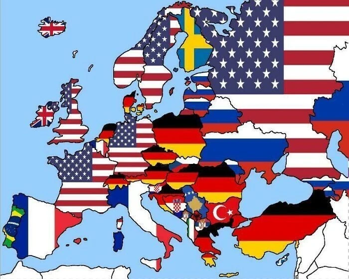
The most Googled countries in the world (excluding searches for one's own country) 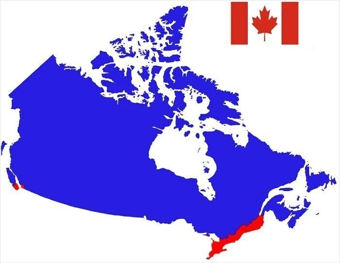
More people live in the red area of Canada than in the blue area 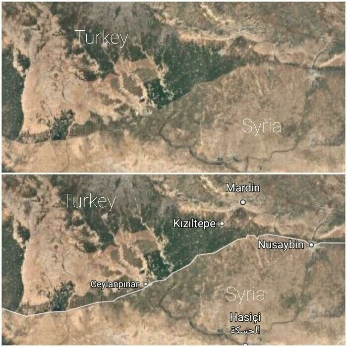
The border contrast between Turkey and Syria is visible to the naked eye 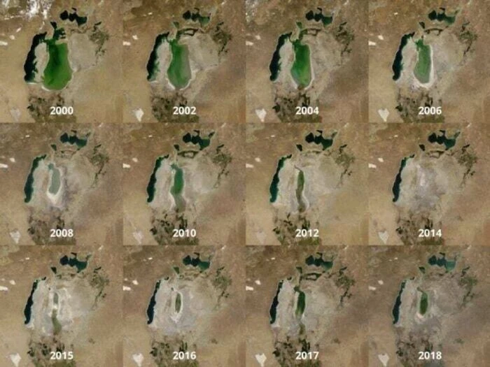
The shrinking of the Aral Sea, 2000–2018 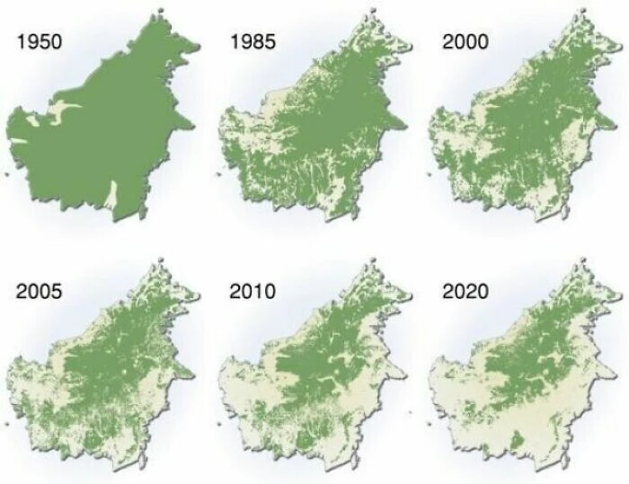
Deforestation in Borneo, 1950–2020 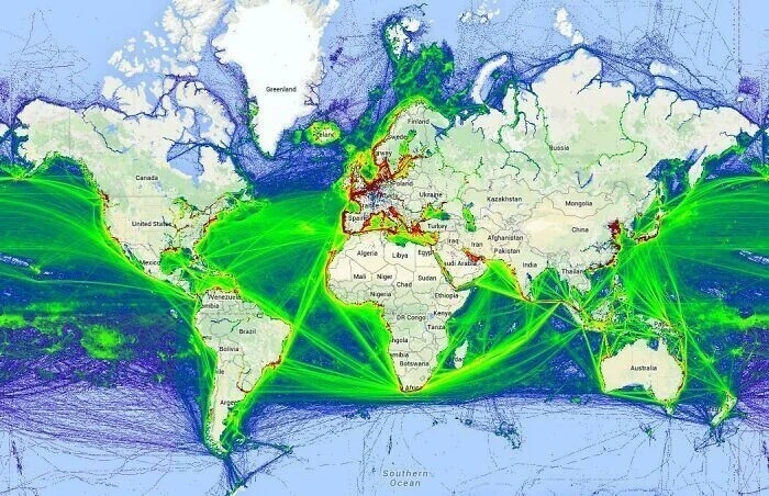
A map of global maritime shipping routes 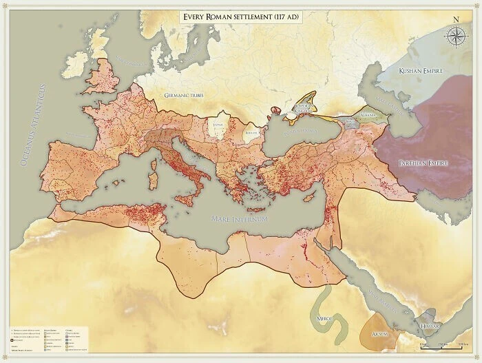
All known Roman settlements recorded by historians, dating back to 117 BCE 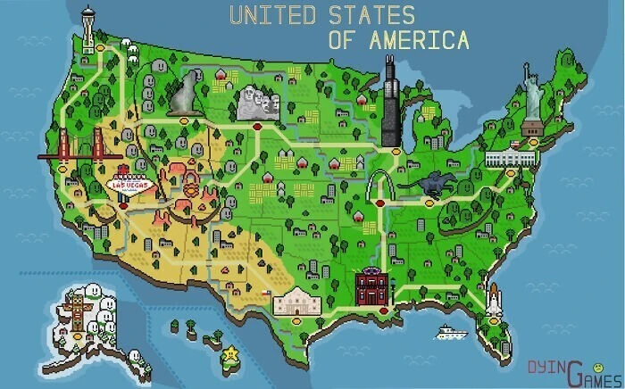
A retro pixel-art map of the United States 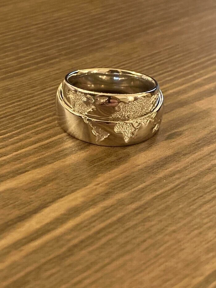
Wedding rings that fit together to form a world map 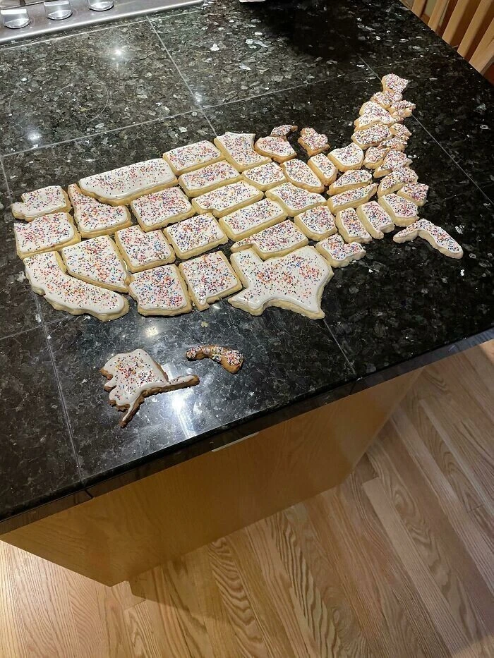
A map of the United States made of cookies 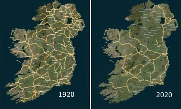
Ireland's railway network, 1920 vs. 2020: a dramatic shift 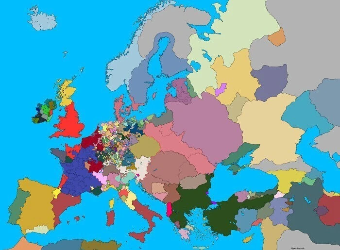
A political map of Europe in 1444 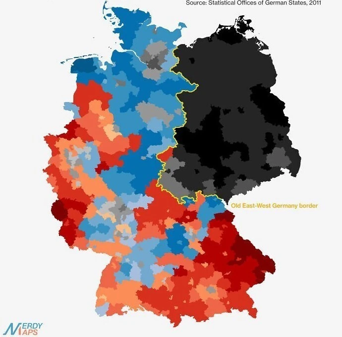
Religious breakdown of Germany: red indicates Catholic, blue Protestant, and black non-religious or other. The yellow line marks the former border between West and East Germany 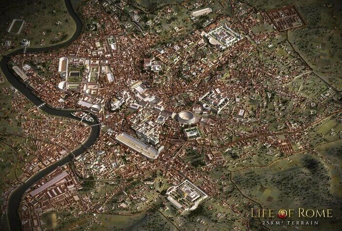
A detailed scale model of Imperial Rome 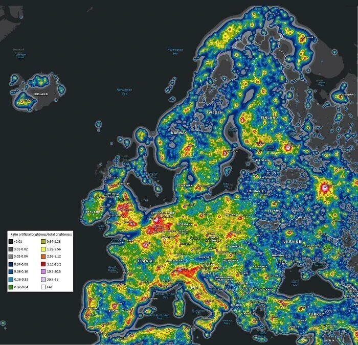
A light pollution map of Europe 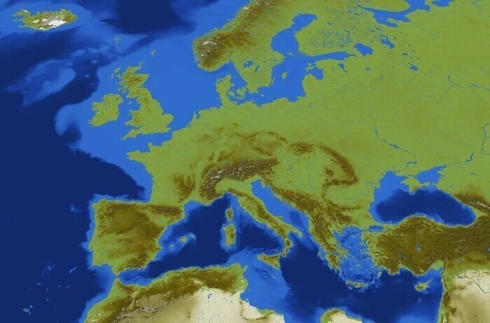
A playable map of Europe recreated by a Minecraft player 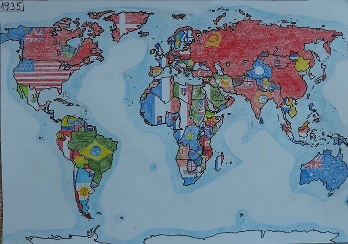
A world map from 1935 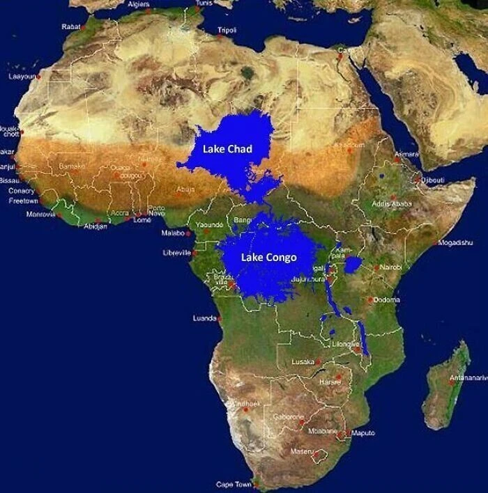
What would happen if you dammed the mouth of the Congo River 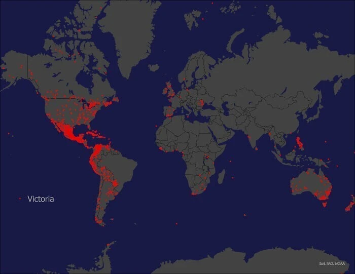
Places around the globe named "Victoria" 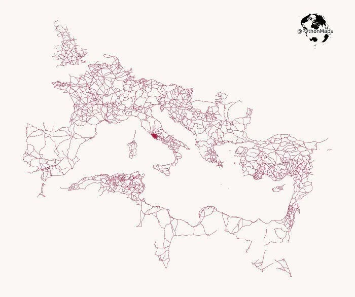
The network of roads built across the Roman Empire