A holey Peruvian mountain and its mystery (7 photos + 1 video)
In the Pisco Valley of Peru, there is a strange place that is a collection of thousands of shallow holes. The holes are arranged in a narrow strip, 14 to 20 meters wide, that stretches up the hill for about 1,500 meters. Their purpose or function remains a mystery. 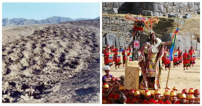
This place is popularly known as Monte Sierpe (Snake Mountain) or Cerro Viruela (Smallpox Hill). It is also called the "Stripe of Holes". 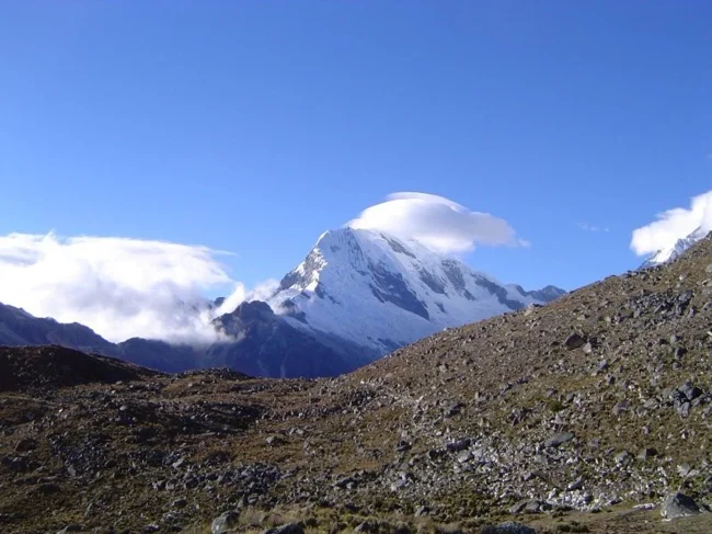
Mount Pisco
Cerro Viruela is a relatively unknown site, even among archaeologists who have been working in Peru for decades.
It first came to the attention of the media in the 1930s, after aviator Robert Shippey published an aerial photograph in National Geographic. Very few archaeologists have visited the site since then. In 1953, American explorer Victor Wolfgang von Hagen surveyed the area and described the pits as "graves," but empty. He estimated that there were about 5,000 such graves in the area. 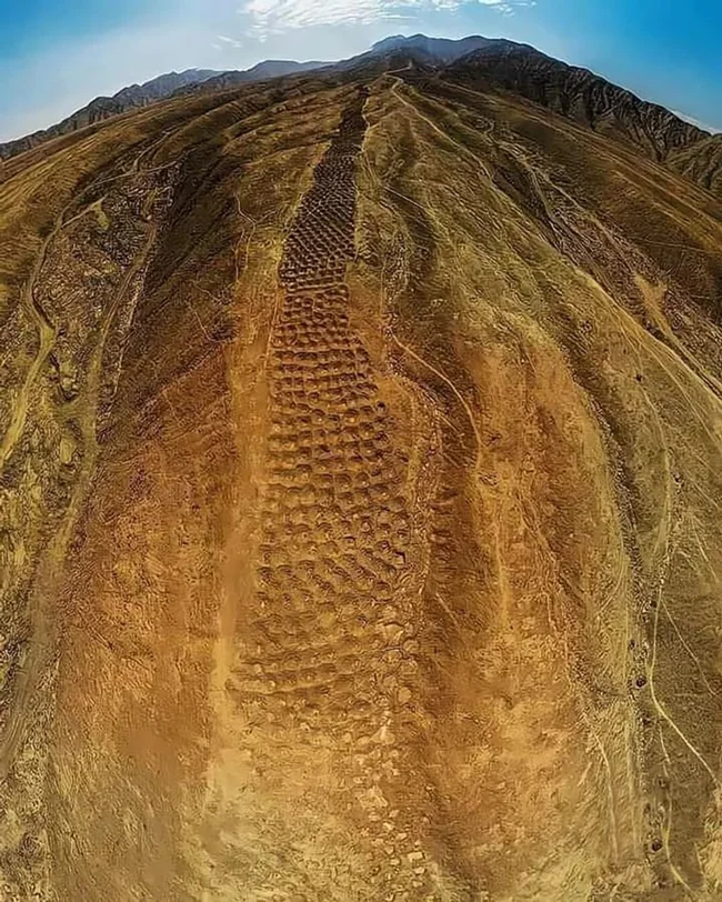
Archaeologist John Hyslop, in his 1984 book The Inca Road System, suggested that the circular structures may have been used for storage, similar to those found on the southern coast of Peru at sites such as Quebrada de la Vaca and Tambo Colorado.
The holes are about a meter across and between half a meter and a meter deep. They were made in a variety of ways, some dug into man-made mounds of soil, others into small stone structures on the surface. The group is divided into several unique subgroups, which they call blocks. Each of which has a different pattern of holes. 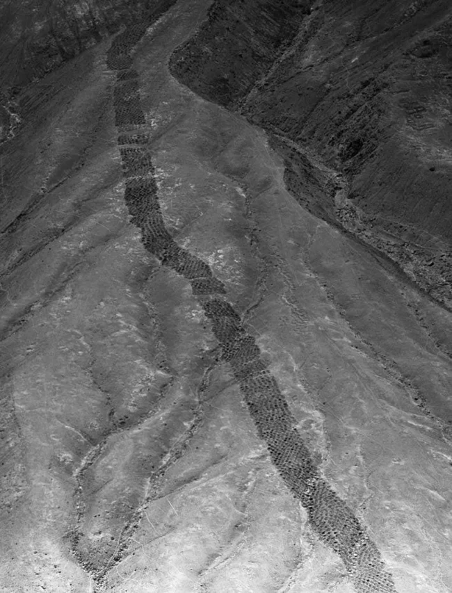
In 2015, a team of archaeologists from the University of California conducted a detailed survey of the site, using a drone to create a map of the "Strip of Holes," which they estimate consists of 5,000 to 6,000 depressions. The archaeologists found no direct evidence, but the presence of an Inca road nearby, a series of colcas (Inca-era storage sites), and pottery found near the strip suggest that the Strip of Holes dates to around the 15th century, after the Inca Empire conquered the Chincha people. They also believe that the holes were once used for storage, but what exactly and why are still unclear. 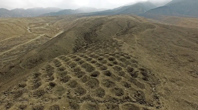
Charles Stanish, an expert on Andean culture who led the UCLA study, believes the holes were dug to measure the produce farmers had to deliver as tribute to the Inca rulers. 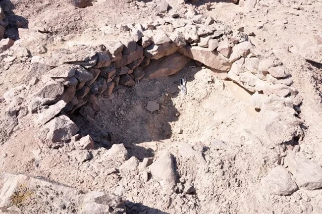
If the "Strip of Holes" was a means of measuring tribute paid to the Inca Empire, then why are there no similar ones elsewhere in the empire? Stanish explains that the Inca state was a vast empire, and its individual regions retained a certain autonomy. The Band of Holes may be a local solution to a specific problem of measuring tribute, developed in the Pisco Valley. “The further you get from the major Inca centers and Machu Picchu, the more local influences become apparent,” Stanish says. “Monte Sierpe may have been serving a very local need.” 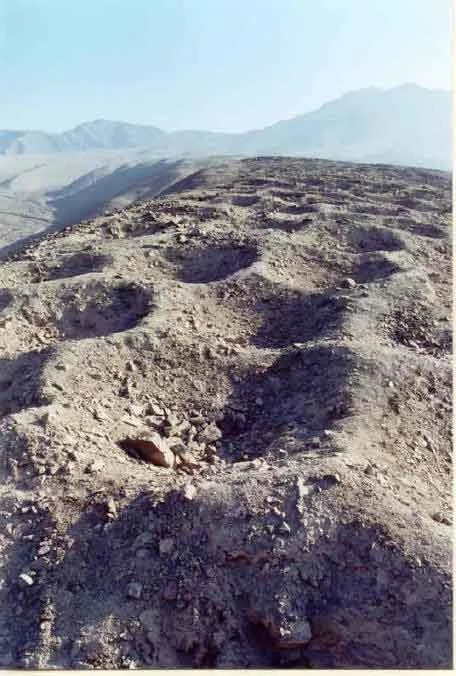
Jean-Pierre Protzen, an expert on Inca architecture at the University of California, disagrees. Protzen, who has worked for many years at Tambo Colorado, believes the Band of Holes is not contemporary with the Inca center. “There are other, earlier, large sites near Monte Sierpe that could be related to it,” Protzen says. He believes that the holes could have been used to store excrement, an important fertilizer.
In fact, all of these are just versions, and it is still unclear who created these holes and why.


